Lunar Crater Topo Map Nevada
To zoom in, hover over the map of Lunar Crater
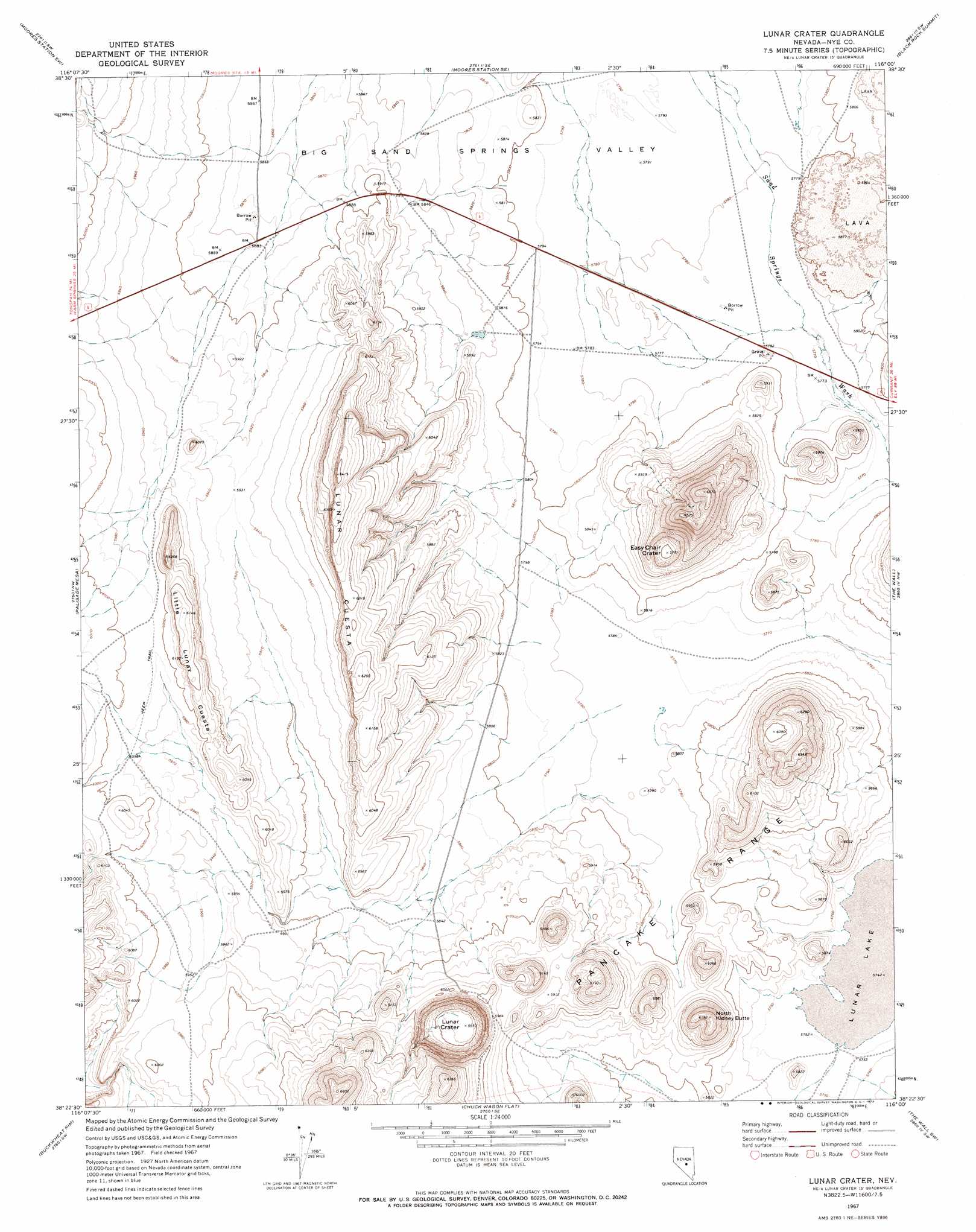
USGS Topo Quad 38116d1 - 1:24,000 scale
| Topo Map Name: | Lunar Crater |
| USGS Topo Quad ID: | 38116d1 |
| Print Size: | ca. 21 1/4" wide x 27" high |
| Southeast Coordinates: | 38.375° N latitude / 116° W longitude |
| Map Center Coordinates: | 38.4375° N latitude / 116.0625° W longitude |
| U.S. State: | NV |
| Filename: | o38116d1.jpg |
| Download Map JPG Image: | Lunar Crater topo map 1:24,000 scale |
| Map Type: | Topographic |
| Topo Series: | 7.5´ |
| Map Scale: | 1:24,000 |
| Source of Map Images: | United States Geological Survey (USGS) |
| Alternate Map Versions: |
Lunar Crater NV 1967, updated 1973 Download PDF Buy paper map Lunar Crater NV 2012 Download PDF Buy paper map Lunar Crater NV 2014 Download PDF Buy paper map |
1:24,000 Topo Quads surrounding Lunar Crater
Morey Peak |
Moores Station |
Chaos Creek |
Portuguese Mountain Nw |
Portuguese Mountain |
Hobble Canyon |
Moores Station Sw |
Moores Station Se |
Black Rock Summit |
Lockes |
Blue Jay Spring |
Palisade Mesa |
Lunar Crater |
The Wall |
The Wall Ne |
Tybo Well |
Buckwheat Rim |
Chuck Wagon Flat |
The Wall Sw |
The Wall Se |
Warm Springs |
Twin Springs Slough |
Echo Canyon |
Goat Ranch Well |
Big Creek Ranch |
> Back to 38116a1 at 1:100,000 scale
> Back to 38116a1 at 1:250,000 scale
> Back to U.S. Topo Maps home
Lunar Crater topo map: Gazetteer
Lunar Crater: Craters
Easy Chair Crater elevation 1766m 5793′Lunar Crater elevation 1698m 5570′
Lunar Crater: Reservoirs
Lava Bed Catch Basin elevation 1765m 5790′Lunar Crater: Ridges
Little Lunar Cuesta elevation 1862m 6108′Lunar Cuesta elevation 1908m 6259′
Lunar Crater: Springs
Lava Bed Spring elevation 1770m 5807′Lunar Crater: Summits
North Kidney Butte elevation 1887m 6190′Lunar Crater: Valleys
Big Sand Springs Valley elevation 1752m 5748′Lunar Crater digital topo map on disk
Buy this Lunar Crater topo map showing relief, roads, GPS coordinates and other geographical features, as a high-resolution digital map file on DVD: