Barley Creek Topo Map Nevada
To zoom in, hover over the map of Barley Creek
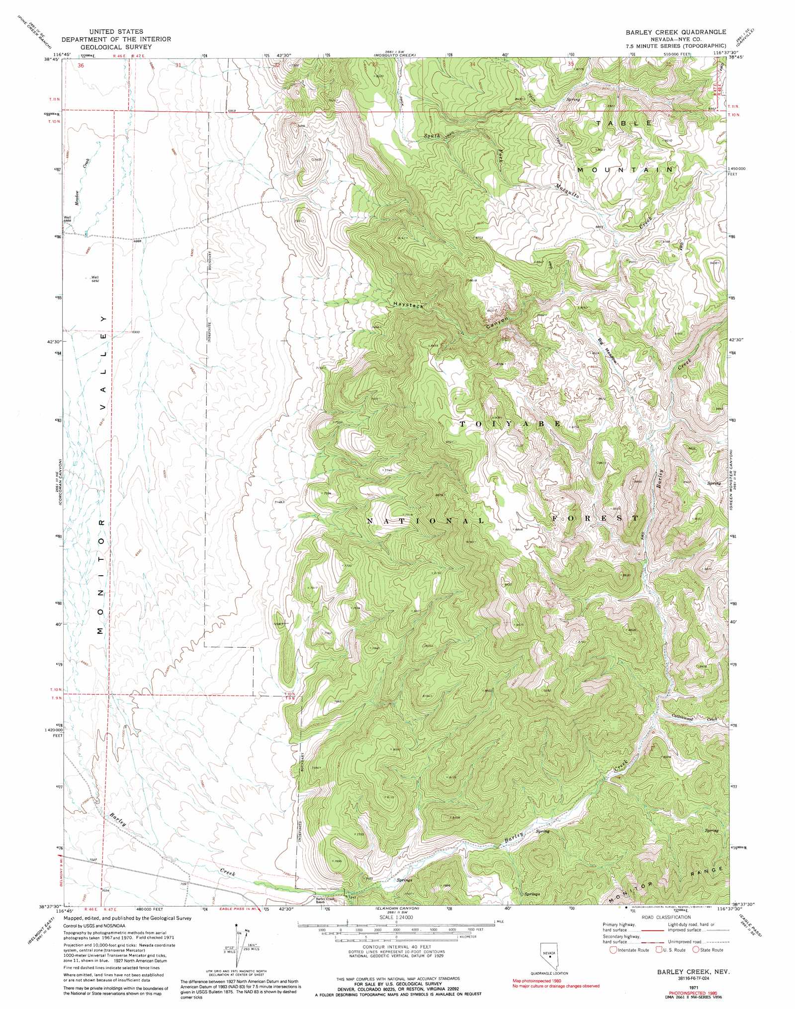
USGS Topo Quad 38116f6 - 1:24,000 scale
| Topo Map Name: | Barley Creek |
| USGS Topo Quad ID: | 38116f6 |
| Print Size: | ca. 21 1/4" wide x 27" high |
| Southeast Coordinates: | 38.625° N latitude / 116.625° W longitude |
| Map Center Coordinates: | 38.6875° N latitude / 116.6875° W longitude |
| U.S. State: | NV |
| Filename: | o38116f6.jpg |
| Download Map JPG Image: | Barley Creek topo map 1:24,000 scale |
| Map Type: | Topographic |
| Topo Series: | 7.5´ |
| Map Scale: | 1:24,000 |
| Source of Map Images: | United States Geological Survey (USGS) |
| Alternate Map Versions: |
Barley Creek NV 1971, updated 1974 Download PDF Buy paper map Barley Creek NV 1971, updated 1991 Download PDF Buy paper map Barley Creek NV 2012 Download PDF Buy paper map Barley Creek NV 2014 Download PDF Buy paper map |
| FStopo: | US Forest Service topo Barley Creek is available: Download FStopo PDF Download FStopo TIF |
1:24,000 Topo Quads surrounding Barley Creek
Jet Spring |
Northumberland Pass |
Box Spring |
Dobbin Summit |
Stargo Creek |
Mount Jefferson |
Pine Creek Ranch |
Mosquito Creek |
Danville |
Fish Springs |
Jefferson |
Corcoran Canyon |
Barley Creek |
Green Monster Canyon |
Upper Fish Lake |
Belmont West |
Belmont East |
Elkhorn Canyon |
Eagle Pass |
Little Fish Lake |
Big Ten Peak West |
Big Ten Peak East |
Mccann Canyon |
Mcintyre Summit |
Flagstaff Mountain |
> Back to 38116e1 at 1:100,000 scale
> Back to 38116a1 at 1:250,000 scale
> Back to U.S. Topo Maps home
Barley Creek topo map: Gazetteer
Barley Creek: Flats
Big Meadow elevation 2571m 8435′Barley Creek: Streams
Cottonwood Creek elevation 2337m 7667′Meadow Creek elevation 2099m 6886′
Barley Creek: Valleys
Haystack Canyon elevation 2258m 7408′Barley Creek digital topo map on disk
Buy this Barley Creek topo map showing relief, roads, GPS coordinates and other geographical features, as a high-resolution digital map file on DVD: