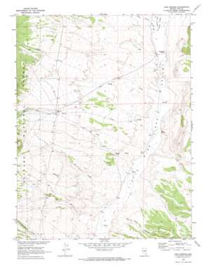
Fish Springs Topo Map Nevada
To zoom in, hover over the map of Fish Springs
USGS Topo Quad 38116g4 - 1:24,000 scale
| Topo Map Name: | Fish Springs |
| USGS Topo Quad ID: | 38116g4 |
| Print Size: | ca. 21 1/4" wide x 27" high |
| Southeast Coordinates: | 38.75° N latitude / 116.375° W longitude |
| Map Center Coordinates: | 38.8125° N latitude / 116.4375° W longitude |
| U.S. State: | NV |
| Filename: | o38116g4.jpg |
| Download Map JPG Image: | Fish Springs topo map 1:24,000 scale |
| Map Type: | Topographic |
| Topo Series: | 7.5´ |
| Map Scale: | 1:24,000 |
| Source of Map Images: | United States Geological Survey (USGS) |
| Alternate Map Versions: |
Fish Springs NV 1968, updated 1972 Download PDF Buy paper map Fish Springs NV 2012 Download PDF Buy paper map Fish Springs NV 2014 Download PDF Buy paper map |
| FStopo: | US Forest Service topo Fish Springs is available: Download FStopo PDF Download FStopo TIF |
1:24,000 Topo Quads surrounding Fish Springs
> Back to 38116e1 at 1:100,000 scale
> Back to 38116a1 at 1:250,000 scale
> Back to U.S. Topo Maps home
Fish Springs topo map: Gazetteer
Fish Springs: Flats
Anderson Field elevation 2039m 6689′Fish Springs: Populated Places
Antelope (historical) elevation 2134m 7001′Fish Springs: Post Offices
Antelope Post Office (historical) elevation 2134m 7001′Fish Springs: Springs
Fish Springs elevation 2024m 6640′Fish Springs elevation 2000m 6561′
Sevenmile Spring elevation 2046m 6712′
Fish Springs: Streams
Clear Creek elevation 2024m 6640′East Dobbin Creek elevation 2049m 6722′
Savory Creek elevation 2049m 6722′
Sawmill Creek elevation 2013m 6604′
Sevenmile Wash elevation 2044m 6706′
Stargo Creek elevation 2054m 6738′
Tulle Creek elevation 2032m 6666′
Fish Springs: Valleys
Big Cow Canyon elevation 2015m 6610′Cottonwood Canyon elevation 2104m 6902′
Tulle Canyon elevation 2164m 7099′
Fish Springs digital topo map on disk
Buy this Fish Springs topo map showing relief, roads, GPS coordinates and other geographical features, as a high-resolution digital map file on DVD:


