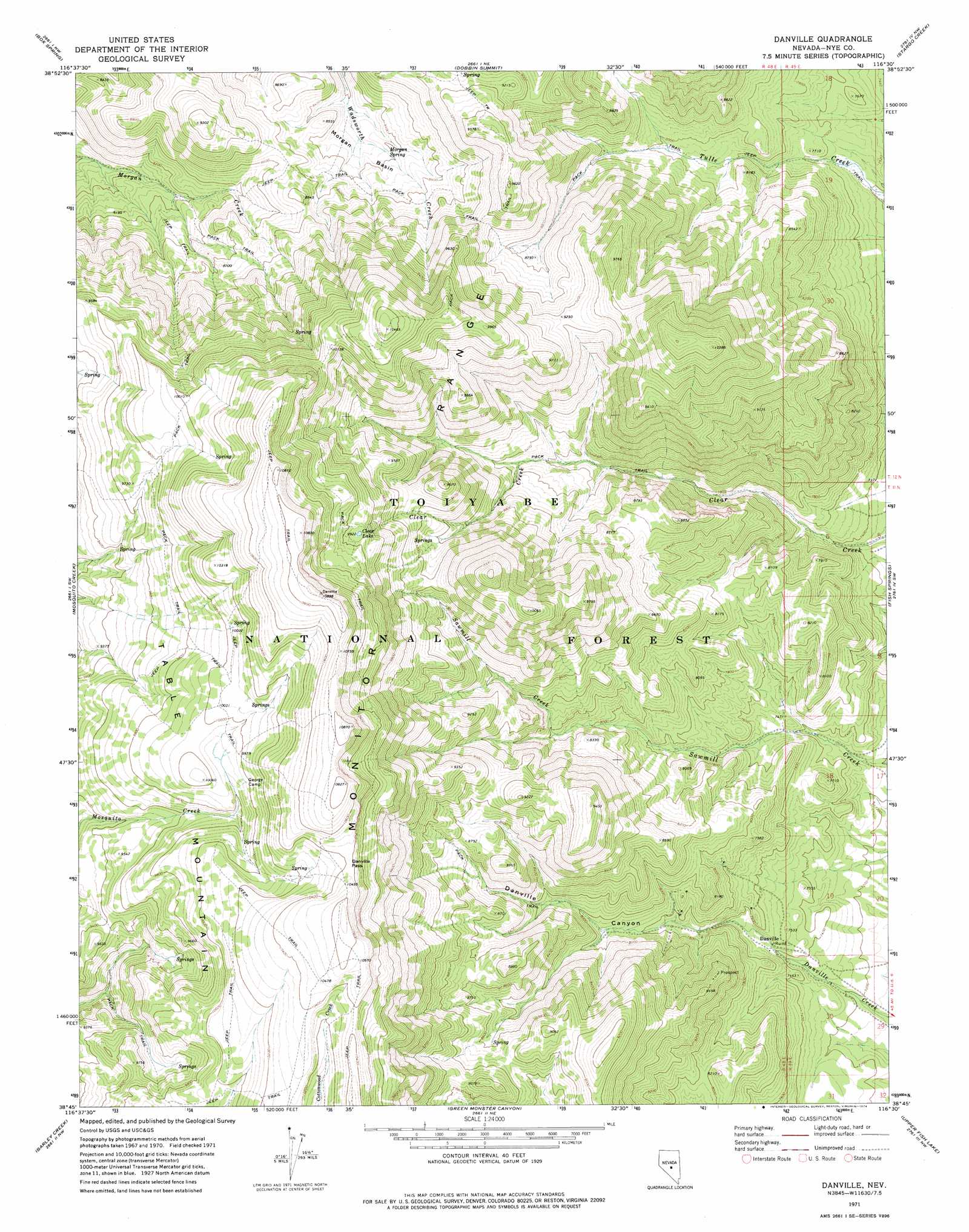
Danville Topo Map Nevada
To zoom in, hover over the map of Danville
USGS Topo Quad 38116g5 - 1:24,000 scale
| Topo Map Name: | Danville |
| USGS Topo Quad ID: | 38116g5 |
| Print Size: | ca. 21 1/4" wide x 27" high |
| Southeast Coordinates: | 38.75° N latitude / 116.5° W longitude |
| Map Center Coordinates: | 38.8125° N latitude / 116.5625° W longitude |
| U.S. State: | NV |
| Filename: | o38116g5.jpg |
| Download Map JPG Image: | Danville topo map 1:24,000 scale |
| Map Type: | Topographic |
| Topo Series: | 7.5´ |
| Map Scale: | 1:24,000 |
| Source of Map Images: | United States Geological Survey (USGS) |
| Alternate Map Versions: |
Danville NV 1971, updated 1974 Download PDF Buy paper map Danville NV 2012 Download PDF Buy paper map Danville NV 2014 Download PDF Buy paper map |
| FStopo: | US Forest Service topo Danville is available: Download FStopo PDF Download FStopo TIF |
1:24,000 Topo Quads surrounding Danville
Wildcat Peak |
Dianas Punch Bowl |
Butler Ranch |
Savory Mountain |
Segura Ranch |
Northumberland Pass |
Box Spring |
Dobbin Summit |
Stargo Creek |
Fish Springs Ne |
Pine Creek Ranch |
Mosquito Creek |
Danville |
Fish Springs |
Fish Springs Se |
Corcoran Canyon |
Barley Creek |
Green Monster Canyon |
Upper Fish Lake |
Morey Peak |
Belmont East |
Elkhorn Canyon |
Eagle Pass |
Little Fish Lake |
Hobble Canyon |
> Back to 38116e1 at 1:100,000 scale
> Back to 38116a1 at 1:250,000 scale
> Back to U.S. Topo Maps home
Danville topo map: Gazetteer
Danville: Basins
Morgan Basin elevation 2526m 8287′Danville: Gaps
Danville Pass elevation 3174m 10413′Danville: Lakes
Clear Lake elevation 3025m 9924′Danville: Mines
Argonaut Mine elevation 2355m 7726′Boston Mine elevation 2355m 7726′
Eagle Nest Mine elevation 2329m 7641′
Eucalyptus Mine elevation 2355m 7726′
Richmond Mine elevation 2355m 7726′
Sage Hen Mine elevation 2355m 7726′
Danville: Populated Places
Danville (historical) elevation 2281m 7483′Lauville (historical) elevation 2269m 7444′
Danville: Post Offices
Danville Post Office (historical) elevation 2281m 7483′Danville: Ranges
Monitor Range elevation 3119m 10232′Danville: Ridges
Table Mountain elevation 3246m 10649′Danville: Springs
Morgan Spring elevation 2562m 8405′Danville: Summits
Tulle Mountain elevation 3157m 10357′Danville: Valleys
Danville Canyon elevation 2239m 7345′Danville digital topo map on disk
Buy this Danville topo map showing relief, roads, GPS coordinates and other geographical features, as a high-resolution digital map file on DVD: