Mosquito Creek Topo Map Nevada
To zoom in, hover over the map of Mosquito Creek
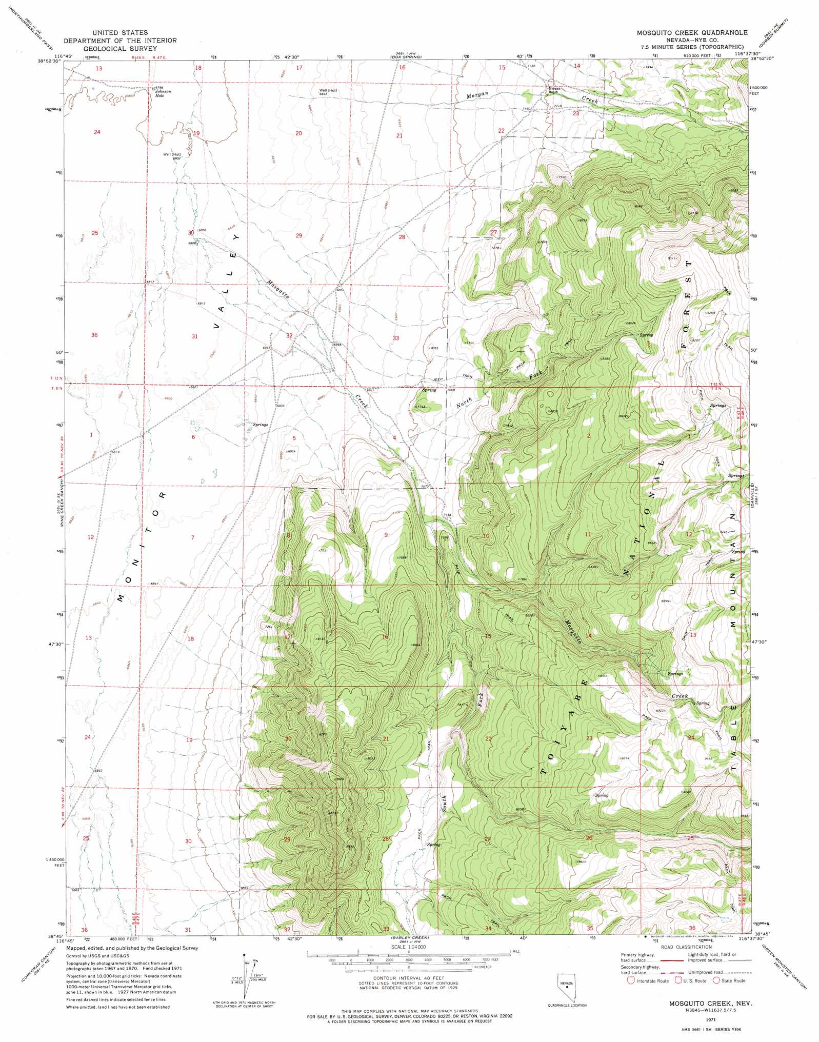
USGS Topo Quad 38116g6 - 1:24,000 scale
| Topo Map Name: | Mosquito Creek |
| USGS Topo Quad ID: | 38116g6 |
| Print Size: | ca. 21 1/4" wide x 27" high |
| Southeast Coordinates: | 38.75° N latitude / 116.625° W longitude |
| Map Center Coordinates: | 38.8125° N latitude / 116.6875° W longitude |
| U.S. State: | NV |
| Filename: | o38116g6.jpg |
| Download Map JPG Image: | Mosquito Creek topo map 1:24,000 scale |
| Map Type: | Topographic |
| Topo Series: | 7.5´ |
| Map Scale: | 1:24,000 |
| Source of Map Images: | United States Geological Survey (USGS) |
| Alternate Map Versions: |
Mosquito Creek NV 1971, updated 1974 Download PDF Buy paper map Mosquito Creek NV 2012 Download PDF Buy paper map Mosquito Creek NV 2014 Download PDF Buy paper map |
| FStopo: | US Forest Service topo Mosquito Creek is available: Download FStopo PDF Download FStopo TIF |
1:24,000 Topo Quads surrounding Mosquito Creek
Wildcat Canyon |
Wildcat Peak |
Dianas Punch Bowl |
Butler Ranch |
Savory Mountain |
Jet Spring |
Northumberland Pass |
Box Spring |
Dobbin Summit |
Stargo Creek |
Mount Jefferson |
Pine Creek Ranch |
Mosquito Creek |
Danville |
Fish Springs |
Jefferson |
Corcoran Canyon |
Barley Creek |
Green Monster Canyon |
Upper Fish Lake |
Belmont West |
Belmont East |
Elkhorn Canyon |
Eagle Pass |
Little Fish Lake |
> Back to 38116e1 at 1:100,000 scale
> Back to 38116a1 at 1:250,000 scale
> Back to U.S. Topo Maps home
Mosquito Creek topo map: Gazetteer
Mosquito Creek: Lakes
Johnson Hole elevation 2074m 6804′Mosquito Creek: Streams
Morgan Creek elevation 2082m 6830′Mosquito Creek elevation 2077m 6814′
North Fork Mosquito Creek elevation 2114m 6935′
South Fork Mosquito Creek elevation 2165m 7103′
Mosquito Creek: Valleys
Cottonwood Canyon elevation 2208m 7244′Mosquito Creek digital topo map on disk
Buy this Mosquito Creek topo map showing relief, roads, GPS coordinates and other geographical features, as a high-resolution digital map file on DVD: