Stargo Creek Topo Map Nevada
To zoom in, hover over the map of Stargo Creek
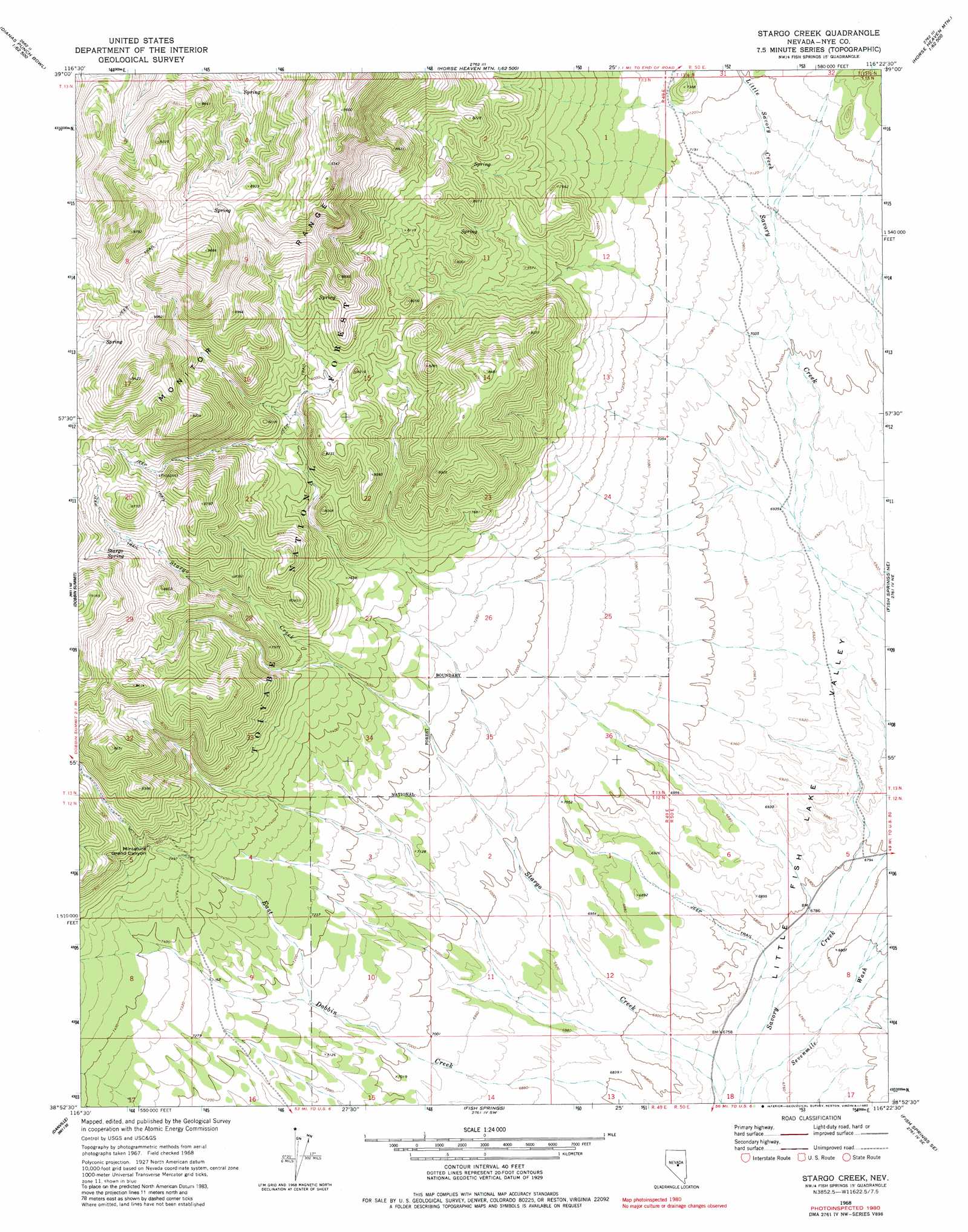
USGS Topo Quad 38116h4 - 1:24,000 scale
| Topo Map Name: | Stargo Creek |
| USGS Topo Quad ID: | 38116h4 |
| Print Size: | ca. 21 1/4" wide x 27" high |
| Southeast Coordinates: | 38.875° N latitude / 116.375° W longitude |
| Map Center Coordinates: | 38.9375° N latitude / 116.4375° W longitude |
| U.S. State: | NV |
| Filename: | o38116h4.jpg |
| Download Map JPG Image: | Stargo Creek topo map 1:24,000 scale |
| Map Type: | Topographic |
| Topo Series: | 7.5´ |
| Map Scale: | 1:24,000 |
| Source of Map Images: | United States Geological Survey (USGS) |
| Alternate Map Versions: |
Stargo Creek NV 1968, updated 1972 Download PDF Buy paper map Stargo Creek NV 1968, updated 1982 Download PDF Buy paper map Stargo Creek NV 2012 Download PDF Buy paper map Stargo Creek NV 2014 Download PDF Buy paper map |
| FStopo: | US Forest Service topo Stargo Creek is available: Download FStopo PDF Download FStopo TIF |
1:24,000 Topo Quads surrounding Stargo Creek
The Monitor |
White Sage Canyon |
Horse Heaven Mountain |
Ninemile Peak |
Cockalorum Spring |
Dianas Punch Bowl |
Butler Ranch |
Savory Mountain |
Segura Ranch |
Snowball Ranch |
Box Spring |
Dobbin Summit |
Stargo Creek |
Fish Springs Ne |
Park Mountain |
Mosquito Creek |
Danville |
Fish Springs |
Fish Springs Se |
Pritchards Station |
Barley Creek |
Green Monster Canyon |
Upper Fish Lake |
Morey Peak |
Moores Station |
> Back to 38116e1 at 1:100,000 scale
> Back to 38116a1 at 1:250,000 scale
> Back to U.S. Topo Maps home
Stargo Creek topo map: Gazetteer
Stargo Creek: Basins
Miniature Grand Canyon elevation 2324m 7624′Stargo Creek: Populated Places
Stargo (historical) elevation 2498m 8195′Stargo Creek: Ranges
Red Mountains elevation 2503m 8211′Stargo Creek: Springs
Stargo Spring elevation 2571m 8435′Stargo Creek: Streams
Little Savory Creek elevation 2152m 7060′Stargo Creek digital topo map on disk
Buy this Stargo Creek topo map showing relief, roads, GPS coordinates and other geographical features, as a high-resolution digital map file on DVD: