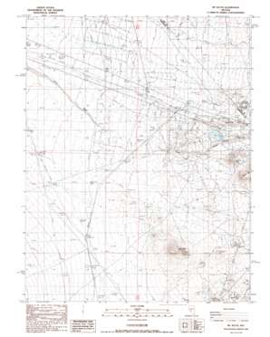
Mount Butte Topo Map Nevada
To zoom in, hover over the map of Mount Butte
USGS Topo Quad 38117a3 - 1:24,000 scale
| Topo Map Name: | Mount Butte |
| USGS Topo Quad ID: | 38117a3 |
| Print Size: | ca. 21 1/4" wide x 27" high |
| Southeast Coordinates: | 38° N latitude / 117.25° W longitude |
| Map Center Coordinates: | 38.0625° N latitude / 117.3125° W longitude |
| U.S. State: | NV |
| Filename: | o38117a3.jpg |
| Download Map JPG Image: | Mount Butte topo map 1:24,000 scale |
| Map Type: | Topographic |
| Topo Series: | 7.5´ |
| Map Scale: | 1:24,000 |
| Source of Map Images: | United States Geological Survey (USGS) |
| Alternate Map Versions: |
Mt. Butte NV 1987, updated 1987 Download PDF Buy paper map Mount Butte NV 2012 Download PDF Buy paper map Mount Butte NV 2014 Download PDF Buy paper map |
1:24,000 Topo Quads surrounding Mount Butte
> Back to 38117a1 at 1:100,000 scale
> Back to 38116a1 at 1:250,000 scale
> Back to U.S. Topo Maps home
Mount Butte topo map: Gazetteer
Mount Butte: Airports
Lambertucci Airstrip elevation 1715m 5626′Mount Butte: Mines
Belcher Divide Mine elevation 1764m 5787′Garibaldi Mine elevation 1727m 5666′
Hill of Gold Mine elevation 1770m 5807′
Keystone Mine elevation 1769m 5803′
Monarch Mine elevation 1757m 5764′
Silver Queen Mine elevation 1730m 5675′
Three Hills Mine elevation 1793m 5882′
Tonopah Mine elevation 1715m 5626′
West Tonopah Mine elevation 1763m 5784′
Mount Butte: Populated Places
Divide (historical) elevation 1761m 5777′Mount Butte: Post Offices
Divide Post Office (historical) elevation 1761m 5777′Mount Butte: Summits
Mount Butte elevation 1848m 6062′Table Mountain elevation 1747m 5731′
Mount Butte digital topo map on disk
Buy this Mount Butte topo map showing relief, roads, GPS coordinates and other geographical features, as a high-resolution digital map file on DVD:


