Lone Mountain Topo Map Nevada
To zoom in, hover over the map of Lone Mountain
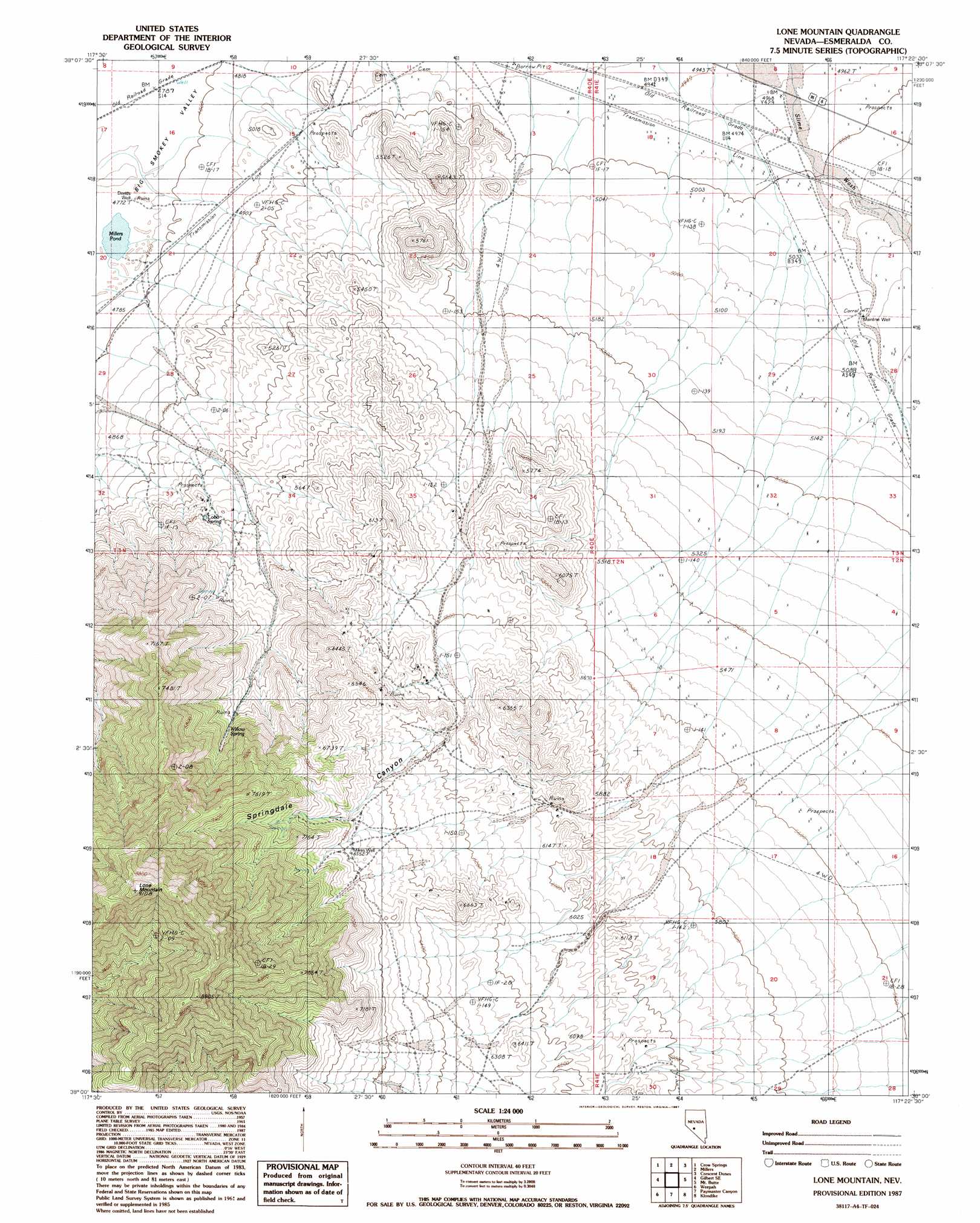
USGS Topo Quad 38117a4 - 1:24,000 scale
| Topo Map Name: | Lone Mountain |
| USGS Topo Quad ID: | 38117a4 |
| Print Size: | ca. 21 1/4" wide x 27" high |
| Southeast Coordinates: | 38° N latitude / 117.375° W longitude |
| Map Center Coordinates: | 38.0625° N latitude / 117.4375° W longitude |
| U.S. State: | NV |
| Filename: | o38117a4.jpg |
| Download Map JPG Image: | Lone Mountain topo map 1:24,000 scale |
| Map Type: | Topographic |
| Topo Series: | 7.5´ |
| Map Scale: | 1:24,000 |
| Source of Map Images: | United States Geological Survey (USGS) |
| Alternate Map Versions: |
Lone Mountain NV 1987, updated 1987 Download PDF Buy paper map Lone Mountain NV 2012 Download PDF Buy paper map Lone Mountain NV 2014 Download PDF Buy paper map |
1:24,000 Topo Quads surrounding Lone Mountain
Outlaw Springs |
Outlaw Springs Se |
San Antonio Ranch Sw |
Liberty Springs |
San Antonio Well |
Gilbert |
Crow Springs |
Millers |
Crescent Dunes |
Rays |
Devils Gate |
Gilbert Se |
Lone Mountain |
Mount Butte |
Tonopah |
North Of Silver Peak |
Weepah |
Paymaster Canyon |
Klondike |
Mud Lake Nw |
Silver Peak |
Goat Island |
Paymaster Ridge |
Alkali |
Mcmahon Ridge |
> Back to 38117a1 at 1:100,000 scale
> Back to 38116a1 at 1:250,000 scale
> Back to U.S. Topo Maps home
Lone Mountain topo map: Gazetteer
Lone Mountain: Lakes
Millers Pond elevation 1458m 4783′Lone Mountain: Mines
Heidi Mine elevation 1624m 5328′Lone Mountain: Springs
Lobo Spring elevation 1647m 5403′Willow Spring elevation 1837m 6026′
Lone Mountain: Streams
Slime Wash elevation 1511m 4957′Lone Mountain: Summits
Lone Mountain elevation 2777m 9110′Lone Mountain: Valleys
Springdale Canyon elevation 1756m 5761′Lone Mountain: Wells
Davids Well elevation 1458m 4783′Mainline Well elevation 1548m 5078′
Mikes Well elevation 2000m 6561′
Lone Mountain digital topo map on disk
Buy this Lone Mountain topo map showing relief, roads, GPS coordinates and other geographical features, as a high-resolution digital map file on DVD: