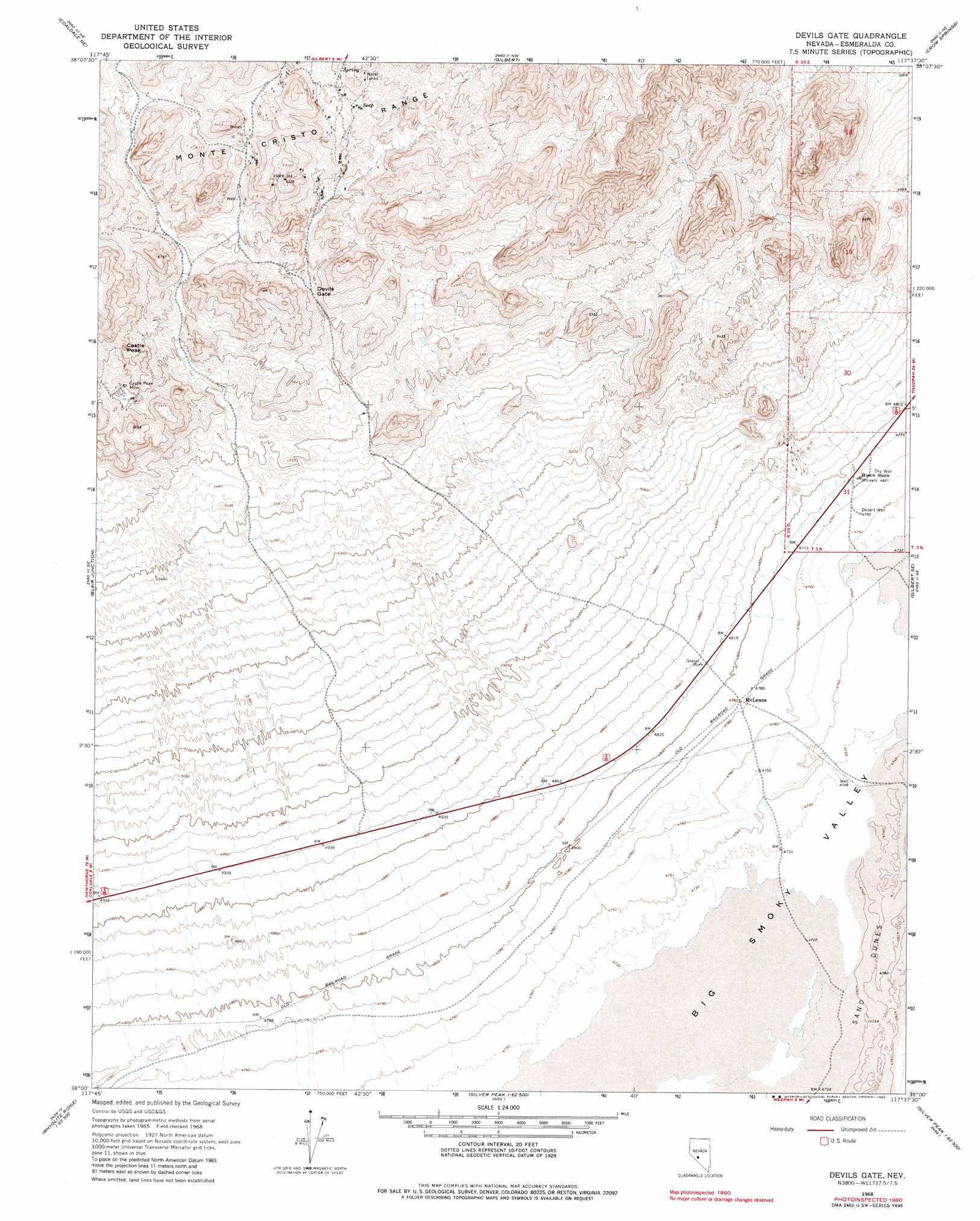
Devils Gate Topo Map Nevada
To zoom in, hover over the map of Devils Gate
USGS Topo Quad 38117a6 - 1:24,000 scale
| Topo Map Name: | Devils Gate |
| USGS Topo Quad ID: | 38117a6 |
| Print Size: | ca. 21 1/4" wide x 27" high |
| Southeast Coordinates: | 38° N latitude / 117.625° W longitude |
| Map Center Coordinates: | 38.0625° N latitude / 117.6875° W longitude |
| U.S. State: | NV |
| Filename: | o38117a6.jpg |
| Download Map JPG Image: | Devils Gate topo map 1:24,000 scale |
| Map Type: | Topographic |
| Topo Series: | 7.5´ |
| Map Scale: | 1:24,000 |
| Source of Map Images: | United States Geological Survey (USGS) |
| Alternate Map Versions: |
Devils Gate NV 1968, updated 1970 Download PDF Buy paper map Devils Gate NV 1968, updated 1983 Download PDF Buy paper map Devils Gate NV 2012 Download PDF Buy paper map Devils Gate NV 2014 Download PDF Buy paper map |
1:24,000 Topo Quads surrounding Devils Gate
Eddyville |
Kirby Flat |
Outlaw Springs |
Outlaw Springs Se |
San Antonio Ranch Sw |
Rock Hill |
Coaldale Ne |
Gilbert |
Crow Springs |
Millers |
Coaldale |
Blair Junction |
Devils Gate |
Gilbert Se |
Lone Mountain |
Rhyolite Ridge Nw |
Rhyolite Ridge Ne |
North Of Silver Peak |
Weepah |
Paymaster Canyon |
Rhyolite Ridge Sw |
Rhyolite Ridge |
Silver Peak |
Goat Island |
Paymaster Ridge |
> Back to 38117a1 at 1:100,000 scale
> Back to 38116a1 at 1:250,000 scale
> Back to U.S. Topo Maps home
Devils Gate topo map: Gazetteer
Devils Gate: Gaps
Devils Gate elevation 1757m 5764′Devils Gate: Mines
Alto Divide Mine elevation 1864m 6115′Castle Peak Mine elevation 1772m 5813′
Castle Rock Mine elevation 1779m 5836′
Original Gilbert Mine elevation 1825m 5987′
Devils Gate: Pillars
Black Rock elevation 1459m 4786′Devils Gate: Populated Places
McLeans elevation 1461m 4793′Devils Gate: Summits
Castle Peak elevation 1843m 6046′Devils Gate: Wells
Desert Well elevation 1449m 4753′Devils Gate digital topo map on disk
Buy this Devils Gate topo map showing relief, roads, GPS coordinates and other geographical features, as a high-resolution digital map file on DVD: