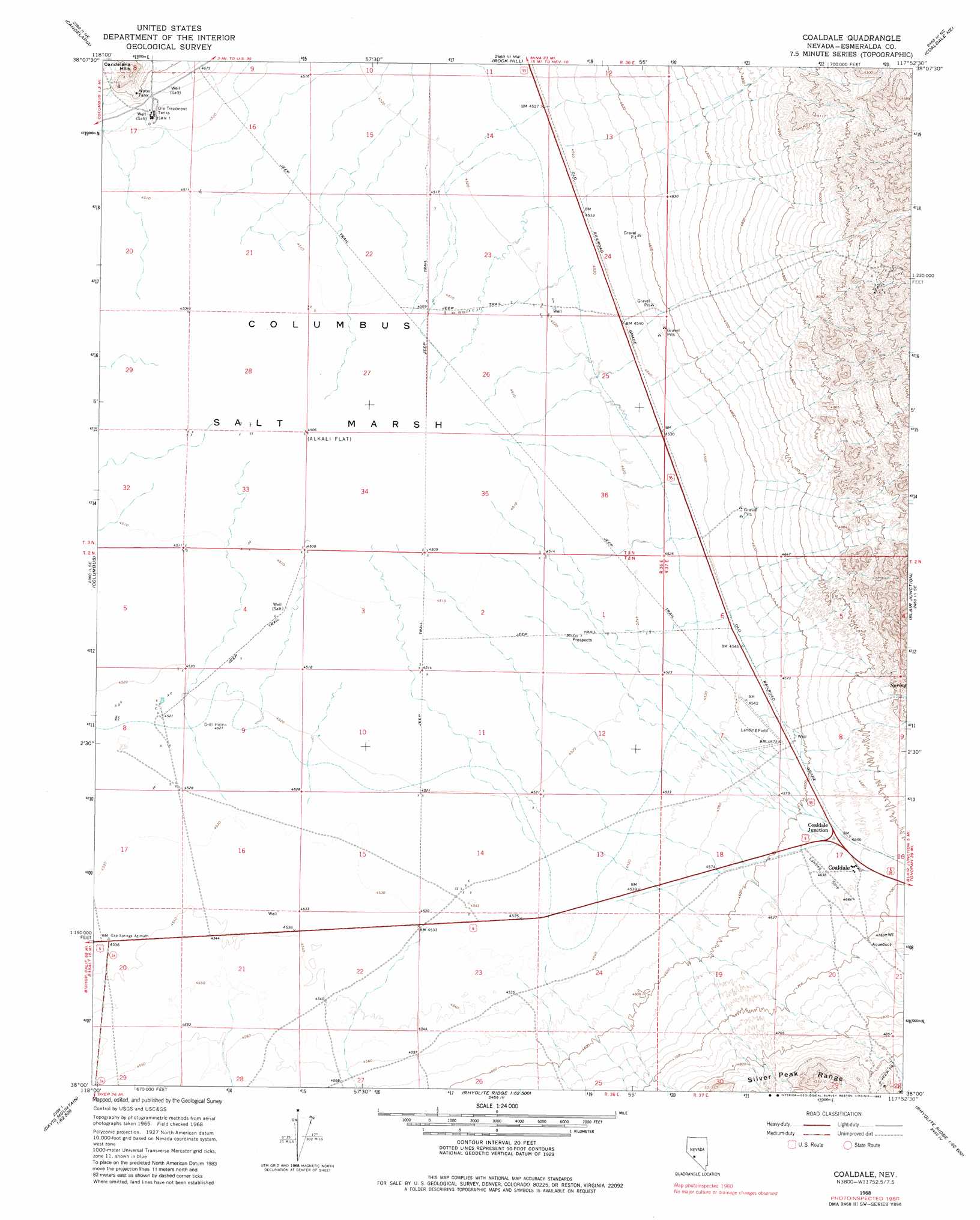
Coaldale Topo Map Nevada
To zoom in, hover over the map of Coaldale
USGS Topo Quad 38117a8 - 1:24,000 scale
| Topo Map Name: | Coaldale |
| USGS Topo Quad ID: | 38117a8 |
| Print Size: | ca. 21 1/4" wide x 27" high |
| Southeast Coordinates: | 38° N latitude / 117.875° W longitude |
| Map Center Coordinates: | 38.0625° N latitude / 117.9375° W longitude |
| U.S. State: | NV |
| Filename: | o38117a8.jpg |
| Download Map JPG Image: | Coaldale topo map 1:24,000 scale |
| Map Type: | Topographic |
| Topo Series: | 7.5´ |
| Map Scale: | 1:24,000 |
| Source of Map Images: | United States Geological Survey (USGS) |
| Alternate Map Versions: |
Coaldale NV 1968, updated 1970 Download PDF Buy paper map Coaldale NV 1968, updated 1983 Download PDF Buy paper map Coaldale NV 2012 Download PDF Buy paper map Coaldale NV 2014 Download PDF Buy paper map |
1:24,000 Topo Quads surrounding Coaldale
Camp Douglas |
Sodaville |
Eddyville |
Kirby Flat |
Outlaw Springs |
Belleville |
Candelaria |
Rock Hill |
Coaldale Ne |
Gilbert |
Miller Mountain |
Columbus |
Coaldale |
Blair Junction |
Devils Gate |
Volcanic Hills West |
Volcanic Hills East |
Rhyolite Ridge Nw |
Rhyolite Ridge Ne |
North Of Silver Peak |
Davis Mountain |
East Of Davis Mountain |
Rhyolite Ridge Sw |
Rhyolite Ridge |
Silver Peak |
> Back to 38117a1 at 1:100,000 scale
> Back to 38116a1 at 1:250,000 scale
> Back to U.S. Topo Maps home
Coaldale topo map: Gazetteer
Coaldale: Airports
Coaldale Airport elevation 1414m 4639′Coaldale: Basins
Columbia Valley elevation 1375m 4511′Coaldale: Flats
Columbus Salt Marsh elevation 1375m 4511′Coaldale: Mines
Micrometal Mine elevation 1380m 4527′Coaldale: Populated Places
Argentum (historical) elevation 1383m 4537′Calmville (historical) elevation 1385m 4543′
Coaldale elevation 1421m 4662′
Coaldale (historical) elevation 1397m 4583′
Coaldale Junction elevation 1411m 4629′
Coaldale: Post Offices
Calmville Post Office (historical) elevation 1385m 4543′Coaldale Post Office (historical) elevation 1397m 4583′
Coaldale digital topo map on disk
Buy this Coaldale topo map showing relief, roads, GPS coordinates and other geographical features, as a high-resolution digital map file on DVD: