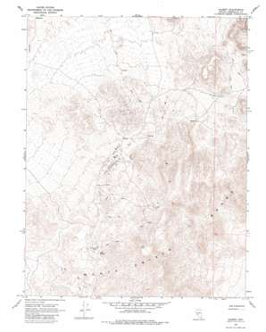
Gilbert Topo Map Nevada
To zoom in, hover over the map of Gilbert
USGS Topo Quad 38117b6 - 1:24,000 scale
| Topo Map Name: | Gilbert |
| USGS Topo Quad ID: | 38117b6 |
| Print Size: | ca. 21 1/4" wide x 27" high |
| Southeast Coordinates: | 38.125° N latitude / 117.625° W longitude |
| Map Center Coordinates: | 38.1875° N latitude / 117.6875° W longitude |
| U.S. State: | NV |
| Filename: | o38117b6.jpg |
| Download Map JPG Image: | Gilbert topo map 1:24,000 scale |
| Map Type: | Topographic |
| Topo Series: | 7.5´ |
| Map Scale: | 1:24,000 |
| Source of Map Images: | United States Geological Survey (USGS) |
| Alternate Map Versions: |
Gilbert NV 1968, updated 1970 Download PDF Buy paper map Gilbert NV 1968, updated 1981 Download PDF Buy paper map Gilbert NV 2012 Download PDF Buy paper map Gilbert NV 2014 Download PDF Buy paper map |
1:24,000 Topo Quads surrounding Gilbert
> Back to 38117a1 at 1:100,000 scale
> Back to 38116a1 at 1:250,000 scale
> Back to U.S. Topo Maps home
Gilbert topo map: Gazetteer
Gilbert: Mines
Carrie Mine elevation 2082m 6830′Eureka Mine elevation 2023m 6637′
Gilbert Mine elevation 1931m 6335′
Last Hope Mine elevation 1914m 6279′
Mammoth Mine elevation 1917m 6289′
Monte Cristo Mine elevation 1947m 6387′
Gilbert: Populated Places
Gilbert (historical) elevation 1887m 6190′Gilbert: Post Offices
Gilbert Post Office (historical) elevation 1887m 6190′Gilbert: Springs
Cook Spring elevation 2051m 6729′Gilbert digital topo map on disk
Buy this Gilbert topo map showing relief, roads, GPS coordinates and other geographical features, as a high-resolution digital map file on DVD:


