Coaldale Ne Topo Map Nevada
To zoom in, hover over the map of Coaldale Ne
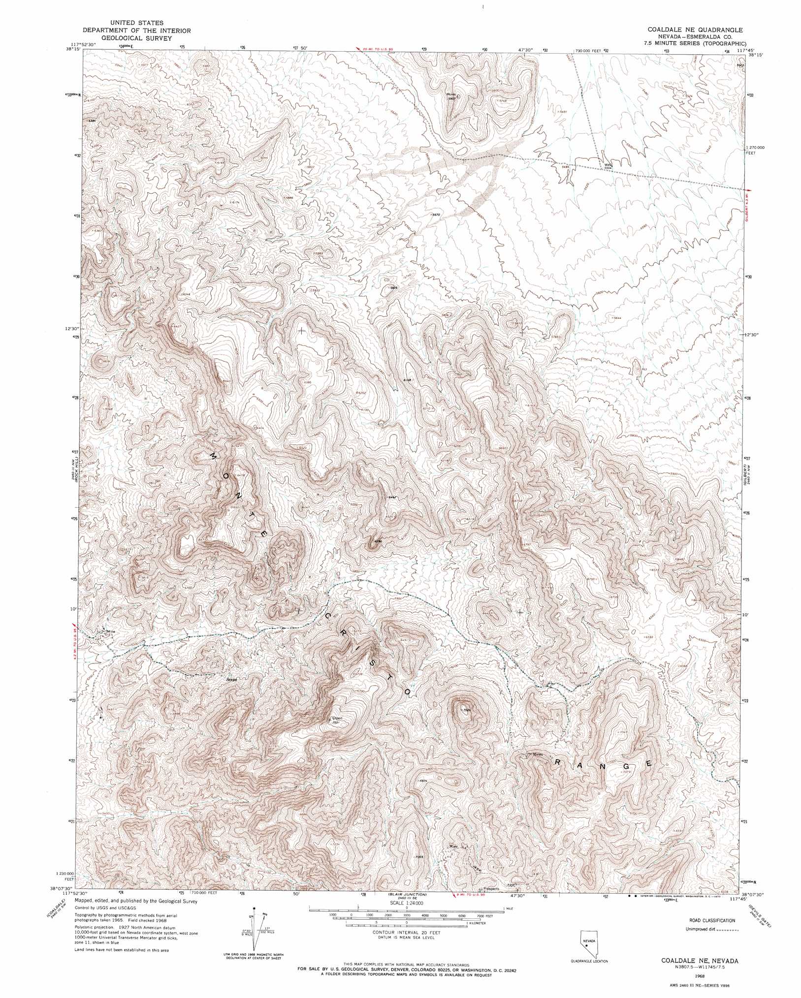
USGS Topo Quad 38117b7 - 1:24,000 scale
| Topo Map Name: | Coaldale Ne |
| USGS Topo Quad ID: | 38117b7 |
| Print Size: | ca. 21 1/4" wide x 27" high |
| Southeast Coordinates: | 38.125° N latitude / 117.75° W longitude |
| Map Center Coordinates: | 38.1875° N latitude / 117.8125° W longitude |
| U.S. State: | NV |
| Filename: | o38117b7.jpg |
| Download Map JPG Image: | Coaldale Ne topo map 1:24,000 scale |
| Map Type: | Topographic |
| Topo Series: | 7.5´ |
| Map Scale: | 1:24,000 |
| Source of Map Images: | United States Geological Survey (USGS) |
| Alternate Map Versions: |
Coaldale NE NV 1968, updated 1970 Download PDF Buy paper map Coaldale NE NV 2012 Download PDF Buy paper map Coaldale NE NV 2014 Download PDF Buy paper map |
1:24,000 Topo Quads surrounding Coaldale Ne
Mina |
Bettles Well |
Dicalite Summit |
Cole Spring |
Outlaw Springs Ne |
Sodaville |
Eddyville |
Kirby Flat |
Outlaw Springs |
Outlaw Springs Se |
Candelaria |
Rock Hill |
Coaldale Ne |
Gilbert |
Crow Springs |
Columbus |
Coaldale |
Blair Junction |
Devils Gate |
Gilbert Se |
Volcanic Hills East |
Rhyolite Ridge Nw |
Rhyolite Ridge Ne |
North Of Silver Peak |
Weepah |
> Back to 38117a1 at 1:100,000 scale
> Back to 38116a1 at 1:250,000 scale
> Back to U.S. Topo Maps home
Coaldale Ne digital topo map on disk
Buy this Coaldale Ne topo map showing relief, roads, GPS coordinates and other geographical features, as a high-resolution digital map file on DVD: