Henrys Well Topo Map Nevada
To zoom in, hover over the map of Henrys Well
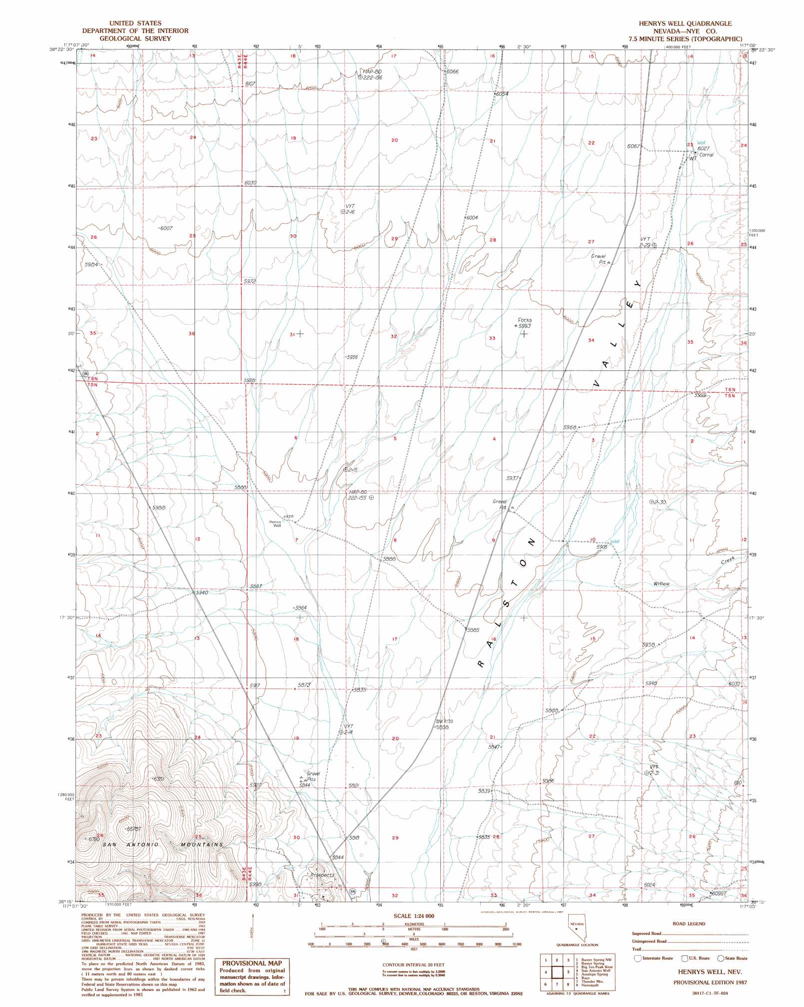
USGS Topo Quad 38117c1 - 1:24,000 scale
| Topo Map Name: | Henrys Well |
| USGS Topo Quad ID: | 38117c1 |
| Print Size: | ca. 21 1/4" wide x 27" high |
| Southeast Coordinates: | 38.25° N latitude / 117° W longitude |
| Map Center Coordinates: | 38.3125° N latitude / 117.0625° W longitude |
| U.S. State: | NV |
| Filename: | o38117c1.jpg |
| Download Map JPG Image: | Henrys Well topo map 1:24,000 scale |
| Map Type: | Topographic |
| Topo Series: | 7.5´ |
| Map Scale: | 1:24,000 |
| Source of Map Images: | United States Geological Survey (USGS) |
| Alternate Map Versions: |
Henrys Well NV 1987, updated 1987 Download PDF Buy paper map Henrys Well NV 2012 Download PDF Buy paper map Henrys Well NV 2014 Download PDF Buy paper map |
1:24,000 Topo Quads surrounding Henrys Well
Peavine Ranch |
Seyler Peak |
Manhattan |
Belmont West |
Belmont East |
San Antonio Ranch |
Baxter Spring Nw |
Baxter Spring |
Big Ten Peak West |
Big Ten Peak East |
Liberty Springs |
San Antonio Well |
Henrys Well |
Antelope Spring |
Saulsbury Basin |
Crescent Dunes |
Rays |
Thumder Mountain |
Hannapah |
Mud Spring |
Mount Butte |
Tonopah |
East Of Tonopah |
Mckinney Tanks |
Yellow Cone |
> Back to 38117a1 at 1:100,000 scale
> Back to 38116a1 at 1:250,000 scale
> Back to U.S. Topo Maps home
Henrys Well topo map: Gazetteer
Henrys Well: Streams
Willow Creek elevation 1797m 5895′Henrys Well: Trails
Tonopah Manhattan Stage Route elevation 1796m 5892′Henrys Well: Wells
Blair Well elevation 1801m 5908′Chance Well elevation 1836m 6023′
Henrys Well elevation 1794m 5885′
Henrys Well digital topo map on disk
Buy this Henrys Well topo map showing relief, roads, GPS coordinates and other geographical features, as a high-resolution digital map file on DVD: