Liberty Springs Topo Map Nevada
To zoom in, hover over the map of Liberty Springs
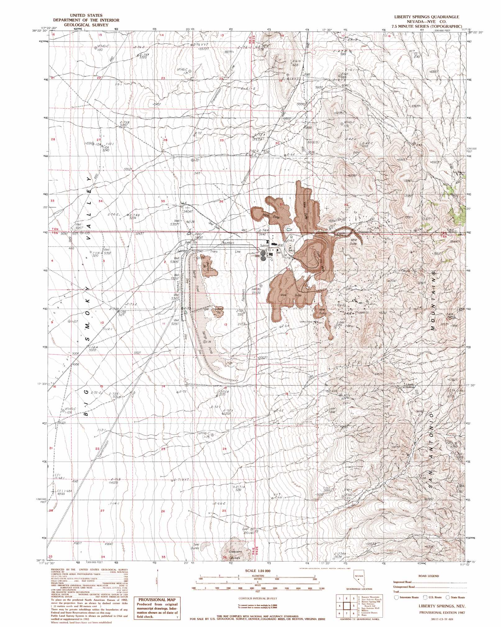
USGS Topo Quad 38117c3 - 1:24,000 scale
| Topo Map Name: | Liberty Springs |
| USGS Topo Quad ID: | 38117c3 |
| Print Size: | ca. 21 1/4" wide x 27" high |
| Southeast Coordinates: | 38.25° N latitude / 117.25° W longitude |
| Map Center Coordinates: | 38.3125° N latitude / 117.3125° W longitude |
| U.S. State: | NV |
| Filename: | o38117c3.jpg |
| Download Map JPG Image: | Liberty Springs topo map 1:24,000 scale |
| Map Type: | Topographic |
| Topo Series: | 7.5´ |
| Map Scale: | 1:24,000 |
| Source of Map Images: | United States Geological Survey (USGS) |
| Alternate Map Versions: |
Liberty Springs NV 1987, updated 1987 Download PDF Buy paper map Liberty Springs NV 2012 Download PDF Buy paper map Liberty Springs NV 2014 Download PDF Buy paper map |
1:24,000 Topo Quads surrounding Liberty Springs
Cloverdale Ranch |
Secret Basin |
Peavine Ranch |
Seyler Peak |
Manhattan |
Outlaw Springs Ne |
Rainier Mountain |
San Antonio Ranch |
Baxter Spring Nw |
Baxter Spring |
Outlaw Springs Se |
San Antonio Ranch Sw |
Liberty Springs |
San Antonio Well |
Henrys Well |
Crow Springs |
Millers |
Crescent Dunes |
Rays |
Thumder Mountain |
Gilbert Se |
Lone Mountain |
Mount Butte |
Tonopah |
East Of Tonopah |
> Back to 38117a1 at 1:100,000 scale
> Back to 38116a1 at 1:250,000 scale
> Back to U.S. Topo Maps home
Liberty Springs topo map: Gazetteer
Liberty Springs: Mines
Cicero Mine elevation 1806m 5925′Florence Mine elevation 1998m 6555′
Hall Mine elevation 1796m 5892′
Lea Mine elevation 1908m 6259′
Lee Mine elevation 1806m 5925′
Liberty Mine elevation 1806m 5925′
Merrimac Mine elevation 1935m 6348′
Palistine Mine elevation 1806m 5925′
Potomic Mine elevation 1806m 5925′
San Antonio Mine elevation 2082m 6830′
Spanish Mine elevation 1873m 6145′
Liberty Springs: Populated Places
Liberty (historical) elevation 1806m 5925′Liberty Springs: Springs
Liberty Springs elevation 1910m 6266′Liberty Springs digital topo map on disk
Buy this Liberty Springs topo map showing relief, roads, GPS coordinates and other geographical features, as a high-resolution digital map file on DVD: