Outlaw Springs Se Topo Map Nevada
To zoom in, hover over the map of Outlaw Springs Se
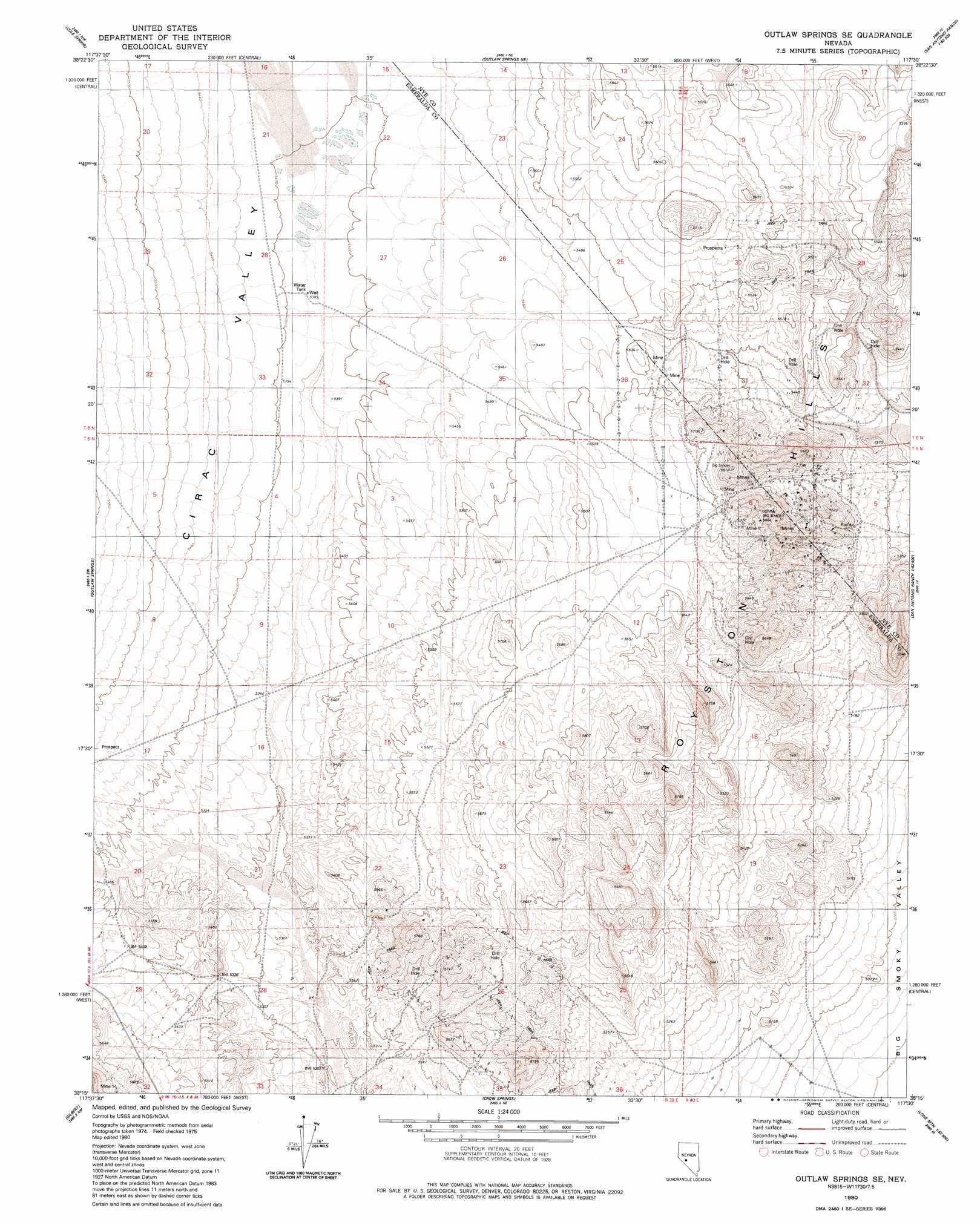
USGS Topo Quad 38117c5 - 1:24,000 scale
| Topo Map Name: | Outlaw Springs Se |
| USGS Topo Quad ID: | 38117c5 |
| Print Size: | ca. 21 1/4" wide x 27" high |
| Southeast Coordinates: | 38.25° N latitude / 117.5° W longitude |
| Map Center Coordinates: | 38.3125° N latitude / 117.5625° W longitude |
| U.S. State: | NV |
| Filename: | o38117c5.jpg |
| Download Map JPG Image: | Outlaw Springs Se topo map 1:24,000 scale |
| Map Type: | Topographic |
| Topo Series: | 7.5´ |
| Map Scale: | 1:24,000 |
| Source of Map Images: | United States Geological Survey (USGS) |
| Alternate Map Versions: |
Outlaw Springs SE NV 1980, updated 1980 Download PDF Buy paper map Outlaw Springs SE NV 2012 Download PDF Buy paper map Outlaw Springs SE NV 2014 Download PDF Buy paper map |
1:24,000 Topo Quads surrounding Outlaw Springs Se
Simon |
Black Spring |
Cloverdale Ranch |
Secret Basin |
Peavine Ranch |
Dicalite Summit |
Cole Spring |
Outlaw Springs Ne |
Rainier Mountain |
San Antonio Ranch |
Kirby Flat |
Outlaw Springs |
Outlaw Springs Se |
San Antonio Ranch Sw |
Liberty Springs |
Coaldale Ne |
Gilbert |
Crow Springs |
Millers |
Crescent Dunes |
Blair Junction |
Devils Gate |
Gilbert Se |
Lone Mountain |
Mount Butte |
> Back to 38117a1 at 1:100,000 scale
> Back to 38116a1 at 1:250,000 scale
> Back to U.S. Topo Maps home
Outlaw Springs Se topo map: Gazetteer
Outlaw Springs Se: Mines
Royal Blue Mining Company elevation 1677m 5501′Outlaw Springs Se: Populated Places
Royston (historical) elevation 1609m 5278′Outlaw Springs Se digital topo map on disk
Buy this Outlaw Springs Se topo map showing relief, roads, GPS coordinates and other geographical features, as a high-resolution digital map file on DVD: