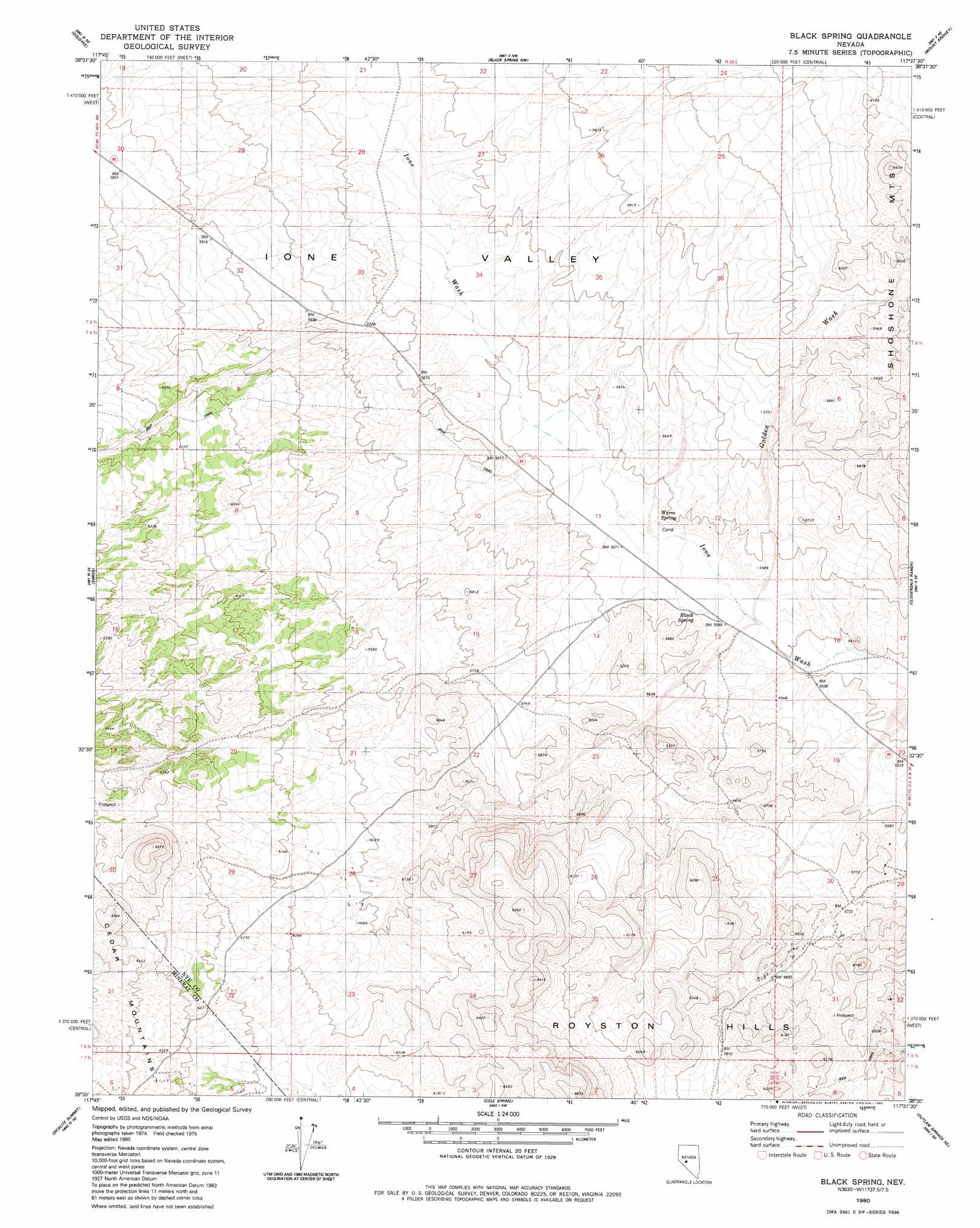
Black Spring Topo Map Nevada
To zoom in, hover over the map of Black Spring
USGS Topo Quad 38117e6 - 1:24,000 scale
| Topo Map Name: | Black Spring |
| USGS Topo Quad ID: | 38117e6 |
| Print Size: | ca. 21 1/4" wide x 27" high |
| Southeast Coordinates: | 38.5° N latitude / 117.625° W longitude |
| Map Center Coordinates: | 38.5625° N latitude / 117.6875° W longitude |
| U.S. State: | NV |
| Filename: | o38117e6.jpg |
| Download Map JPG Image: | Black Spring topo map 1:24,000 scale |
| Map Type: | Topographic |
| Topo Series: | 7.5´ |
| Map Scale: | 1:24,000 |
| Source of Map Images: | United States Geological Survey (USGS) |
| Alternate Map Versions: |
Black Spring NV 1980, updated 1980 Download PDF Buy paper map Black Spring NV 2012 Download PDF Buy paper map Black Spring NV 2014 Download PDF Buy paper map |
1:24,000 Topo Quads surrounding Black Spring
Gabbs |
Paradise Peak |
Ione Sw |
Grantsville |
Bakeoven Creek |
Granny Goose Well |
Goldyke |
Black Spring Nw |
Mount Ardivey |
Farrington Canyon |
Stewart Spring |
Simon |
Black Spring |
Cloverdale Ranch |
Secret Basin |
Bettles Well |
Dicalite Summit |
Cole Spring |
Outlaw Springs Ne |
Rainier Mountain |
Eddyville |
Kirby Flat |
Outlaw Springs |
Outlaw Springs Se |
San Antonio Ranch Sw |
> Back to 38117e1 at 1:100,000 scale
> Back to 38116a1 at 1:250,000 scale
> Back to U.S. Topo Maps home
Black Spring topo map: Gazetteer
Black Spring: Mines
Cipac Mine elevation 1788m 5866′Black Spring: Springs
Black Spring elevation 1689m 5541′Warm Spring elevation 1695m 5561′
Black Spring: Streams
Golden Wash elevation 1684m 5524′Black Spring digital topo map on disk
Buy this Black Spring topo map showing relief, roads, GPS coordinates and other geographical features, as a high-resolution digital map file on DVD: