Farrington Canyon Topo Map Nevada
To zoom in, hover over the map of Farrington Canyon
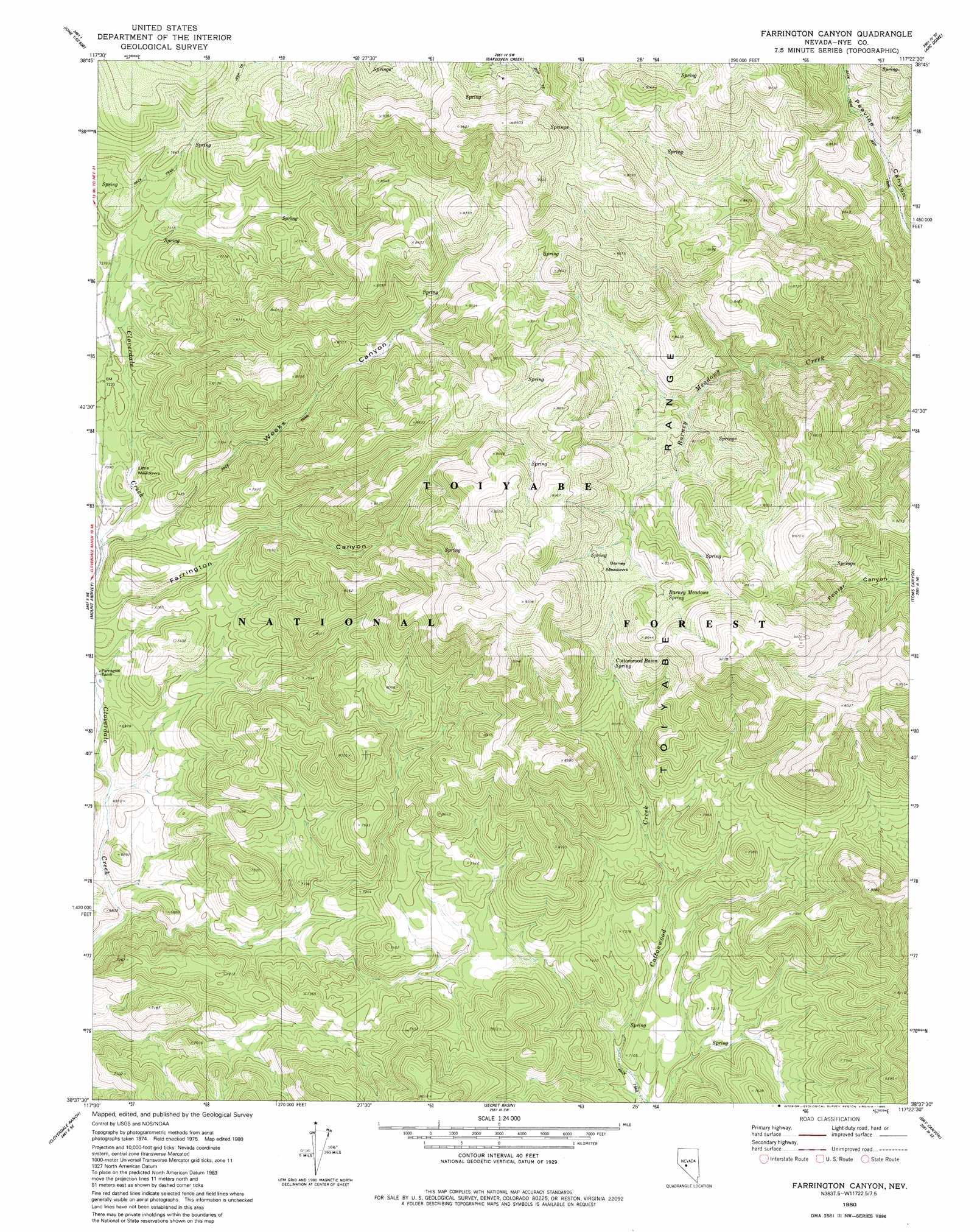
USGS Topo Quad 38117f4 - 1:24,000 scale
| Topo Map Name: | Farrington Canyon |
| USGS Topo Quad ID: | 38117f4 |
| Print Size: | ca. 21 1/4" wide x 27" high |
| Southeast Coordinates: | 38.625° N latitude / 117.375° W longitude |
| Map Center Coordinates: | 38.6875° N latitude / 117.4375° W longitude |
| U.S. State: | NV |
| Filename: | o38117f4.jpg |
| Download Map JPG Image: | Farrington Canyon topo map 1:24,000 scale |
| Map Type: | Topographic |
| Topo Series: | 7.5´ |
| Map Scale: | 1:24,000 |
| Source of Map Images: | United States Geological Survey (USGS) |
| Alternate Map Versions: |
Farrington Canyon NV 1980, updated 1980 Download PDF Buy paper map Farrington Canyon NV 2011 Download PDF Buy paper map Farrington Canyon NV 2014 Download PDF Buy paper map |
| FStopo: | US Forest Service topo Farrington Canyon is available: Download FStopo PDF Download FStopo TIF |
1:24,000 Topo Quads surrounding Farrington Canyon
Ione Nw |
Ione |
Corral Wash |
South Toiyabe Peak |
Carvers Nw |
Ione Sw |
Grantsville |
Bakeoven Creek |
Arc Dome |
Carvers |
Black Spring Nw |
Mount Ardivey |
Farrington Canyon |
Toms Canyon |
Pablo Canyon Ranch |
Black Spring |
Cloverdale Ranch |
Secret Basin |
Peavine Ranch |
Seyler Peak |
Cole Spring |
Outlaw Springs Ne |
Rainier Mountain |
San Antonio Ranch |
Baxter Spring Nw |
> Back to 38117e1 at 1:100,000 scale
> Back to 38116a1 at 1:250,000 scale
> Back to U.S. Topo Maps home
Farrington Canyon topo map: Gazetteer
Farrington Canyon: Flats
Barney Meadows elevation 2526m 8287′Little Meadows elevation 2157m 7076′
Farrington Canyon: Parks
Reese River State Game Refuge elevation 2465m 8087′Farrington Canyon: Springs
Barney Meadows Spring elevation 2572m 8438′Cottonwood Basin Spring elevation 2457m 8061′
Rat Trap Spring elevation 2346m 7696′
Farrington Canyon: Valleys
Weeks Canyon elevation 2123m 6965′Farrington Canyon digital topo map on disk
Buy this Farrington Canyon topo map showing relief, roads, GPS coordinates and other geographical features, as a high-resolution digital map file on DVD: