Black Spring Nw Topo Map Nevada
To zoom in, hover over the map of Black Spring Nw
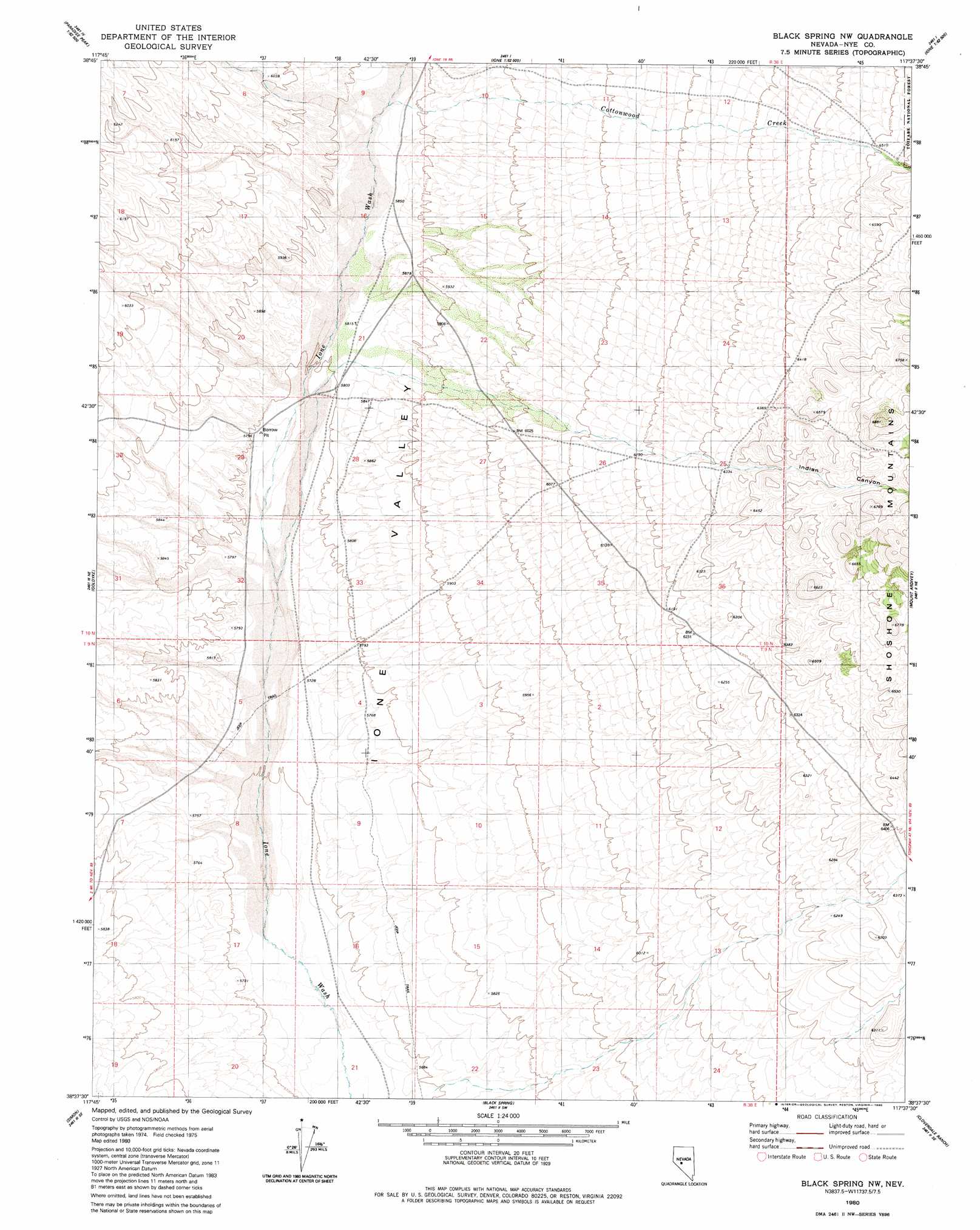
USGS Topo Quad 38117f6 - 1:24,000 scale
| Topo Map Name: | Black Spring Nw |
| USGS Topo Quad ID: | 38117f6 |
| Print Size: | ca. 21 1/4" wide x 27" high |
| Southeast Coordinates: | 38.625° N latitude / 117.625° W longitude |
| Map Center Coordinates: | 38.6875° N latitude / 117.6875° W longitude |
| U.S. State: | NV |
| Filename: | o38117f6.jpg |
| Download Map JPG Image: | Black Spring Nw topo map 1:24,000 scale |
| Map Type: | Topographic |
| Topo Series: | 7.5´ |
| Map Scale: | 1:24,000 |
| Source of Map Images: | United States Geological Survey (USGS) |
| Alternate Map Versions: |
Black Spring NW NV 1980, updated 1980 Download PDF Buy paper map Black Spring NW NV 2012 Download PDF Buy paper map Black Spring NW NV 2014 Download PDF Buy paper map |
| FStopo: | US Forest Service topo Black Spring NW is available: Download FStopo PDF Download FStopo TIF |
1:24,000 Topo Quads surrounding Black Spring Nw
Downeyville |
Ellsworth |
Ione Nw |
Ione |
Corral Wash |
Gabbs |
Paradise Peak |
Ione Sw |
Grantsville |
Bakeoven Creek |
Granny Goose Well |
Goldyke |
Black Spring Nw |
Mount Ardivey |
Farrington Canyon |
Stewart Spring |
Simon |
Black Spring |
Cloverdale Ranch |
Secret Basin |
Bettles Well |
Dicalite Summit |
Cole Spring |
Outlaw Springs Ne |
Rainier Mountain |
> Back to 38117e1 at 1:100,000 scale
> Back to 38116a1 at 1:250,000 scale
> Back to U.S. Topo Maps home
Black Spring Nw topo map: Gazetteer
Black Spring Nw: Streams
Cottonwood Creek elevation 1790m 5872′Black Spring Nw: Valleys
Indian Canyon elevation 1919m 6295′Black Spring Nw: Wells
U S Well elevation 1775m 5823′Black Spring Nw digital topo map on disk
Buy this Black Spring Nw topo map showing relief, roads, GPS coordinates and other geographical features, as a high-resolution digital map file on DVD: