Carvers Topo Map Nevada
To zoom in, hover over the map of Carvers
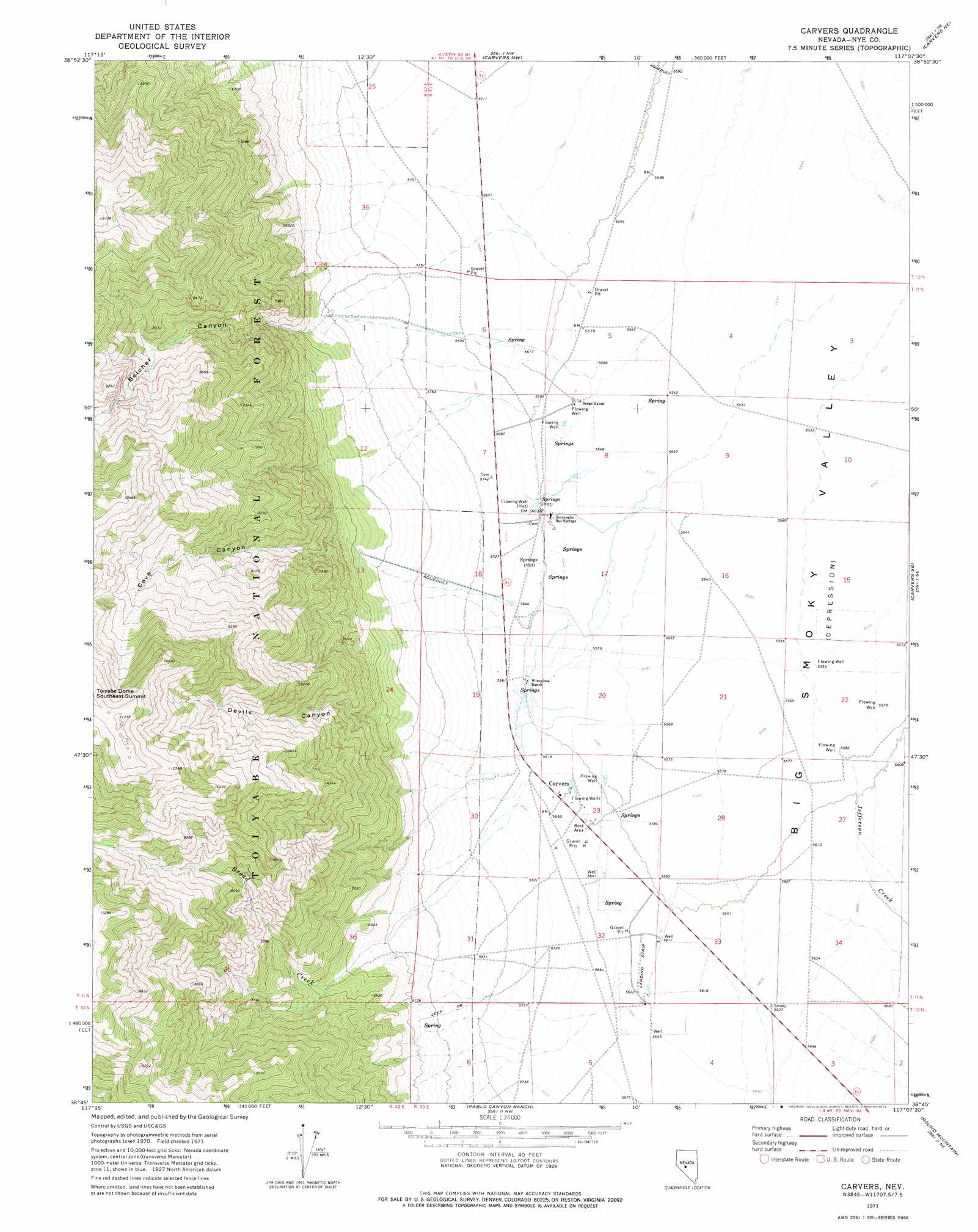
USGS Topo Quad 38117g2 - 1:24,000 scale
| Topo Map Name: | Carvers |
| USGS Topo Quad ID: | 38117g2 |
| Print Size: | ca. 21 1/4" wide x 27" high |
| Southeast Coordinates: | 38.75° N latitude / 117.125° W longitude |
| Map Center Coordinates: | 38.8125° N latitude / 117.1875° W longitude |
| U.S. State: | NV |
| Filename: | o38117g2.jpg |
| Download Map JPG Image: | Carvers topo map 1:24,000 scale |
| Map Type: | Topographic |
| Topo Series: | 7.5´ |
| Map Scale: | 1:24,000 |
| Source of Map Images: | United States Geological Survey (USGS) |
| Alternate Map Versions: |
Carvers NV 1971, updated 1974 Download PDF Buy paper map Carvers NV 1971, updated 1974 Download PDF Buy paper map Carvers NV 2011 Download PDF Buy paper map Carvers NV 2014 Download PDF Buy paper map |
| FStopo: | US Forest Service topo Carvers is available: Download FStopo PDF Download FStopo TIF |
1:24,000 Topo Quads surrounding Carvers
Barrett Canyon |
Tierney Creek |
Millett Ranch |
East Of Millett Ranch |
Wildcat Canyon |
Corral Wash |
South Toiyabe Peak |
Carvers Nw |
Carvers Ne |
Jet Spring |
Bakeoven Creek |
Arc Dome |
Carvers |
Carvers Se |
Mount Jefferson |
Farrington Canyon |
Toms Canyon |
Pablo Canyon Ranch |
Round Mountain |
Jefferson |
Secret Basin |
Peavine Ranch |
Seyler Peak |
Manhattan |
Belmont West |
> Back to 38117e1 at 1:100,000 scale
> Back to 38116a1 at 1:250,000 scale
> Back to U.S. Topo Maps home
Carvers topo map: Gazetteer
Carvers: Airports
M and O Ranch Airport elevation 1712m 5616′Wine Glass Ranch Airport elevation 1698m 5570′
Carvers: Populated Places
Carvers elevation 1720m 5643′Darroughs Hot Springs elevation 1701m 5580′
Carvers: Streams
Broad Creek elevation 1717m 5633′Jefferson Creek elevation 1704m 5590′
Carvers: Summits
Toiyabe Dome Southeast Summit elevation 3449m 11315′Carvers: Valleys
Belcher Canyon elevation 1855m 6085′Cove Canyon elevation 1967m 6453′
Devils Canyon elevation 1956m 6417′
Niagara Cañon elevation 1890m 6200′
Carvers digital topo map on disk
Buy this Carvers topo map showing relief, roads, GPS coordinates and other geographical features, as a high-resolution digital map file on DVD: