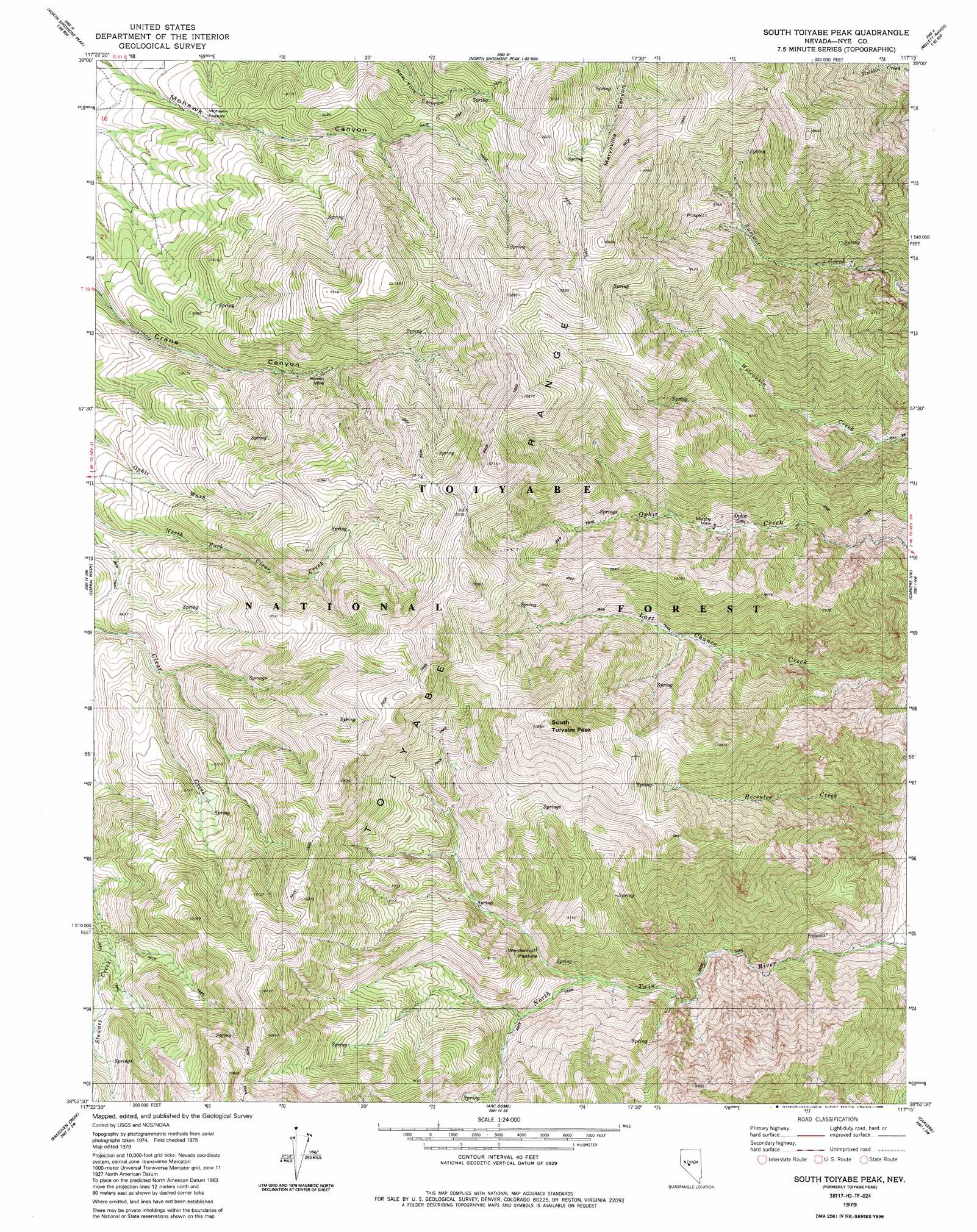
South Toiyabe Peak Topo Map Nevada
To zoom in, hover over the map of South Toiyabe Peak
USGS Topo Quad 38117h3 - 1:24,000 scale
| Topo Map Name: | South Toiyabe Peak |
| USGS Topo Quad ID: | 38117h3 |
| Print Size: | ca. 21 1/4" wide x 27" high |
| Southeast Coordinates: | 38.875° N latitude / 117.25° W longitude |
| Map Center Coordinates: | 38.9375° N latitude / 117.3125° W longitude |
| U.S. State: | NV |
| Filename: | o38117h3.jpg |
| Download Map JPG Image: | South Toiyabe Peak topo map 1:24,000 scale |
| Map Type: | Topographic |
| Topo Series: | 7.5´ |
| Map Scale: | 1:24,000 |
| Source of Map Images: | United States Geological Survey (USGS) |
| Alternate Map Versions: |
Toiyabe Peak NV 1979, updated 1980 Download PDF Buy paper map South Toiyabe Peak NV 1979, updated 1985 Download PDF Buy paper map South Toiyabe Peak NV 2011 Download PDF Buy paper map South Toiyabe Peak NV 2014 Download PDF Buy paper map |
| FStopo: | US Forest Service topo South Toiyabe Peak is available: Download FStopo PDF Download FStopo TIF |
1:24,000 Topo Quads surrounding South Toiyabe Peak
Gold Park |
North Shoshone Peak |
Reese River Butte |
Brewer Canyon |
Kingston |
South Shoshone Peak |
Barrett Canyon |
Tierney Creek |
Millett Ranch |
East Of Millett Ranch |
Ione |
Corral Wash |
South Toiyabe Peak |
Carvers Nw |
Carvers Ne |
Grantsville |
Bakeoven Creek |
Arc Dome |
Carvers |
Carvers Se |
Mount Ardivey |
Farrington Canyon |
Toms Canyon |
Pablo Canyon Ranch |
Round Mountain |
> Back to 38117e1 at 1:100,000 scale
> Back to 38116a1 at 1:250,000 scale
> Back to U.S. Topo Maps home
South Toiyabe Peak topo map: Gazetteer
South Toiyabe Peak: Flats
Mohawk Pasture elevation 2288m 7506′Werdenhoff Pasture elevation 2446m 8024′
South Toiyabe Peak: Mines
Buckeye Mine elevation 2279m 7477′Gruss Mine elevation 3011m 9878′
Hamlin Mine elevation 2490m 8169′
Murphy Mine elevation 2379m 7805′
New Moose Tungsten Mine elevation 2290m 7513′
Ophir Mine elevation 2601m 8533′
Sullivar Mines elevation 2755m 9038′
Summit Canyon Barite Mine elevation 2865m 9399′
South Toiyabe Peak: Populated Places
Ophir (historical) elevation 2479m 8133′South Toiyabe Peak: Post Offices
Twin River Post Office (historical) elevation 2330m 7644′South Toiyabe Peak: Summits
South Toiyabe Peak elevation 3184m 10446′South Toiyabe Peak digital topo map on disk
Buy this South Toiyabe Peak topo map showing relief, roads, GPS coordinates and other geographical features, as a high-resolution digital map file on DVD: