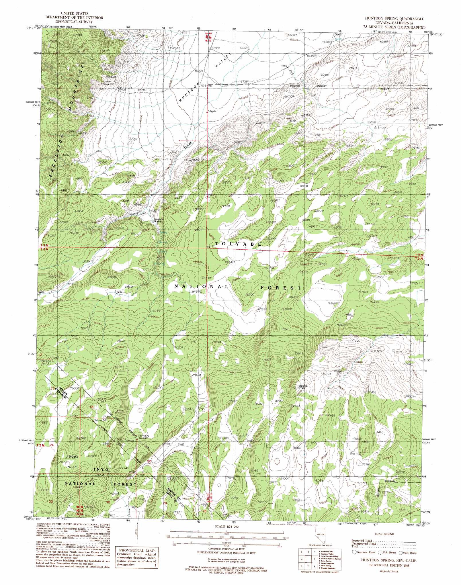
Huntoon Spring Topo Map Nevada
To zoom in, hover over the map of Huntoon Spring
USGS Topo Quad 38118a5 - 1:24,000 scale
| Topo Map Name: | Huntoon Spring |
| USGS Topo Quad ID: | 38118a5 |
| Print Size: | ca. 21 1/4" wide x 27" high |
| Southeast Coordinates: | 38° N latitude / 118.5° W longitude |
| Map Center Coordinates: | 38.0625° N latitude / 118.5625° W longitude |
| U.S. States: | NV, CA |
| Filename: | o38118a5.jpg |
| Download Map JPG Image: | Huntoon Spring topo map 1:24,000 scale |
| Map Type: | Topographic |
| Topo Series: | 7.5´ |
| Map Scale: | 1:24,000 |
| Source of Map Images: | United States Geological Survey (USGS) |
| Alternate Map Versions: |
Huntoon Spring NV 1988, updated 1988 Download PDF Buy paper map Huntoon Spring NV 1994, updated 1997 Download PDF Buy paper map Huntoon Spring NV 2012 Download PDF Buy paper map Huntoon Spring NV 2014 Download PDF Buy paper map |
| FStopo: | US Forest Service topo Huntoon Spring is available: Download FStopo PDF Download FStopo TIF |
1:24,000 Topo Quads surrounding Huntoon Spring
Mount Hicks |
Powell Mountain |
Whisky Flat |
Rattlesnake Flat |
Moho Mountain |
Cedar Hill |
Anchorite Hills |
Huntoon Valley |
Little Huntoon Valley |
Teels Marsh |
Alameda Well |
West Of Huntoon Spring |
Huntoon Spring |
Jacks Spring |
Basalt |
Cowtrack Mountain |
Indian Meadows |
River Spring |
Truman Meadows |
Mount Montgomery |
Dexter Canyon |
Glass Mountain |
Benton Hot Spirngs |
Benton |
Boundary Peak |
> Back to 38118a1 at 1:100,000 scale
> Back to 38118a1 at 1:250,000 scale
> Back to U.S. Topo Maps home
Huntoon Spring topo map: Gazetteer
Huntoon Spring: Ranges
Adobe Hills elevation 2378m 7801′Huntoon Spring: Springs
Huntoon Spring elevation 1867m 6125′Huntoon Spring: Streams
Huntoon Creek elevation 1730m 5675′Huntoon Creek elevation 1730m 5675′
Huntoon Spring digital topo map on disk
Buy this Huntoon Spring topo map showing relief, roads, GPS coordinates and other geographical features, as a high-resolution digital map file on DVD: