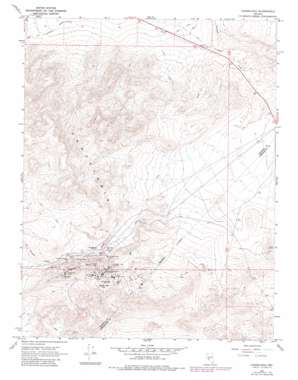
Candelaria Topo Map Nevada
To zoom in, hover over the map of Candelaria
USGS Topo Quad 38118b1 - 1:24,000 scale
| Topo Map Name: | Candelaria |
| USGS Topo Quad ID: | 38118b1 |
| Print Size: | ca. 21 1/4" wide x 27" high |
| Southeast Coordinates: | 38.125° N latitude / 118° W longitude |
| Map Center Coordinates: | 38.1875° N latitude / 118.0625° W longitude |
| U.S. State: | NV |
| Filename: | o38118b1.jpg |
| Download Map JPG Image: | Candelaria topo map 1:24,000 scale |
| Map Type: | Topographic |
| Topo Series: | 7.5´ |
| Map Scale: | 1:24,000 |
| Source of Map Images: | United States Geological Survey (USGS) |
| Alternate Map Versions: |
Candelaria NV 1967, updated 1969 Download PDF Buy paper map Candelaria NV 1967, updated 1982 Download PDF Buy paper map Candelaria NV 2011 Download PDF Buy paper map Candelaria NV 2014 Download PDF Buy paper map |
1:24,000 Topo Quads surrounding Candelaria
> Back to 38118a1 at 1:100,000 scale
> Back to 38118a1 at 1:250,000 scale
> Back to U.S. Topo Maps home
Candelaria topo map: Gazetteer
Candelaria: Mines
Argentum Mine elevation 1783m 5849′Bellmarte Mine elevation 1868m 6128′
Black Metallic Mine elevation 1844m 6049′
Blanch Mine elevation 1815m 5954′
Boak Mine elevation 1485m 4872′
Columbus Consolidated Mine elevation 1849m 6066′
Columbus Mine elevation 1876m 6154′
Equator Mine elevation 1865m 6118′
Figge Hoblyn Mine elevation 1839m 6033′
Georgine Mine elevation 1837m 6026′
Hecla Mine elevation 1948m 6391′
Lucky Hill Mine elevation 1915m 6282′
Metallic Mine elevation 1865m 6118′
Metallic-Equator Joint Shaft elevation 1851m 6072′
Mount Diablo Mine elevation 1899m 6230′
New Potosi Mine elevation 1871m 6138′
Newmont Mine elevation 1886m 6187′
Northern Belle Mine elevation 1789m 5869′
Pappinaux Mine elevation 1839m 6033′
Peru Mine elevation 1872m 6141′
Petrol Mine elevation 1866m 6122′
Potosi Mine elevation 1915m 6282′
Princess Mine elevation 1962m 6437′
Swastika Mine elevation 1898m 6227′
The Victor Mine elevation 1953m 6407′
Vulture Mine elevation 1859m 6099′
Candelaria: Populated Places
Candelaria (historical) elevation 1742m 5715′Metallic City (historical) elevation 1850m 6069′
Candelaria: Post Offices
Candelaria Post Office (historical) elevation 1742m 5715′Metallic Post Office (historical) elevation 1845m 6053′
Candelaria: Ranges
Candelaria Hills elevation 1861m 6105′Candelaria: Summits
Candelaria Mountain elevation 2023m 6637′Candelaria: Valleys
Pickhandle Gulch elevation 1719m 5639′Candelaria digital topo map on disk
Buy this Candelaria topo map showing relief, roads, GPS coordinates and other geographical features, as a high-resolution digital map file on DVD:


