Anchorite Hills Topo Map Nevada
To zoom in, hover over the map of Anchorite Hills
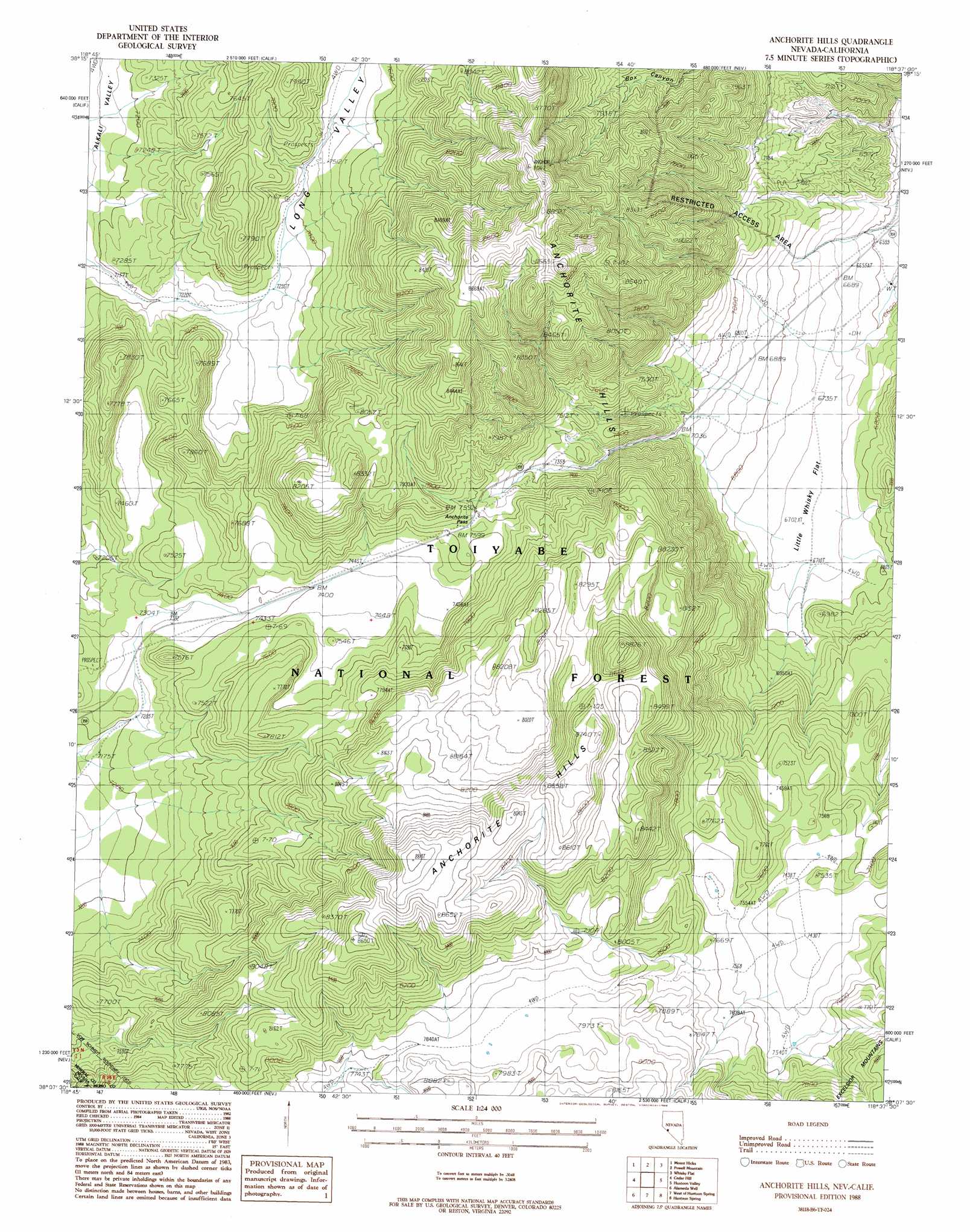
USGS Topo Quad 38118b6 - 1:24,000 scale
| Topo Map Name: | Anchorite Hills |
| USGS Topo Quad ID: | 38118b6 |
| Print Size: | ca. 21 1/4" wide x 27" high |
| Southeast Coordinates: | 38.125° N latitude / 118.625° W longitude |
| Map Center Coordinates: | 38.1875° N latitude / 118.6875° W longitude |
| U.S. States: | NV, CA |
| Filename: | o38118b6.jpg |
| Download Map JPG Image: | Anchorite Hills topo map 1:24,000 scale |
| Map Type: | Topographic |
| Topo Series: | 7.5´ |
| Map Scale: | 1:24,000 |
| Source of Map Images: | United States Geological Survey (USGS) |
| Alternate Map Versions: |
Anchorite Hills NV 1988 Download PDF Buy paper map Anchorite Hills NV 1994, updated 1997 Download PDF Buy paper map Anchorite Hills NV 2011 Download PDF Buy paper map Anchorite Hills NV 2014 Download PDF Buy paper map |
| FStopo: | US Forest Service topo Anchorite Hills is available: Download FStopo PDF Download FStopo TIF |
1:24,000 Topo Quads surrounding Anchorite Hills
Ninemile Ranch |
Corey Peak |
Lucky Boy |
Powell Mountain Ne |
Pamlico |
Aurora |
Mount Hicks |
Powell Mountain |
Whisky Flat |
Rattlesnake Flat |
Kirkwood Spring |
Cedar Hill |
Anchorite Hills |
Huntoon Valley |
Little Huntoon Valley |
Sulphur Pond |
Alameda Well |
West Of Huntoon Spring |
Huntoon Spring |
Jacks Spring |
Mono Mills |
Cowtrack Mountain |
Indian Meadows |
River Spring |
Truman Meadows |
> Back to 38118a1 at 1:100,000 scale
> Back to 38118a1 at 1:250,000 scale
> Back to U.S. Topo Maps home
Anchorite Hills topo map: Gazetteer
Anchorite Hills: Flats
Little Whisky Flat elevation 2048m 6719′Anchorite Hills: Gaps
Anchorite Pass elevation 2328m 7637′Anchorite Hills: Ranges
Anchorite Hills elevation 2323m 7621′Anchorite Hills: Valleys
Long Valley elevation 2244m 7362′Anchorite Hills digital topo map on disk
Buy this Anchorite Hills topo map showing relief, roads, GPS coordinates and other geographical features, as a high-resolution digital map file on DVD: