Gabbs Mountain Topo Map Nevada
To zoom in, hover over the map of Gabbs Mountain
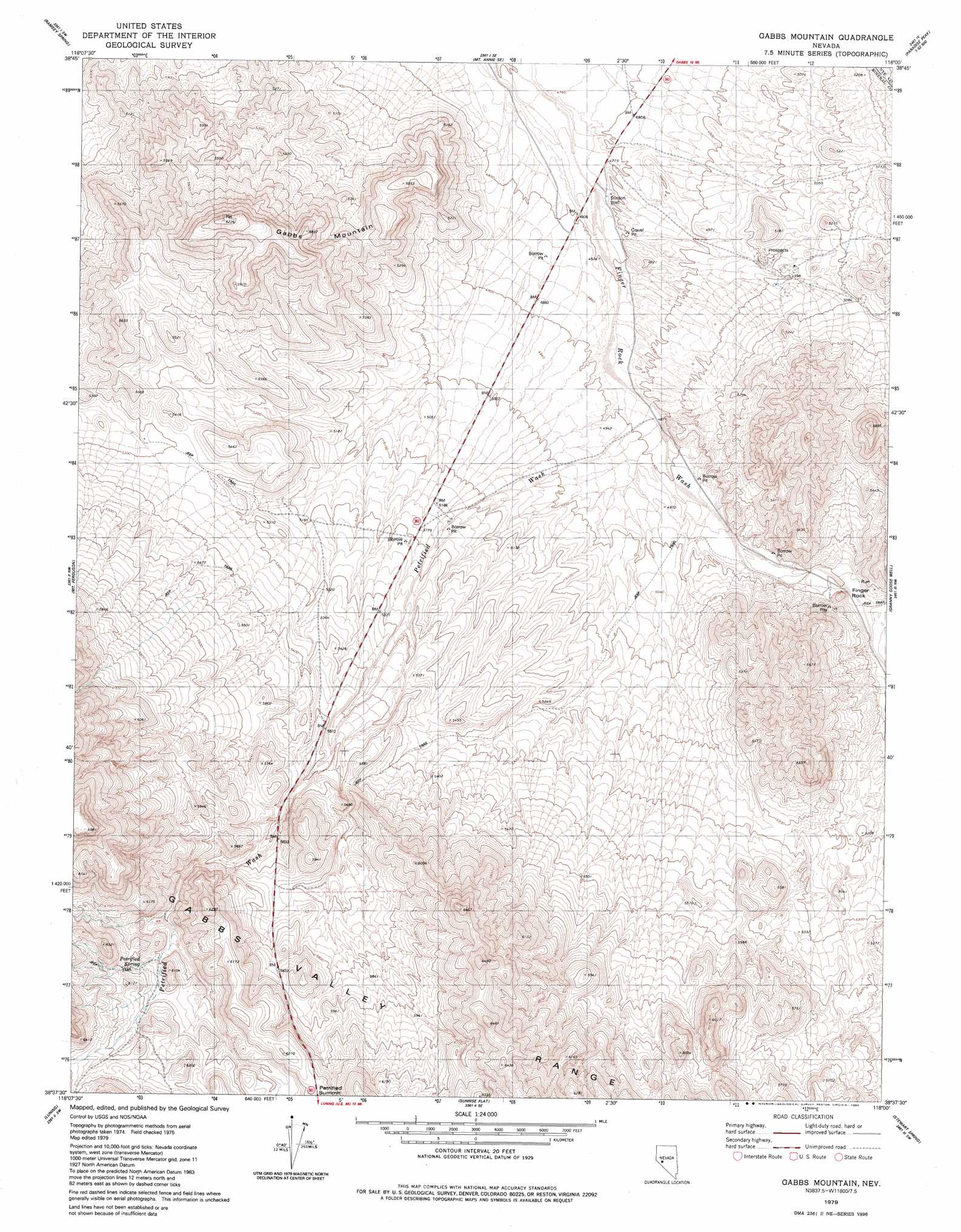
USGS Topo Quad 38118f1 - 1:24,000 scale
| Topo Map Name: | Gabbs Mountain |
| USGS Topo Quad ID: | 38118f1 |
| Print Size: | ca. 21 1/4" wide x 27" high |
| Southeast Coordinates: | 38.625° N latitude / 118° W longitude |
| Map Center Coordinates: | 38.6875° N latitude / 118.0625° W longitude |
| U.S. State: | NV |
| Filename: | o38118f1.jpg |
| Download Map JPG Image: | Gabbs Mountain topo map 1:24,000 scale |
| Map Type: | Topographic |
| Topo Series: | 7.5´ |
| Map Scale: | 1:24,000 |
| Source of Map Images: | United States Geological Survey (USGS) |
| Alternate Map Versions: |
Gabbs Mountain NV 1979, updated 1980 Download PDF Buy paper map Gabbs Mountain NV 2011 Download PDF Buy paper map Gabbs Mountain NV 2015 Download PDF Buy paper map |
1:24,000 Topo Quads surrounding Gabbs Mountain
Murphys Well |
Mount Annie |
Mount Annie Ne |
Downeyville |
Ellsworth |
Poinsettia Spring |
Ramsey Spring |
Mount Annie Se |
Gabbs |
Paradise Peak |
Win Wan Flat |
Mount Ferguson |
Gabbs Mountain |
Granny Goose Well |
Goldyke |
Indian Head Peak |
Luning |
Sunrise Flat |
Stewart Spring |
Simon |
Mable Mountain |
Black Dyke Mountain |
Mina |
Bettles Well |
Dicalite Summit |
> Back to 38118e1 at 1:100,000 scale
> Back to 38118a1 at 1:250,000 scale
> Back to U.S. Topo Maps home
Gabbs Mountain topo map: Gazetteer
Gabbs Mountain: Gaps
Petrified Summit elevation 1871m 6138′Gabbs Mountain: Pillars
Finger Rock elevation 1570m 5150′Gabbs Mountain: Springs
Petrified Spring elevation 1811m 5941′Gabbs Mountain: Streams
Antone Wash elevation 1529m 5016′Petrified Wash elevation 1483m 4865′
Gabbs Mountain: Summits
Gabbs Mountain elevation 1894m 6213′Gabbs Mountain: Valleys
Stewart Valley elevation 1483m 4865′Gabbs Mountain: Wells
Finger Rock Well Number Three elevation 1531m 5022′Stinson Well elevation 1457m 4780′
Gabbs Mountain digital topo map on disk
Buy this Gabbs Mountain topo map showing relief, roads, GPS coordinates and other geographical features, as a high-resolution digital map file on DVD: