Kinkaid Nw Topo Map Nevada
To zoom in, hover over the map of Kinkaid Nw
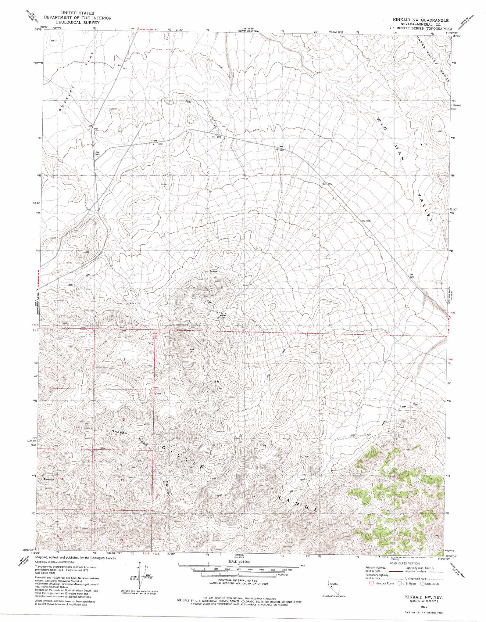
USGS Topo Quad 38118f4 - 1:24,000 scale
| Topo Map Name: | Kinkaid Nw |
| USGS Topo Quad ID: | 38118f4 |
| Print Size: | ca. 21 1/4" wide x 27" high |
| Southeast Coordinates: | 38.625° N latitude / 118.375° W longitude |
| Map Center Coordinates: | 38.6875° N latitude / 118.4375° W longitude |
| U.S. State: | NV |
| Filename: | o38118f4.jpg |
| Download Map JPG Image: | Kinkaid Nw topo map 1:24,000 scale |
| Map Type: | Topographic |
| Topo Series: | 7.5´ |
| Map Scale: | 1:24,000 |
| Source of Map Images: | United States Geological Survey (USGS) |
| Alternate Map Versions: |
Kinkaid NW NV 1979, updated 1980 Download PDF Buy paper map Kinkaid NW NV 2011 Download PDF Buy paper map Kinkaid NW NV 2014 Download PDF Buy paper map |
1:24,000 Topo Quads surrounding Kinkaid Nw
Gillis Canyon Nw |
Hu-Pwi Wash |
Pilot Cone |
Murphys Well |
Mount Annie |
Gillis Canyon |
Ghost Dance Ridge |
Copper Mountain |
Poinsettia Spring |
Ramsey Spring |
Walker Lake |
Ryan Canyon |
Kinkaid Nw |
Win Wan Flat |
Mount Ferguson |
Hawthorne West |
Hawthorne East |
Kinkaid |
Indian Head Peak |
Luning |
Lucky Boy |
Powell Mountain Ne |
Pamlico |
Mable Mountain |
Black Dyke Mountain |
> Back to 38118e1 at 1:100,000 scale
> Back to 38118a1 at 1:250,000 scale
> Back to U.S. Topo Maps home
Kinkaid Nw topo map: Gazetteer
Kinkaid Nw: Flats
Buckley Flat elevation 1718m 5636′Kinkaid Nw: Mines
Deep Mines elevation 1962m 6437′Last Chance Mine elevation 2044m 6706′
Kinkaid Nw digital topo map on disk
Buy this Kinkaid Nw topo map showing relief, roads, GPS coordinates and other geographical features, as a high-resolution digital map file on DVD: