Copper Mountain Topo Map Nevada
To zoom in, hover over the map of Copper Mountain
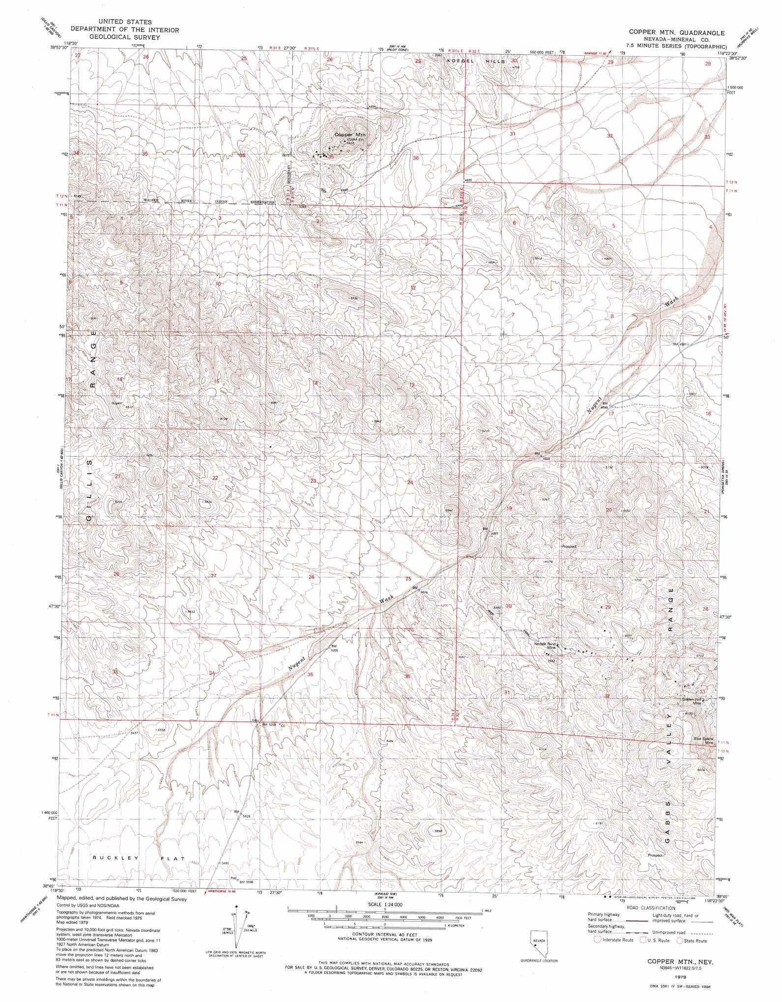
USGS Topo Quad 38118g4 - 1:24,000 scale
| Topo Map Name: | Copper Mountain |
| USGS Topo Quad ID: | 38118g4 |
| Print Size: | ca. 21 1/4" wide x 27" high |
| Southeast Coordinates: | 38.75° N latitude / 118.375° W longitude |
| Map Center Coordinates: | 38.8125° N latitude / 118.4375° W longitude |
| U.S. State: | NV |
| Filename: | o38118g4.jpg |
| Download Map JPG Image: | Copper Mountain topo map 1:24,000 scale |
| Map Type: | Topographic |
| Topo Series: | 7.5´ |
| Map Scale: | 1:24,000 |
| Source of Map Images: | United States Geological Survey (USGS) |
| Alternate Map Versions: |
Copper Mtn. NV 1979, updated 1980 Download PDF Buy paper map Copper Mountain NV 2011 Download PDF Buy paper map Copper Mountain NV 2014 Download PDF Buy paper map |
1:24,000 Topo Quads surrounding Copper Mountain
Terrill Mountains |
Red Ridge |
Rawhide |
Big Kasock Mountain |
Slate Mountain |
Gillis Canyon Nw |
Hu-Pwi Wash |
Pilot Cone |
Murphys Well |
Mount Annie |
Gillis Canyon |
Ghost Dance Ridge |
Copper Mountain |
Poinsettia Spring |
Ramsey Spring |
Walker Lake |
Ryan Canyon |
Kinkaid Nw |
Win Wan Flat |
Mount Ferguson |
Hawthorne West |
Hawthorne East |
Kinkaid |
Indian Head Peak |
Luning |
> Back to 38118e1 at 1:100,000 scale
> Back to 38118a1 at 1:250,000 scale
> Back to U.S. Topo Maps home
Copper Mountain topo map: Gazetteer
Copper Mountain: Mines
Blue Sphinx elevation 1761m 5777′Copper Mountain Mine elevation 1705m 5593′
Gold Pen Mine elevation 1705m 5593′
Golden Pen Mine elevation 1770m 5807′
Lone Star Mine elevation 1787m 5862′
Nevada Rand Mine elevation 1698m 5570′
Copper Mountain: Ridges
Rand Ridge elevation 1929m 6328′Copper Mountain: Summits
Copper Mountain elevation 1649m 5410′Copper Mountain: Valleys
Win Wan Valley elevation 1579m 5180′Copper Mountain digital topo map on disk
Buy this Copper Mountain topo map showing relief, roads, GPS coordinates and other geographical features, as a high-resolution digital map file on DVD: