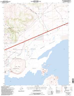
Negit Island Topo Map California
To zoom in, hover over the map of Negit Island
USGS Topo Quad 38119a1 - 1:24,000 scale
| Topo Map Name: | Negit Island |
| USGS Topo Quad ID: | 38119a1 |
| Print Size: | ca. 21 1/4" wide x 27" high |
| Southeast Coordinates: | 38° N latitude / 119° W longitude |
| Map Center Coordinates: | 38.0625° N latitude / 119.0625° W longitude |
| U.S. State: | CA |
| Filename: | o38119a1.jpg |
| Download Map JPG Image: | Negit Island topo map 1:24,000 scale |
| Map Type: | Topographic |
| Topo Series: | 7.5´ |
| Map Scale: | 1:24,000 |
| Source of Map Images: | United States Geological Survey (USGS) |
| Alternate Map Versions: |
Negit Island CA 1986, updated 1986 Download PDF Buy paper map Negit Island CA 1994, updated 1997 Download PDF Buy paper map Negit Island CA 2012 Download PDF Buy paper map Negit Island CA 2015 Download PDF Buy paper map |
| FStopo: | US Forest Service topo Negit Island is available: Download FStopo PDF Download FStopo TIF |
1:24,000 Topo Quads surrounding Negit Island
> Back to 38119a1 at 1:100,000 scale
> Back to 38118a1 at 1:250,000 scale
> Back to U.S. Topo Maps home
Negit Island topo map: Gazetteer
Negit Island: Islands
Negit Island elevation 1983m 6505′Paoha Island elevation 2033m 6669′
Negit Island: Lakes
Mono Lake elevation 1944m 6377′Negit Island: Springs
Coyote Spring elevation 2190m 7185′Hot Spring elevation 1960m 6430′
Waford Spring elevation 1976m 6482′
Negit Island: Streams
Wilson Creek elevation 1952m 6404′Negit Island: Summits
Black Point elevation 2111m 6925′Negit Island: Valleys
Bridgeport Canyon elevation 2104m 6902′Rancheria Gulch elevation 2005m 6578′
Negit Island digital topo map on disk
Buy this Negit Island topo map showing relief, roads, GPS coordinates and other geographical features, as a high-resolution digital map file on DVD:


