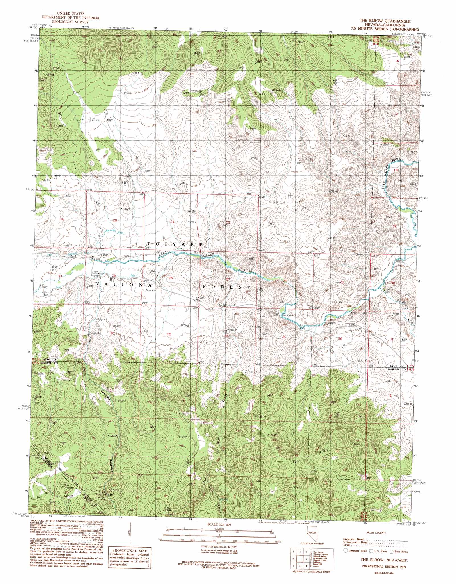
The Elbow Topo Map Nevada
To zoom in, hover over the map of The Elbow
USGS Topo Quad 38119d1 - 1:24,000 scale
| Topo Map Name: | The Elbow |
| USGS Topo Quad ID: | 38119d1 |
| Print Size: | ca. 21 1/4" wide x 27" high |
| Southeast Coordinates: | 38.375° N latitude / 119° W longitude |
| Map Center Coordinates: | 38.4375° N latitude / 119.0625° W longitude |
| U.S. States: | NV, CA |
| Filename: | o38119d1.jpg |
| Download Map JPG Image: | The Elbow topo map 1:24,000 scale |
| Map Type: | Topographic |
| Topo Series: | 7.5´ |
| Map Scale: | 1:24,000 |
| Source of Map Images: | United States Geological Survey (USGS) |
| Alternate Map Versions: |
The Elbow NV 1989, updated 1989 Download PDF Buy paper map The Elbow NV 2012 Download PDF Buy paper map The Elbow NV 2014 Download PDF Buy paper map |
| FStopo: | US Forest Service topo The Elbow is available: Download FStopo PDF Download FStopo TIF |
1:24,000 Topo Quads surrounding The Elbow
Desert Creek Ranch |
Mount Etna |
Pine Grove Spring |
Butler Mountain |
Copper Canyon |
Desert Creek Peak |
Nye Canyon |
Wichman Canyon |
Mitchell Spring |
Mount Grant |
Mount Patterson |
Sweetwater Creek |
The Elbow |
Ninemile Ranch |
Corey Peak |
Mount Jackson |
Bridgeport |
Dome Hill |
Aurora |
Mount Hicks |
Twin Lakes |
Big Alkali |
Bodie |
Kirkwood Spring |
Cedar Hill |
> Back to 38119a1 at 1:100,000 scale
> Back to 38118a1 at 1:250,000 scale
> Back to U.S. Topo Maps home
The Elbow topo map: Gazetteer
The Elbow: Bends
The Elbow elevation 1714m 5623′The Elbow: Mines
Gold Fund Mine elevation 2188m 7178′The Elbow: Populated Places
Elbow Stage Station (historical) elevation 1761m 5777′The Elbow: Post Offices
Elbow Post Office (historical) elevation 1761m 5777′The Elbow: Slopes
Dead Ox Pitch elevation 1766m 5793′The Elbow: Streams
Red Wash Creek elevation 1733m 5685′Rough Creek elevation 1702m 5583′
The Elbow: Valleys
East Canyon elevation 2016m 6614′Sonoma Canyon elevation 1773m 5816′
The Elbow digital topo map on disk
Buy this The Elbow topo map showing relief, roads, GPS coordinates and other geographical features, as a high-resolution digital map file on DVD: