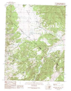
Sweetwater Creek Topo Map Nevada
To zoom in, hover over the map of Sweetwater Creek
USGS Topo Quad 38119d2 - 1:24,000 scale
| Topo Map Name: | Sweetwater Creek |
| USGS Topo Quad ID: | 38119d2 |
| Print Size: | ca. 21 1/4" wide x 27" high |
| Southeast Coordinates: | 38.375° N latitude / 119.125° W longitude |
| Map Center Coordinates: | 38.4375° N latitude / 119.1875° W longitude |
| U.S. States: | NV, CA |
| Filename: | o38119d2.jpg |
| Download Map JPG Image: | Sweetwater Creek topo map 1:24,000 scale |
| Map Type: | Topographic |
| Topo Series: | 7.5´ |
| Map Scale: | 1:24,000 |
| Source of Map Images: | United States Geological Survey (USGS) |
| Alternate Map Versions: |
Sweetwater Creek NV 1989, updated 1989 Download PDF Buy paper map Sweetwater Creek NV 1989, updated 1989 Download PDF Buy paper map Sweetwater Creek NV 2012 Download PDF Buy paper map Sweetwater Creek NV 2014 Download PDF Buy paper map |
| FStopo: | US Forest Service topo Sweetwater Creek is available: Download FStopo PDF Download FStopo TIF |
1:24,000 Topo Quads surrounding Sweetwater Creek
> Back to 38119a1 at 1:100,000 scale
> Back to 38118a1 at 1:250,000 scale
> Back to U.S. Topo Maps home
Sweetwater Creek topo map: Gazetteer
Sweetwater Creek: Areas
Sweetwater Natural Area elevation 2373m 7785′Sweetwater Creek: Flats
Sweetwater Flat elevation 2021m 6630′Wedertz Flat elevation 2275m 7463′
Sweetwater Creek: Gaps
Devils Gate elevation 1857m 6092′Sweetwater Creek: Lakes
Murphy Pond elevation 2328m 7637′Sweetwater Creek: Populated Places
Sweetwater (historical) elevation 1911m 6269′Sweetwater Creek: Post Offices
Sweetwater Post Office (historical) elevation 1911m 6269′Sweetwater Creek: Springs
Clinton Spring elevation 2381m 7811′Long Doctor Spring elevation 2016m 6614′
Sweetwater Creek: Streams
Fryingpan Creek elevation 1843m 6046′Green Creek elevation 1888m 6194′
Green Creek elevation 1879m 6164′
Sweetwater Creek elevation 1775m 5823′
Sweetwater Creek: Summits
Round Mountain elevation 2138m 7014′Sweetwater Creek: Valleys
Cottonwood Canyon elevation 2193m 7194′Cottonwood Canyon elevation 2101m 6893′
Ferris Canyon elevation 2204m 7230′
Ferris Canyon elevation 1935m 6348′
Fryingpan Canyon elevation 2194m 7198′
Little Fryingpan Canyon elevation 1914m 6279′
Masonic Gulch elevation 1779m 5836′
Masonic Gulch elevation 1815m 5954′
Quaking Asp Canyon elevation 2012m 6601′
Quaking Asp Canyon elevation 2149m 7050′
Silverado Canyon elevation 2000m 6561′
Silverado Canyon elevation 2196m 7204′
Sweetwater Canyon elevation 2061m 6761′
Water Canyon elevation 1854m 6082′
Sweetwater Creek digital topo map on disk
Buy this Sweetwater Creek topo map showing relief, roads, GPS coordinates and other geographical features, as a high-resolution digital map file on DVD:


