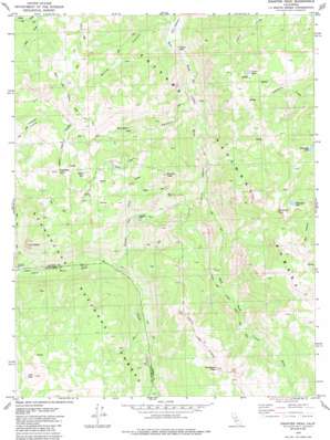
Disaster Peak Topo Map California
To zoom in, hover over the map of Disaster Peak
USGS Topo Quad 38119d6 - 1:24,000 scale
| Topo Map Name: | Disaster Peak |
| USGS Topo Quad ID: | 38119d6 |
| Print Size: | ca. 21 1/4" wide x 27" high |
| Southeast Coordinates: | 38.375° N latitude / 119.625° W longitude |
| Map Center Coordinates: | 38.4375° N latitude / 119.6875° W longitude |
| U.S. State: | CA |
| Filename: | o38119d6.jpg |
| Download Map JPG Image: | Disaster Peak topo map 1:24,000 scale |
| Map Type: | Topographic |
| Topo Series: | 7.5´ |
| Map Scale: | 1:24,000 |
| Source of Map Images: | United States Geological Survey (USGS) |
| Alternate Map Versions: |
Disaster Peak CA 1979, updated 1980 Download PDF Buy paper map Disaster Peak CA 1979, updated 1980 Download PDF Buy paper map Disaster Peak CA 1979, updated 1985 Download PDF Buy paper map Disaster Peak CA 1979, updated 1985 Download PDF Buy paper map Disaster Peak CA 2001, updated 2004 Download PDF Buy paper map Disaster Peak CA 2001, updated 2004 Download PDF Buy paper map Disaster Peak CA 2012 Download PDF Buy paper map Disaster Peak CA 2015 Download PDF Buy paper map |
| FStopo: | US Forest Service topo Disaster Peak is available: Download FStopo PDF Download FStopo TIF |
1:24,000 Topo Quads surrounding Disaster Peak
> Back to 38119a1 at 1:100,000 scale
> Back to 38118a1 at 1:250,000 scale
> Back to U.S. Topo Maps home
Disaster Peak topo map: Gazetteer
Disaster Peak: Basins
Paradise Valley elevation 2695m 8841′Disaster Peak: Falls
Carson Falls elevation 2130m 6988′Disaster Peak: Flats
Coyote Meadow elevation 2701m 8861′Falls Meadows elevation 2105m 6906′
Iceberg Meadow elevation 1972m 6469′
Disaster Peak: Lakes
Golden Lake elevation 2792m 9160′Poison Lake elevation 2792m 9160′
Tamarack Lake elevation 2843m 9327′
Whitecliff Lake elevation 2965m 9727′
Disaster Peak: Streams
Boulder Creek elevation 2109m 6919′Elder Creek elevation 2367m 7765′
Disaster Peak: Summits
Boulder Peak elevation 2860m 9383′Disaster Peak elevation 3053m 10016′
Red Peak elevation 3050m 10006′
Stanislaus Peak elevation 3426m 11240′
The Iceberg elevation 2531m 8303′
Whitecliff Peak elevation 3296m 10813′
Disaster Peak: Valleys
Golden Canyon elevation 2190m 7185′Murray Canyon elevation 2109m 6919′
White Canyon elevation 2108m 6916′
Disaster Peak digital topo map on disk
Buy this Disaster Peak topo map showing relief, roads, GPS coordinates and other geographical features, as a high-resolution digital map file on DVD:


