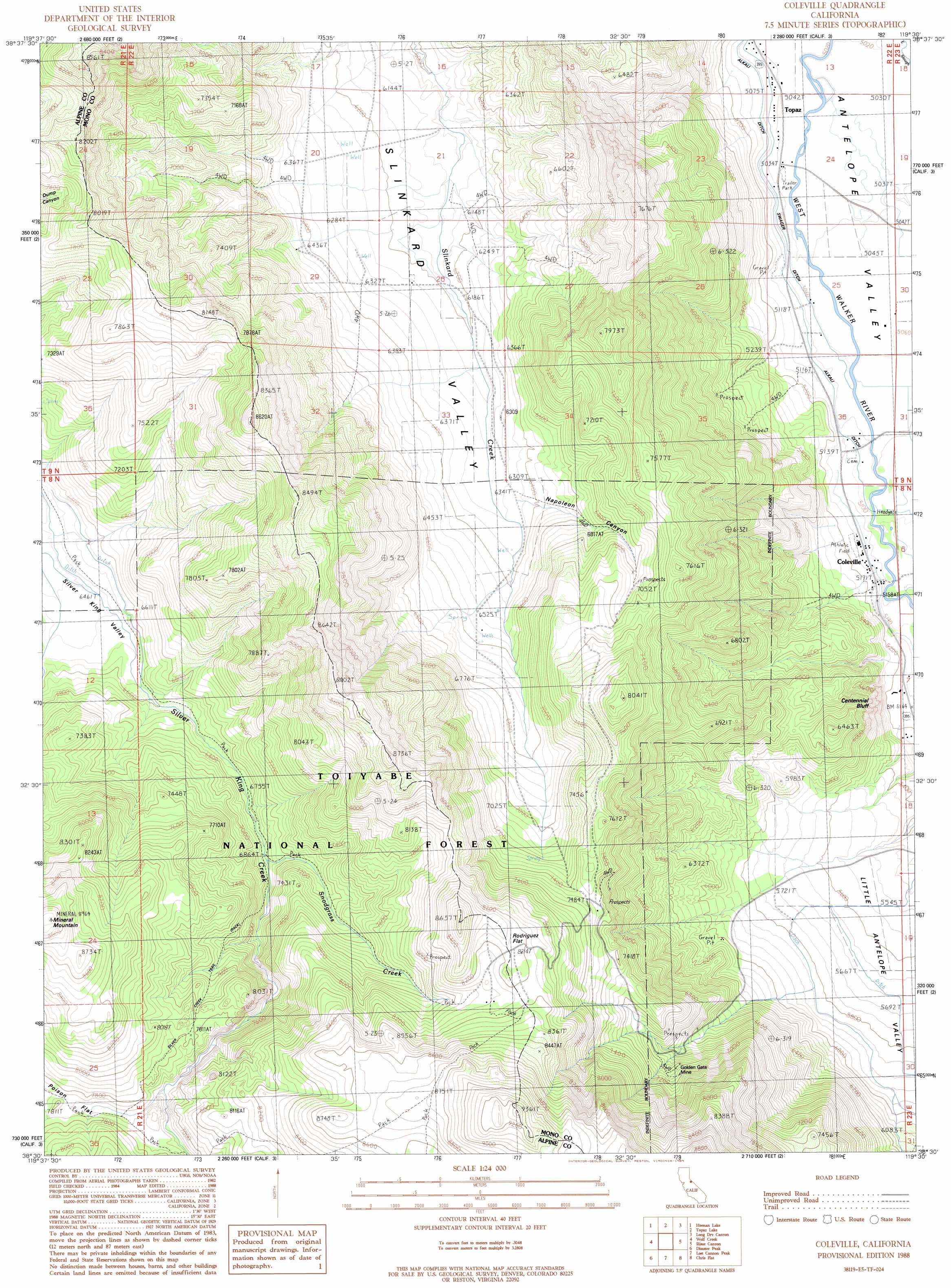
Coleville Topo Map California
To zoom in, hover over the map of Coleville
USGS Topo Quad 38119e5 - 1:24,000 scale
| Topo Map Name: | Coleville |
| USGS Topo Quad ID: | 38119e5 |
| Print Size: | ca. 21 1/4" wide x 27" high |
| Southeast Coordinates: | 38.5° N latitude / 119.5° W longitude |
| Map Center Coordinates: | 38.5625° N latitude / 119.5625° W longitude |
| U.S. State: | CA |
| Filename: | o38119e5.jpg |
| Download Map JPG Image: | Coleville topo map 1:24,000 scale |
| Map Type: | Topographic |
| Topo Series: | 7.5´ |
| Map Scale: | 1:24,000 |
| Source of Map Images: | United States Geological Survey (USGS) |
| Alternate Map Versions: |
Coleville CA 1988, updated 1989 Download PDF Buy paper map Coleville CA 1988, updated 1995 Download PDF Buy paper map Coleville CA 2012 Download PDF Buy paper map Coleville CA 2015 Download PDF Buy paper map |
| FStopo: | US Forest Service topo Coleville is available: Download FStopo PDF Download FStopo TIF |
1:24,000 Topo Quads surrounding Coleville
Woodfords |
Carters Station |
Double Spring |
Oreana Peak |
Smith |
Markleeville |
Heenan Lake |
Topaz Lake |
Long Dry Canyon |
Desert Creek Ranch |
Ebbetts Pass |
Wolf Creek |
Coleville |
Risue Canyon |
Desert Creek Peak |
Dardanelles Cone |
Disaster Peak |
Lost Cannon Peak |
Chris Flat |
Mount Patterson |
Dardanelle |
Sonora Pass |
Pickel Meadow |
Fales Hot Springs |
Mount Jackson |
> Back to 38119e1 at 1:100,000 scale
> Back to 38118a1 at 1:250,000 scale
> Back to U.S. Topo Maps home
Coleville topo map: Gazetteer
Coleville: Canals
Alkali Ditch elevation 1559m 5114′Swager Ditch elevation 1540m 5052′
Coleville: Cliffs
Centennial Bluff elevation 1635m 5364′Coleville: Flats
Little Antelope Valley elevation 1705m 5593′Rodriguez Flat elevation 2488m 8162′
Coleville: Mines
Golden Gate Mine elevation 2191m 7188′Coleville: Populated Places
Coleville elevation 1567m 5141′Coleville: Post Offices
Topaz Post Office elevation 1534m 5032′Coleville: Streams
Snodgrass Creek elevation 2096m 6876′Coleville: Summits
Mineral Mountain elevation 2718m 8917′Coleville: Trails
Lost Canyon Trail (historical) elevation 1859m 6099′Coleville: Valleys
Napoleon Canyon elevation 1924m 6312′Coleville digital topo map on disk
Buy this Coleville topo map showing relief, roads, GPS coordinates and other geographical features, as a high-resolution digital map file on DVD: