Yerington Ne Topo Map Nevada
To zoom in, hover over the map of Yerington Ne
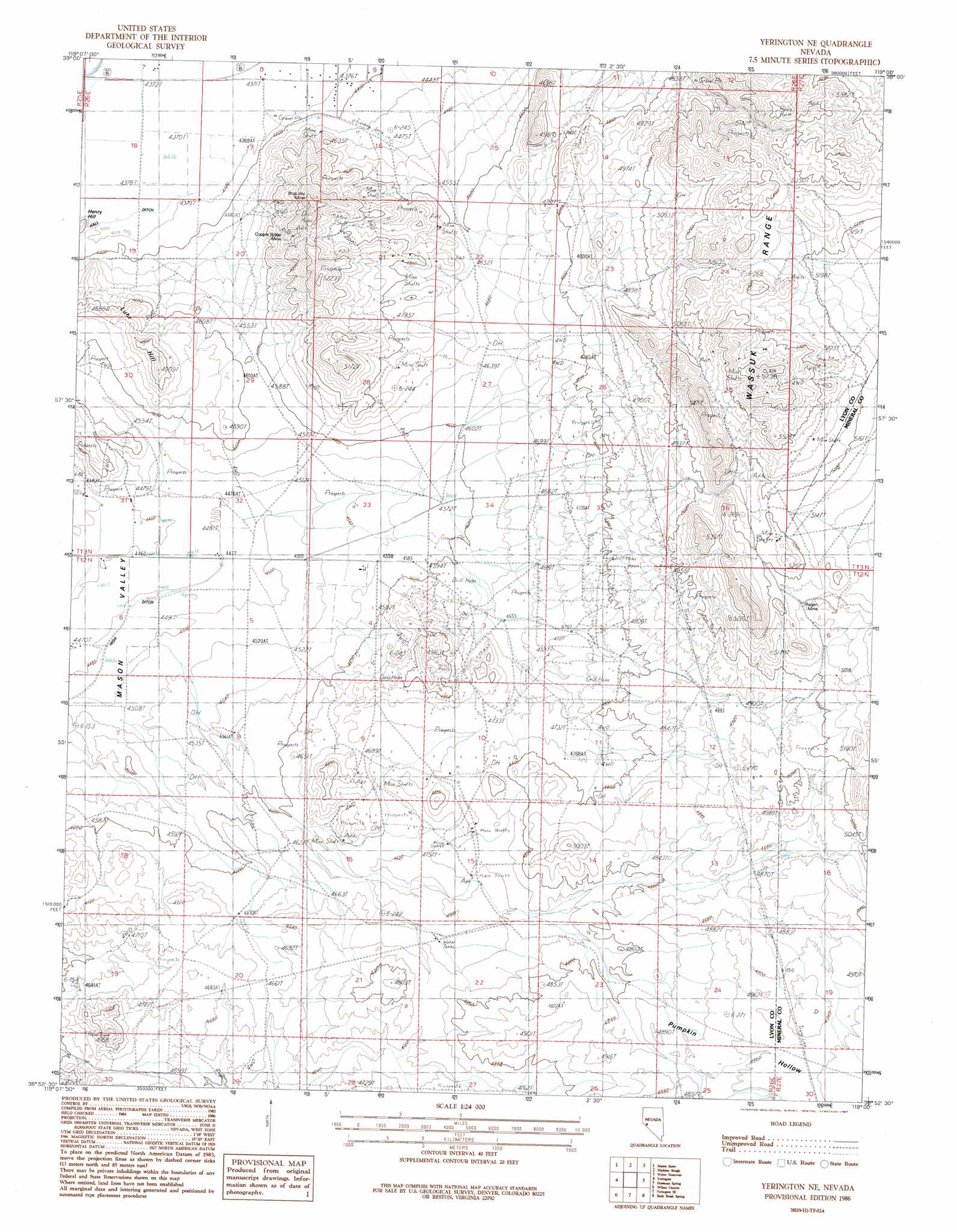
USGS Topo Quad 38119h1 - 1:24,000 scale
| Topo Map Name: | Yerington Ne |
| USGS Topo Quad ID: | 38119h1 |
| Print Size: | ca. 21 1/4" wide x 27" high |
| Southeast Coordinates: | 38.875° N latitude / 119° W longitude |
| Map Center Coordinates: | 38.9375° N latitude / 119.0625° W longitude |
| U.S. State: | NV |
| Filename: | o38119h1.jpg |
| Download Map JPG Image: | Yerington Ne topo map 1:24,000 scale |
| Map Type: | Topographic |
| Topo Series: | 7.5´ |
| Map Scale: | 1:24,000 |
| Source of Map Images: | United States Geological Survey (USGS) |
| Alternate Map Versions: |
Yerington NE NV 1986, updated 1987 Download PDF Buy paper map Yerington NE NV 2012 Download PDF Buy paper map Yerington NE NV 2014 Download PDF Buy paper map |
1:24,000 Topo Quads surrounding Yerington Ne
Churchill Canyon Well |
Wabuska |
Parker Butte |
Wild Horse Basin |
Russell Spit |
Lincoln Flat |
Mason Butte |
Hinkson Slough |
Weber Reservoir |
Weber Dam |
Artesia Lake |
Yerington |
Yerington Ne |
Hussman Spring |
Schurz |
Smith |
Wilson Canyon |
Yerington Se |
Buck Brush Spring |
Reese River Canyon |
Desert Creek Ranch |
Mount Etna |
Pine Grove Spring |
Butler Mountain |
Copper Canyon |
> Back to 38119e1 at 1:100,000 scale
> Back to 38118a1 at 1:250,000 scale
> Back to U.S. Topo Maps home
Yerington Ne topo map: Gazetteer
Yerington Ne: Mines
Blue Jay Mine elevation 1514m 4967′Copper Ridge Mine elevation 1456m 4776′
Regan Mine elevation 1559m 5114′
Yerington Ne: Valleys
Pumpkin Hollow elevation 1379m 4524′Yerington Ne digital topo map on disk
Buy this Yerington Ne topo map showing relief, roads, GPS coordinates and other geographical features, as a high-resolution digital map file on DVD: