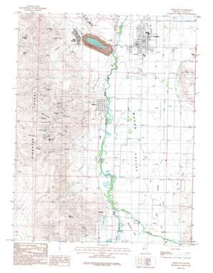
Yerington Topo Map Nevada
To zoom in, hover over the map of Yerington
USGS Topo Quad 38119h2 - 1:24,000 scale
| Topo Map Name: | Yerington |
| USGS Topo Quad ID: | 38119h2 |
| Print Size: | ca. 21 1/4" wide x 27" high |
| Southeast Coordinates: | 38.875° N latitude / 119.125° W longitude |
| Map Center Coordinates: | 38.9375° N latitude / 119.1875° W longitude |
| U.S. State: | NV |
| Filename: | o38119h2.jpg |
| Download Map JPG Image: | Yerington topo map 1:24,000 scale |
| Map Type: | Topographic |
| Topo Series: | 7.5´ |
| Map Scale: | 1:24,000 |
| Source of Map Images: | United States Geological Survey (USGS) |
| Alternate Map Versions: |
Yerington NV 1986, updated 1987 Download PDF Buy paper map Yerington NV 2012 Download PDF Buy paper map Yerington NV 2014 Download PDF Buy paper map |
1:24,000 Topo Quads surrounding Yerington
> Back to 38119e1 at 1:100,000 scale
> Back to 38118a1 at 1:250,000 scale
> Back to U.S. Topo Maps home
Yerington topo map: Gazetteer
Yerington: Canals
Back Fox Ditch elevation 1346m 4416′Fox Ditch elevation 1354m 4442′
Greenwood Ditch elevation 1353m 4438′
Hall Ditch elevation 1360m 4461′
High Ditch elevation 1372m 4501′
Main Fox Ditch elevation 1340m 4396′
McLeod Ditch elevation 1341m 4399′
Mickey Ditch elevation 1357m 4452′
Nelson Ditch elevation 1363m 4471′
Spragg-Woodcock Ditch elevation 1339m 4393′
Woods Ditch elevation 1345m 4412′
Yerington: Gaps
Mickey Pass elevation 1798m 5898′Yerington: Mines
Black Diamond Mine elevation 1847m 6059′Bluestone Mine elevation 1585m 5200′
Gold Dyke Mine elevation 1809m 5935′
Malachite Mine elevation 1633m 5357′
Mason Valley Mine elevation 1565m 5134′
May Queen Mine elevation 1522m 4993′
McConnell Mine elevation 1686m 5531′
Montana-Yerington Mine elevation 1562m 5124′
Native Copper Mine elevation 1479m 4852′
Neilson Mine elevation 1599m 5246′
Nevada-Empire Mine elevation 1222m 4009′
Reno-Yerington Mine elevation 1742m 5715′
Webster Mine elevation 1523m 4996′
Western Nevada Mine elevation 1679m 5508′
Yerington Mine elevation 1222m 4009′
Yerington: Populated Places
Mason elevation 1350m 4429′Nordyke elevation 1354m 4442′
Weed Heights elevation 1422m 4665′
Yerington elevation 1338m 4389′
Yerington: Post Offices
Mason Post Office (historical) elevation 1350m 4429′Nordyke Post Office (historical) elevation 1354m 4442′
Weed Heights Post Office (historical) elevation 1422m 4665′
Yerington Post Office elevation 1338m 4389′
Yerington: Streams
East Walker River elevation 1354m 4442′West Walker River elevation 1354m 4442′
West Walker River elevation 1354m 4442′
Yerington: Summits
Black Mountain elevation 1980m 6496′Henry Hill elevation 1358m 4455′
Luhr Hill elevation 1454m 4770′
Newhouse Peak elevation 1781m 5843′
Singatse Peak elevation 1940m 6364′
Yerington: Valleys
McConnell Canyon elevation 1392m 4566′Sand Canyon elevation 1451m 4760′
The Canyon elevation 1477m 4845′
Western Nevada Canyon elevation 1439m 4721′
Yerington digital topo map on disk
Buy this Yerington topo map showing relief, roads, GPS coordinates and other geographical features, as a high-resolution digital map file on DVD:


