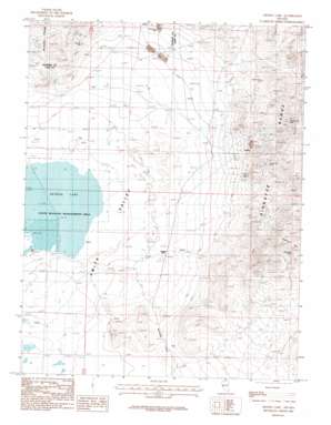
Artesia Lake Topo Map Nevada
To zoom in, hover over the map of Artesia Lake
USGS Topo Quad 38119h3 - 1:24,000 scale
| Topo Map Name: | Artesia Lake |
| USGS Topo Quad ID: | 38119h3 |
| Print Size: | ca. 21 1/4" wide x 27" high |
| Southeast Coordinates: | 38.875° N latitude / 119.25° W longitude |
| Map Center Coordinates: | 38.9375° N latitude / 119.3125° W longitude |
| U.S. State: | NV |
| Filename: | o38119h3.jpg |
| Download Map JPG Image: | Artesia Lake topo map 1:24,000 scale |
| Map Type: | Topographic |
| Topo Series: | 7.5´ |
| Map Scale: | 1:24,000 |
| Source of Map Images: | United States Geological Survey (USGS) |
| Alternate Map Versions: |
Artesia Lake NV 1986, updated 1987 Download PDF Buy paper map Artesia Lake NV 2012 Download PDF Buy paper map Artesia Lake NV 2014 Download PDF Buy paper map |
1:24,000 Topo Quads surrounding Artesia Lake
> Back to 38119e1 at 1:100,000 scale
> Back to 38118a1 at 1:250,000 scale
> Back to U.S. Topo Maps home
Artesia Lake topo map: Gazetteer
Artesia Lake: Dams
Perrin Dam elevation 1443m 4734′Artesia Lake: Gaps
Nordyke Pass elevation 1481m 4858′Artesia Lake: Lakes
Artesia Lake elevation 1388m 4553′Artesia Lake: Mines
Blue Danube Mine elevation 1599m 5246′Buckskin Mine elevation 1503m 4931′
Casting Mine elevation 1612m 5288′
Douglas Hill Mine elevation 1710m 5610′
Guild-Bovard Mine elevation 1497m 4911′
Gypsum Mine elevation 1575m 5167′
Homestake Mine elevation 1801m 5908′
Ludwig Mine elevation 1611m 5285′
Nevada Denver Mine elevation 1630m 5347′
Nevada Douglas Copper Mines elevation 1578m 5177′
Thanksgiving Mine elevation 1795m 5889′
Artesia Lake: Parks
Artesia Lake State Wildlife Management Area elevation 1387m 4550′Artesia Lake: Populated Places
Buckskin (historical) elevation 1510m 4954′Ludwig (historical) elevation 1547m 5075′
Artesia Lake: Post Offices
Buckskin Post Office (historical) elevation 1510m 4954′Ludwig Post Office (historical) elevation 1547m 5075′
Artesia Lake: Ranges
Buckskin Range elevation 1675m 5495′Artesia Lake: Reservoirs
Perrin Reservoir elevation 1443m 4734′Artesia Lake: Springs
Delphi Springs elevation 1428m 4685′Artesia Lake: Summits
Shamrock Hill elevation 1965m 6446′Artesia Lake: Wells
Ambassador Well elevation 1398m 4586′Artesia Lake digital topo map on disk
Buy this Artesia Lake topo map showing relief, roads, GPS coordinates and other geographical features, as a high-resolution digital map file on DVD:


