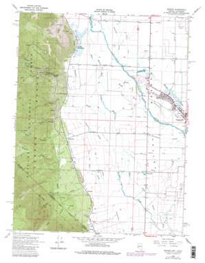
Minden Topo Map Nevada
To zoom in, hover over the map of Minden
USGS Topo Quad 38119h7 - 1:24,000 scale
| Topo Map Name: | Minden |
| USGS Topo Quad ID: | 38119h7 |
| Print Size: | ca. 21 1/4" wide x 27" high |
| Southeast Coordinates: | 38.875° N latitude / 119.75° W longitude |
| Map Center Coordinates: | 38.9375° N latitude / 119.8125° W longitude |
| U.S. States: | NV, CA |
| Filename: | o38119h7.jpg |
| Download Map JPG Image: | Minden topo map 1:24,000 scale |
| Map Type: | Topographic |
| Topo Series: | 7.5´ |
| Map Scale: | 1:24,000 |
| Source of Map Images: | United States Geological Survey (USGS) |
| Alternate Map Versions: |
Minden NV 1968, updated 1971 Download PDF Buy paper map Minden NV 1968, updated 1975 Download PDF Buy paper map Minden NV 1968, updated 1977 Download PDF Buy paper map Minden NV 1968, updated 1980 Download PDF Buy paper map Minden NV 1968, updated 1983 Download PDF Buy paper map Minden NV 1968, updated 1983 Download PDF Buy paper map Minden NV 1974 Download PDF Buy paper map Minden NV 2012 Download PDF Buy paper map Minden NV 2014 Download PDF Buy paper map |
| FStopo: | US Forest Service topo Minden is available: Download FStopo PDF Download FStopo TIF |
1:24,000 Topo Quads surrounding Minden
> Back to 38119e1 at 1:100,000 scale
> Back to 38118a1 at 1:250,000 scale
> Back to U.S. Topo Maps home
Minden topo map: Gazetteer
Minden: Basins
Pine Basin elevation 1913m 6276′Minden: Canals
Big Ditch elevation 1436m 4711′Heise Company Ditch elevation 1443m 4734′
Middle Ditch elevation 1427m 4681′
Middle River Ditch elevation 1434m 4704′
Park and Bull Slough elevation 1438m 4717′
Saint Louis Straight Ditch elevation 1435m 4708′
Minden: Mines
Genoa Comstock Mines elevation 1431m 4694′Simon Extension Mine elevation 1437m 4714′
Minden: Populated Places
Centerville elevation 1440m 4724′Minden elevation 1440m 4724′
Mottsville elevation 1456m 4776′
Sheridan elevation 1467m 4812′
Walleys Hot Springs elevation 1440m 4724′
Minden: Post Offices
Minden Post Office elevation 1440m 4724′Sheridan Post Office (historical) elevation 1465m 4806′
Waterloo Post Office (historical) elevation 1440m 4724′
Minden: Springs
Walleys Hot Springs elevation 1440m 4724′Minden: Streams
Barber Creek elevation 1522m 4993′Brockliss Slough elevation 1425m 4675′
Corsser Creek elevation 1497m 4911′
Cottonwood Slough elevation 1434m 4704′
Daggett Creek elevation 1439m 4721′
East Fork Carson River elevation 1425m 4675′
East Fork Carson River elevation 1425m 4675′
Henningson Slough elevation 1437m 4714′
Home Slough elevation 1424m 4671′
Johnson Slough elevation 1431m 4694′
Martin Slough elevation 1429m 4688′
Monument Creek elevation 1462m 4796′
Rocky Slough elevation 1437m 4714′
Sheridan Creek elevation 1474m 4835′
Sheridan Creek elevation 1473m 4832′
South Fork Daggett Creek elevation 1659m 5442′
West Fork Carson River elevation 1425m 4675′
Minden: Valleys
Haines Canyon elevation 1447m 4747′Jobs Canyon elevation 1467m 4812′
Jobs Canyon elevation 1478m 4849′
Mott Canyon elevation 1468m 4816′
Stutler Canyon elevation 1466m 4809′
Stutler Canyon elevation 1463m 4799′
Taylor Canyon elevation 1465m 4806′
Minden digital topo map on disk
Buy this Minden topo map showing relief, roads, GPS coordinates and other geographical features, as a high-resolution digital map file on DVD:


