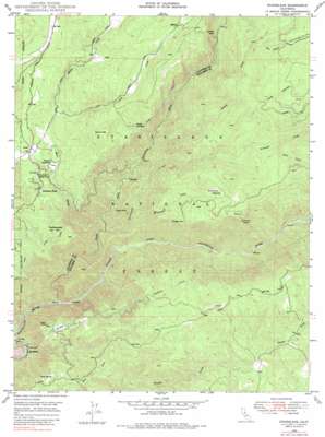
Stanislaus Topo Map California
To zoom in, hover over the map of Stanislaus
USGS Topo Quad 38120b3 - 1:24,000 scale
| Topo Map Name: | Stanislaus |
| USGS Topo Quad ID: | 38120b3 |
| Print Size: | ca. 21 1/4" wide x 27" high |
| Southeast Coordinates: | 38.125° N latitude / 120.25° W longitude |
| Map Center Coordinates: | 38.1875° N latitude / 120.3125° W longitude |
| U.S. State: | CA |
| Filename: | o38120b3.jpg |
| Download Map JPG Image: | Stanislaus topo map 1:24,000 scale |
| Map Type: | Topographic |
| Topo Series: | 7.5´ |
| Map Scale: | 1:24,000 |
| Source of Map Images: | United States Geological Survey (USGS) |
| Alternate Map Versions: |
Stanislaus CA 1948, updated 1966 Download PDF Buy paper map Stanislaus CA 1948, updated 1972 Download PDF Buy paper map Stanislaus CA 1948, updated 1979 Download PDF Buy paper map Stanislaus CA 1948, updated 1979 Download PDF Buy paper map Stanislaus CA 1949 Download PDF Buy paper map Stanislaus CA 2001, updated 2004 Download PDF Buy paper map Stanislaus CA 2012 Download PDF Buy paper map Stanislaus CA 2015 Download PDF Buy paper map |
| FStopo: | US Forest Service topo Stanislaus is available: Download FStopo PDF Download FStopo TIF |
1:24,000 Topo Quads surrounding Stanislaus
> Back to 38120a1 at 1:100,000 scale
> Back to 38120a1 at 1:250,000 scale
> Back to U.S. Topo Maps home
Stanislaus topo map: Gazetteer
Stanislaus: Airports
Hunter Reservoir Heliport elevation 957m 3139′Stanislaus: Canals
Utica Ditch elevation 954m 3129′Stanislaus: Cliffs
McKays Point elevation 1267m 4156′Stanislaus: Dams
Fly in Acres 503 Dam elevation 1170m 3838′Hunters 99-002 Dam elevation 976m 3202′
Stanislaus Forebay 97-083 Dam elevation 795m 2608′
Stanislaus: Flats
Clark Flat elevation 383m 1256′Hungry Flat elevation 1007m 3303′
McCormick Meadows elevation 1100m 3608′
Stanislaus: Gaps
Sugar Pine Gap elevation 1486m 4875′Stanislaus: Mines
Wisehart Pit elevation 1075m 3526′Stanislaus: Parks
Leach Field elevation 1030m 3379′Stanislaus: Populated Places
Avery elevation 1033m 3389′Canyon View elevation 946m 3103′
Douds Landing elevation 1072m 3517′
Ebbetts Pass Highlands elevation 1067m 3500′
Fly-In Acres elevation 1176m 3858′
Hathaway Pines elevation 1014m 3326′
Hathaways Mountain Pines elevation 1051m 3448′
Lakemont Pines elevation 1154m 3786′
McKay elevation 1274m 4179′
Meadowmont elevation 1269m 4163′
Pinebrook elevation 1242m 4074′
Ponderosa Park elevation 1030m 3379′
Stanislaus elevation 341m 1118′
Sunset Point elevation 1042m 3418′
Stanislaus: Post Offices
Avery Post Office elevation 1032m 3385′Stanislaus: Reservoirs
Fly in Acres Reservoir elevation 1170m 3838′Hunter Reservoir elevation 976m 3202′
Pinebrook Reservoir elevation 1132m 3713′
Stanislaus: Streams
Beaver Creek elevation 721m 2365′Big Trees Creek elevation 1322m 4337′
Griswold Creek elevation 482m 1581′
Love Creek elevation 1042m 3418′
McCormick Creek elevation 550m 1804′
Middle Fork Stanislaus River elevation 375m 1230′
Mill Creek elevation 516m 1692′
Moran Creek elevation 1040m 3412′
North Fork Stanislaus River elevation 375m 1230′
Soap Creek elevation 1081m 3546′
Stanislaus: Summits
Cone Hill elevation 807m 2647′Doud Hill elevation 1264m 4146′
Rattlesnake Hill elevation 1031m 3382′
Stanislaus: Tunnels
Stanislaus Tunnel elevation 1059m 3474′Stanislaus: Valleys
Long Canyon elevation 1061m 3480′Stanislaus: Woods
Stanislaus Grove Big Trees elevation 1439m 4721′Stanislaus digital topo map on disk
Buy this Stanislaus topo map showing relief, roads, GPS coordinates and other geographical features, as a high-resolution digital map file on DVD:


