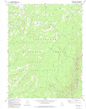
Liberty Hill Topo Map California
To zoom in, hover over the map of Liberty Hill
USGS Topo Quad 38120c1 - 1:24,000 scale
| Topo Map Name: | Liberty Hill |
| USGS Topo Quad ID: | 38120c1 |
| Print Size: | ca. 21 1/4" wide x 27" high |
| Southeast Coordinates: | 38.25° N latitude / 120° W longitude |
| Map Center Coordinates: | 38.3125° N latitude / 120.0625° W longitude |
| U.S. State: | CA |
| Filename: | o38120c1.jpg |
| Download Map JPG Image: | Liberty Hill topo map 1:24,000 scale |
| Map Type: | Topographic |
| Topo Series: | 7.5´ |
| Map Scale: | 1:24,000 |
| Source of Map Images: | United States Geological Survey (USGS) |
| Alternate Map Versions: |
Liberty Hill CA 1979, updated 1995 Download PDF Buy paper map Liberty Hill CA 1979, updated 1995 Download PDF Buy paper map Liberty Hill CA 2001, updated 2004 Download PDF Buy paper map Liberty Hill CA 2012 Download PDF Buy paper map Liberty Hill CA 2015 Download PDF Buy paper map |
| FStopo: | US Forest Service topo Liberty Hill is available: Download FStopo PDF Download FStopo TIF |
1:24,000 Topo Quads surrounding Liberty Hill
> Back to 38120a1 at 1:100,000 scale
> Back to 38120a1 at 1:250,000 scale
> Back to U.S. Topo Maps home
Liberty Hill topo map: Gazetteer
Liberty Hill: Flats
Beartrap Meadow elevation 2142m 7027′Bummers Flat elevation 2070m 6791′
Post Corral Meadow elevation 2191m 7188′
Randalls Meadow elevation 2148m 7047′
Sands Meadow elevation 2125m 6971′
Shoofly Meadow elevation 2084m 6837′
Liberty Hill: Forests
Stanislaus National Forest elevation 1733m 5685′Liberty Hill: Lakes
Rhodes Lake elevation 2181m 7155′Liberty Hill: Springs
White Spring elevation 1639m 5377′Liberty Hill: Streams
Basin Creek elevation 1253m 4110′Bull Creek elevation 1081m 3546′
Campoodle Creek elevation 1303m 4274′
Cascade Creek elevation 1131m 3710′
Lily Creek elevation 1089m 3572′
Lion Creek elevation 1283m 4209′
Mill Creek elevation 1207m 3959′
North Fork elevation 1658m 5439′
Smoothwire Creek elevation 1062m 3484′
South Fork elevation 1660m 5446′
Liberty Hill: Summits
Liberty Hill elevation 2302m 7552′McKee Hill elevation 1942m 6371′
Liberty Hill: Valleys
Blue Canyon elevation 1831m 6007′Little Beaver Canyon elevation 2046m 6712′
Liberty Hill digital topo map on disk
Buy this Liberty Hill topo map showing relief, roads, GPS coordinates and other geographical features, as a high-resolution digital map file on DVD:


