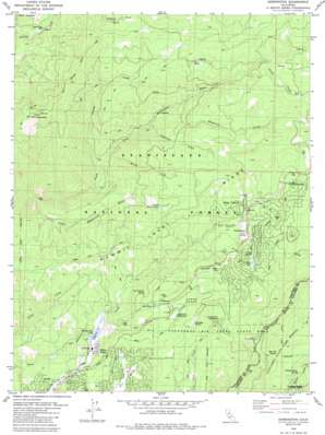
Dorrington Topo Map California
To zoom in, hover over the map of Dorrington
USGS Topo Quad 38120c3 - 1:24,000 scale
| Topo Map Name: | Dorrington |
| USGS Topo Quad ID: | 38120c3 |
| Print Size: | ca. 21 1/4" wide x 27" high |
| Southeast Coordinates: | 38.25° N latitude / 120.25° W longitude |
| Map Center Coordinates: | 38.3125° N latitude / 120.3125° W longitude |
| U.S. State: | CA |
| Filename: | o38120c3.jpg |
| Download Map JPG Image: | Dorrington topo map 1:24,000 scale |
| Map Type: | Topographic |
| Topo Series: | 7.5´ |
| Map Scale: | 1:24,000 |
| Source of Map Images: | United States Geological Survey (USGS) |
| Alternate Map Versions: |
Dorrington CA 1979, updated 1979 Download PDF Buy paper map Dorrington CA 1979, updated 1979 Download PDF Buy paper map Dorrington CA 1979, updated 1985 Download PDF Buy paper map Dorrington CA 2001, updated 2004 Download PDF Buy paper map Dorrington CA 2012 Download PDF Buy paper map Dorrington CA 2015 Download PDF Buy paper map |
| FStopo: | US Forest Service topo Dorrington is available: Download FStopo PDF Download FStopo TIF |
1:24,000 Topo Quads surrounding Dorrington
> Back to 38120a1 at 1:100,000 scale
> Back to 38120a1 at 1:250,000 scale
> Back to U.S. Topo Maps home
Dorrington topo map: Gazetteer
Dorrington: Dams
White Pines 1024-004 Dam elevation 1192m 3910′Dorrington: Flats
French Meadow elevation 1438m 4717′Dorrington: Mines
Heckendorm Mine elevation 1375m 4511′Dorrington: Parks
Calaveras Big Trees State Park elevation 1373m 4504′White Pines Park elevation 1183m 3881′
Dorrington: Populated Places
Arnold elevation 1220m 4002′Big Trees elevation 1441m 4727′
Big Trees Village elevation 1574m 5164′
Blue Lake Junction elevation 1250m 4101′
Blue Lake Springs elevation 1254m 4114′
Camp Connell elevation 1451m 4760′
Dorrington elevation 1453m 4767′
Golden Torch Trailer Park elevation 1520m 4986′
Grizzly Ridge elevation 1311m 4301′
Lakeside Terrace elevation 1321m 4333′
Lilac Park elevation 1270m 4166′
Manuel Mill elevation 1143m 3750′
Mountain Retreat elevation 1235m 4051′
Mumbert Acres elevation 1417m 4648′
Snowshoe Springs elevation 1489m 4885′
White Pines elevation 1191m 3907′
Dorrington: Post Offices
Arnold Post Office elevation 1228m 4028′Bigtrees Post Office (historical) elevation 1441m 4727′
Camp Connell Post Office elevation 1452m 4763′
Dorrington Post Office (historical) elevation 1453m 4767′
Dorrington: Reservoirs
Snowshoe Lake elevation 1434m 4704′White Pines Lake elevation 1182m 3877′
Dorrington: Ridges
Summit Level Ridge elevation 1602m 5255′Dorrington: Springs
Cold Spring elevation 1449m 4753′Million Dollar Spring elevation 1364m 4475′
Oak Leaf Spring elevation 1299m 4261′
San Antonio Spring elevation 1368m 4488′
Dorrington: Streams
Airola Creek elevation 1520m 4986′Big Trees Creek elevation 1181m 3874′
Hayward Creek elevation 1249m 4097′
Lightning Creek elevation 1145m 3756′
Little Mokelumne River elevation 966m 3169′
Martel Creek elevation 1074m 3523′
Swamp Creek elevation 1052m 3451′
Dorrington: Summits
Blue Mountain elevation 1835m 6020′Buck Mountain elevation 1565m 5134′
Dorrington: Trails
Buck Ranch Motor Wax Jeep Trail elevation 1708m 5603′Dorrington: Valleys
Squaw Hollow elevation 1284m 4212′Dorrington: Woods
North Grove elevation 1450m 4757′Dorrington digital topo map on disk
Buy this Dorrington topo map showing relief, roads, GPS coordinates and other geographical features, as a high-resolution digital map file on DVD:


