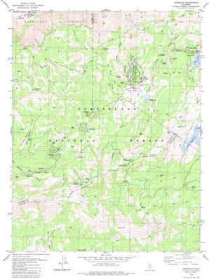
Tamarack Topo Map California
To zoom in, hover over the map of Tamarack
USGS Topo Quad 38120d1 - 1:24,000 scale
| Topo Map Name: | Tamarack |
| USGS Topo Quad ID: | 38120d1 |
| Print Size: | ca. 21 1/4" wide x 27" high |
| Southeast Coordinates: | 38.375° N latitude / 120° W longitude |
| Map Center Coordinates: | 38.4375° N latitude / 120.0625° W longitude |
| U.S. State: | CA |
| Filename: | o38120d1.jpg |
| Download Map JPG Image: | Tamarack topo map 1:24,000 scale |
| Map Type: | Topographic |
| Topo Series: | 7.5´ |
| Map Scale: | 1:24,000 |
| Source of Map Images: | United States Geological Survey (USGS) |
| Alternate Map Versions: |
Tamarack CA 1979, updated 1979 Download PDF Buy paper map Tamarack CA 1979, updated 1979 Download PDF Buy paper map Tamarack CA 2001, updated 2004 Download PDF Buy paper map Tamarack CA 2001, updated 2004 Download PDF Buy paper map Tamarack CA 2012 Download PDF Buy paper map Tamarack CA 2015 Download PDF Buy paper map |
| FStopo: | US Forest Service topo Tamarack is available: Download FStopo PDF Download FStopo TIF |
1:24,000 Topo Quads surrounding Tamarack
> Back to 38120a1 at 1:100,000 scale
> Back to 38120a1 at 1:250,000 scale
> Back to U.S. Topo Maps home
Tamarack topo map: Gazetteer
Tamarack: Airports
Bear Valley Stolport elevation 2154m 7066′Tamarack: Basins
Bear Trap Basin elevation 2191m 7188′Grouse Valley elevation 1954m 6410′
Jelmini Basin elevation 2158m 7080′
Tamarack: Cliffs
Bloods Point elevation 2364m 7755′Tamarack: Dams
Alpine 99-000 Dam elevation 2225m 7299′Bear Valley S H 1088 Dam elevation 2158m 7080′
Reba 519 Dam elevation 2197m 7208′
Utica 99-006 Dam elevation 2080m 6824′
Tamarack: Flats
Big Meadow elevation 2020m 6627′Big Prather Meadow elevation 2137m 7011′
Bloods Meadow elevation 2159m 7083′
Corral Meadow elevation 2031m 6663′
Corral Meadow elevation 2386m 7828′
Gardner Meadow elevation 2042m 6699′
Hells Kitchen elevation 1761m 5777′
Little Prather Meadow elevation 2127m 6978′
Mattley Meadow elevation 2176m 7139′
Rose Meadow elevation 2262m 7421′
Sand Flat elevation 1764m 5787′
Sapps Meadow elevation 2051m 6729′
Thompson Meadow elevation 2134m 7001′
Tamarack: Lakes
Bear Lake elevation 2215m 7267′Lion Lake elevation 2093m 6866′
Mud Lake elevation 2055m 6742′
Tamarack: Pillars
Slick Rock elevation 2078m 6817′Tamarack: Populated Places
Bear Valley elevation 2164m 7099′Big Meadow elevation 1999m 6558′
Lake Alpine elevation 2251m 7385′
Lombardi elevation 2111m 6925′
Sherman Acres elevation 2136m 7007′
Skyhigh elevation 2146m 7040′
Tamarack elevation 2107m 6912′
Tamarack Springs elevation 2148m 7047′
Tamarack: Post Offices
Lake Alpine Post Office (historical) elevation 2228m 7309′Tamarack: Reservoirs
Lake Alpine elevation 2225m 7299′Utica Reservoir elevation 2080m 6824′
Tamarack: Ridges
Bloods Ridge elevation 2444m 8018′Tamarack: Streams
Bear Creek elevation 2148m 7047′Bloods Creek elevation 1852m 6076′
Duck Creek elevation 2062m 6765′
Highland Creek elevation 1706m 5597′
Jelmini Creek elevation 1281m 4202′
Silver Creek elevation 2047m 6715′
Tamarack: Summits
Flagpole Point elevation 2413m 7916′Osborn Hill elevation 2381m 7811′
Sapps Hill elevation 2225m 7299′
Tamarack: Trails
Emigrant Trail elevation 2286m 7500′Tamarack: Valleys
Corral Gulch elevation 2150m 7053′Horse Canyon elevation 2234m 7329′
Onion Valley elevation 2073m 6801′
Poison Canyon elevation 2252m 7388′
Tamarack digital topo map on disk
Buy this Tamarack topo map showing relief, roads, GPS coordinates and other geographical features, as a high-resolution digital map file on DVD:


