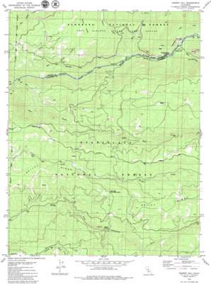
Garnet Hill Topo Map California
To zoom in, hover over the map of Garnet Hill
USGS Topo Quad 38120d3 - 1:24,000 scale
| Topo Map Name: | Garnet Hill |
| USGS Topo Quad ID: | 38120d3 |
| Print Size: | ca. 21 1/4" wide x 27" high |
| Southeast Coordinates: | 38.375° N latitude / 120.25° W longitude |
| Map Center Coordinates: | 38.4375° N latitude / 120.3125° W longitude |
| U.S. State: | CA |
| Filename: | o38120d3.jpg |
| Download Map JPG Image: | Garnet Hill topo map 1:24,000 scale |
| Map Type: | Topographic |
| Topo Series: | 7.5´ |
| Map Scale: | 1:24,000 |
| Source of Map Images: | United States Geological Survey (USGS) |
| Alternate Map Versions: |
Garnet Hill CA 1979, updated 1979 Download PDF Buy paper map Garnet Hill CA 2001, updated 2004 Download PDF Buy paper map Garnet Hill CA 2012 Download PDF Buy paper map Garnet Hill CA 2015 Download PDF Buy paper map |
| FStopo: | US Forest Service topo Garnet Hill is available: Download FStopo PDF Download FStopo TIF |
1:24,000 Topo Quads surrounding Garnet Hill
> Back to 38120a1 at 1:100,000 scale
> Back to 38120a1 at 1:250,000 scale
> Back to U.S. Topo Maps home
Garnet Hill topo map: Gazetteer
Garnet Hill: Canals
Tiger Creek Regulatory Canal elevation 1134m 3720′Garnet Hill: Crossings
Bruce Crossing elevation 983m 3225′Solinsky Crossing elevation 1281m 4202′
Garnet Hill: Mines
Moore Mine elevation 1097m 3599′Garnet Hill: Parks
Salt Springs State Game Refuge elevation 1357m 4452′Garnet Hill: Ridges
Bailey Ridge elevation 1628m 5341′Garnet Hill: Streams
Bear River elevation 939m 3080′Beaver Creek elevation 987m 3238′
Blue Creek elevation 877m 2877′
Camp Creek elevation 897m 2942′
Green Creek elevation 927m 3041′
Moore Creek elevation 984m 3228′
Garnet Hill: Summits
Garnet Hill elevation 1369m 4491′Garnet Hill digital topo map on disk
Buy this Garnet Hill topo map showing relief, roads, GPS coordinates and other geographical features, as a high-resolution digital map file on DVD:


