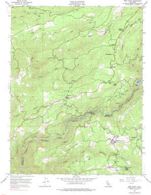
West Point Topo Map California
To zoom in, hover over the map of West Point
USGS Topo Quad 38120d5 - 1:24,000 scale
| Topo Map Name: | West Point |
| USGS Topo Quad ID: | 38120d5 |
| Print Size: | ca. 21 1/4" wide x 27" high |
| Southeast Coordinates: | 38.375° N latitude / 120.5° W longitude |
| Map Center Coordinates: | 38.4375° N latitude / 120.5625° W longitude |
| U.S. State: | CA |
| Filename: | o38120d5.jpg |
| Download Map JPG Image: | West Point topo map 1:24,000 scale |
| Map Type: | Topographic |
| Topo Series: | 7.5´ |
| Map Scale: | 1:24,000 |
| Source of Map Images: | United States Geological Survey (USGS) |
| Alternate Map Versions: |
West Point CA 1948, updated 1960 Download PDF Buy paper map West Point CA 1948, updated 1968 Download PDF Buy paper map West Point CA 1948, updated 1976 Download PDF Buy paper map West Point CA 1948, updated 1976 Download PDF Buy paper map West Point CA 1949 Download PDF Buy paper map West Point CA 2012 Download PDF Buy paper map West Point CA 2015 Download PDF Buy paper map |
| FStopo: | US Forest Service topo West Point is available: Download FStopo PDF Download FStopo TIF |
1:24,000 Topo Quads surrounding West Point
> Back to 38120a1 at 1:100,000 scale
> Back to 38120a1 at 1:250,000 scale
> Back to U.S. Topo Maps home
West Point topo map: Gazetteer
West Point: Canals
Lower Standard Canal elevation 661m 2168′Upper Standard Canal elevation 707m 2319′
Volcano Ditch elevation 915m 3001′
West Point: Dams
Brush Creek 1009-012 Dam elevation 900m 2952′Electra Diversion 97-114 Dam elevation 637m 2089′
Tiger Creek Afterbay 97-105 Dam elevation 712m 2335′
West Point: Flats
Skull Flat elevation 832m 2729′West Point: Mines
Amador Columbia Mine elevation 622m 2040′Belden Mine elevation 893m 2929′
Black Prince Mine elevation 849m 2785′
Marklay Mine elevation 890m 2919′
T N T Mine elevation 982m 3221′
Yellow Aster Mine elevation 677m 2221′
West Point: Parks
Sandy Gulch Field Baseball Park elevation 786m 2578′Sandy Gulch State Historic Landmark elevation 790m 2591′
West Point State Historic Landmark elevation 839m 2752′
West Point: Populated Places
Barton elevation 997m 3270′Bummerville elevation 897m 2942′
Lynn Park Acres elevation 830m 2723′
Pioneer elevation 910m 2985′
Ranch House Estates elevation 776m 2545′
Sandy Gulch elevation 790m 2591′
West Point elevation 844m 2769′
Wilseyville elevation 844m 2769′
West Point: Post Offices
Pioneer Post Office elevation 897m 2942′West Point Post Office elevation 835m 2739′
West Point: Reservoirs
Tiger Creek Reservoir elevation 712m 2335′West Point: Springs
Canzatti Spring elevation 991m 3251′West Point: Streams
Antelope Creek elevation 804m 2637′Ashland Creek elevation 647m 2122′
Bear Creek elevation 829m 2719′
Golden Gate Creek elevation 669m 2194′
Little Mill Creek elevation 899m 2949′
Mill Creek elevation 721m 2365′
Misery Creek elevation 715m 2345′
Pioneer Creek elevation 621m 2037′
West Point: Summits
Mount Crossman elevation 1184m 3884′West Point: Tunnels
Electra Tunnel elevation 732m 2401′West Point Tunnel elevation 902m 2959′
West Point digital topo map on disk
Buy this West Point topo map showing relief, roads, GPS coordinates and other geographical features, as a high-resolution digital map file on DVD:


