Irish Hill Topo Map California
To zoom in, hover over the map of Irish Hill
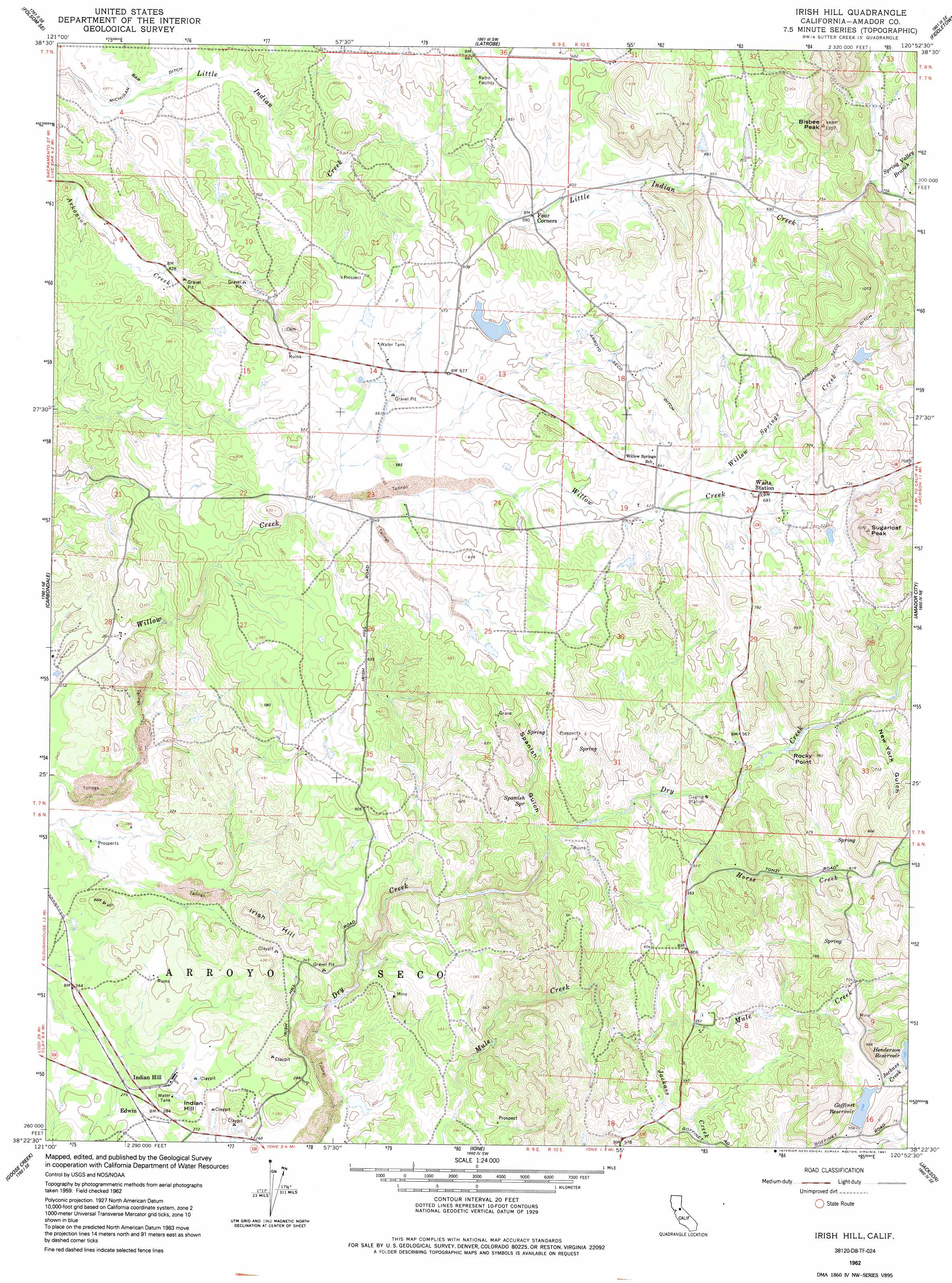
USGS Topo Quad 38120d8 - 1:24,000 scale
| Topo Map Name: | Irish Hill |
| USGS Topo Quad ID: | 38120d8 |
| Print Size: | ca. 21 1/4" wide x 27" high |
| Southeast Coordinates: | 38.375° N latitude / 120.875° W longitude |
| Map Center Coordinates: | 38.4375° N latitude / 120.9375° W longitude |
| U.S. State: | CA |
| Filename: | o38120d8.jpg |
| Download Map JPG Image: | Irish Hill topo map 1:24,000 scale |
| Map Type: | Topographic |
| Topo Series: | 7.5´ |
| Map Scale: | 1:24,000 |
| Source of Map Images: | United States Geological Survey (USGS) |
| Alternate Map Versions: |
Irish Hill CA 1962, updated 1963 Download PDF Buy paper map Irish Hill CA 1962, updated 1991 Download PDF Buy paper map Irish Hill CA 2012 Download PDF Buy paper map Irish Hill CA 2015 Download PDF Buy paper map |
1:24,000 Topo Quads surrounding Irish Hill
Folsom |
Clarksville |
Shingle Springs |
Placerville |
Camino |
Buffalo Creek |
Folsom Se |
Latrobe |
Fiddletown |
Aukum |
Sloughhouse |
Carbondale |
Irish Hill |
Amador City |
Pine Grove |
Clay |
Goose Creek |
Ione |
Jackson |
Mokelumne Hill |
Lockeford |
Clements |
Wallace |
Valley Springs |
San Andreas |
> Back to 38120a1 at 1:100,000 scale
> Back to 38120a1 at 1:250,000 scale
> Back to U.S. Topo Maps home
Irish Hill topo map: Gazetteer
Irish Hill: Airports
Horse Shoe A Ranch Airport elevation 226m 741′Irish Hill: Canals
Arroyo Seco Ditch elevation 245m 803′Irish Hill: Dams
Goffinet 470 Dam elevation 214m 702′Henderson 1-010 Dam elevation 238m 780′
Irish Hill: Populated Places
Edwin elevation 86m 282′Forest Home (historical) elevation 177m 580′
Irish Hill: Reservoirs
Goffinet Reservoir elevation 214m 702′Henderson Reservoir elevation 238m 780′
Irish Hill: Springs
Spanish Spring elevation 140m 459′Irish Hill: Streams
Horse Creek elevation 139m 456′Jackass Creek elevation 147m 482′
Rancheria Creek elevation 162m 531′
Spring Valley Branch elevation 227m 744′
Willow Springs Creek elevation 189m 620′
Irish Hill: Summits
Bisbee Peak elevation 355m 1164′Indian Hill elevation 106m 347′
Irish Hill elevation 123m 403′
Rocky Point elevation 220m 721′
Sugarloaf Peak elevation 323m 1059′
Irish Hill: Valleys
New York Gulch elevation 153m 501′Spanish Gulch elevation 128m 419′
Irish Hill digital topo map on disk
Buy this Irish Hill topo map showing relief, roads, GPS coordinates and other geographical features, as a high-resolution digital map file on DVD: