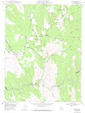
Latrobe Topo Map California
To zoom in, hover over the map of Latrobe
USGS Topo Quad 38120e8 - 1:24,000 scale
| Topo Map Name: | Latrobe |
| USGS Topo Quad ID: | 38120e8 |
| Print Size: | ca. 21 1/4" wide x 27" high |
| Southeast Coordinates: | 38.5° N latitude / 120.875° W longitude |
| Map Center Coordinates: | 38.5625° N latitude / 120.9375° W longitude |
| U.S. State: | CA |
| Filename: | o38120e8.jpg |
| Download Map JPG Image: | Latrobe topo map 1:24,000 scale |
| Map Type: | Topographic |
| Topo Series: | 7.5´ |
| Map Scale: | 1:24,000 |
| Source of Map Images: | United States Geological Survey (USGS) |
| Alternate Map Versions: |
Latrobe CA 1949, updated 1956 Download PDF Buy paper map Latrobe CA 1949, updated 1977 Download PDF Buy paper map Latrobe CA 1949, updated 1977 Download PDF Buy paper map Latrobe CA 1950 Download PDF Buy paper map Latrobe CA 2012 Download PDF Buy paper map Latrobe CA 2015 Download PDF Buy paper map |
1:24,000 Topo Quads surrounding Latrobe
> Back to 38120e1 at 1:100,000 scale
> Back to 38120a1 at 1:250,000 scale
> Back to U.S. Topo Maps home
Latrobe topo map: Gazetteer
Latrobe: Canals
Michigan Bar Ditch elevation 133m 436′Latrobe: Dams
Big Canyon Creek 469 Dam elevation 229m 751′Latrobe: Flats
Hungry Hollow elevation 172m 564′Latrobe: Mines
Big Canyon Mine elevation 264m 866′Bugtown Mine elevation 266m 872′
Copper Hill Mine elevation 185m 606′
Sugarloaf Mine elevation 262m 859′
Vandalia Mine elevation 416m 1364′
Latrobe: Populated Places
Brandon Corner elevation 228m 748′Brela elevation 301m 987′
Bullard elevation 342m 1122′
Dugan elevation 346m 1135′
Flonellis elevation 289m 948′
Latrobe elevation 232m 761′
Shrub elevation 318m 1043′
Latrobe: Streams
Big Canyon Creek elevation 139m 456′Clark Creek elevation 110m 360′
Fanny Creek elevation 205m 672′
French Creek elevation 183m 600′
Little Indian Creek elevation 136m 446′
Marble Creek elevation 207m 679′
Shingle Creek elevation 259m 849′
Slate Creek elevation 179m 587′
Latrobe: Summits
China Mountain elevation 526m 1725′Mount Aigare elevation 454m 1489′
Sugarloaf elevation 365m 1197′
Latrobe: Valleys
Grapevine Ravine elevation 128m 419′Slug Gulch elevation 170m 557′
White Man Ravine elevation 144m 472′
Latrobe digital topo map on disk
Buy this Latrobe topo map showing relief, roads, GPS coordinates and other geographical features, as a high-resolution digital map file on DVD:


