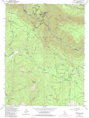
Tunnel Hill Topo Map California
To zoom in, hover over the map of Tunnel Hill
USGS Topo Quad 38120h6 - 1:24,000 scale
| Topo Map Name: | Tunnel Hill |
| USGS Topo Quad ID: | 38120h6 |
| Print Size: | ca. 21 1/4" wide x 27" high |
| Southeast Coordinates: | 38.875° N latitude / 120.625° W longitude |
| Map Center Coordinates: | 38.9375° N latitude / 120.6875° W longitude |
| U.S. State: | CA |
| Filename: | o38120h6.jpg |
| Download Map JPG Image: | Tunnel Hill topo map 1:24,000 scale |
| Map Type: | Topographic |
| Topo Series: | 7.5´ |
| Map Scale: | 1:24,000 |
| Source of Map Images: | United States Geological Survey (USGS) |
| Alternate Map Versions: |
Tunnel Hill CA 1950, updated 1953 Download PDF Buy paper map Tunnel Hill CA 1950, updated 1958 Download PDF Buy paper map Tunnel Hill CA 1950, updated 1964 Download PDF Buy paper map Tunnel Hill CA 1950, updated 1976 Download PDF Buy paper map Tunnel Hill CA 1950, updated 1988 Download PDF Buy paper map Tunnel Hill CA 1950, updated 1988 Download PDF Buy paper map Tunnel Hill CA 2012 Download PDF Buy paper map Tunnel Hill CA 2015 Download PDF Buy paper map |
| FStopo: | US Forest Service topo Tunnel Hill is available: Download FStopo PDF Download FStopo TIF |
1:24,000 Topo Quads surrounding Tunnel Hill
> Back to 38120e1 at 1:100,000 scale
> Back to 38120a1 at 1:250,000 scale
> Back to U.S. Topo Maps home
Tunnel Hill topo map: Gazetteer
Tunnel Hill: Dams
Rock Creek 465 Dam elevation 1002m 3287′Tunnel Hill: Flats
Buckeye Flat elevation 521m 1709′Kentucky Flat elevation 1049m 3441′
Squaw Flat elevation 601m 1971′
Tunnel Hill: Forests
Blodgett Experimental Forest elevation 1303m 4274′Tunnel Hill: Mines
Bedrock Mine elevation 954m 3129′Bluebird Mine elevation 1151m 3776′
Boedner Mine elevation 979m 3211′
Bootjack Mine elevation 1136m 3727′
Kenna Mine elevation 1063m 3487′
Kenny Mine elevation 981m 3218′
Tiedman Mine elevation 965m 3166′
Tunnel Hill: Populated Places
Quintette elevation 1234m 4048′Tunnel Hill: Reservoirs
Chiquita Lake elevation 1002m 3287′Tunnel Hill: Ridges
Ditch Camp Point elevation 1171m 3841′Nevada Point elevation 1248m 4094′
Peavine Point elevation 1223m 4012′
Tipton Hill elevation 1015m 3330′
Tunnel Hill elevation 1254m 4114′
Tunnel Hill: Springs
Dad Youngs Spring elevation 1057m 3467′Gaddis Spring elevation 1323m 4340′
Zero Spring elevation 840m 2755′
Tunnel Hill: Streams
Al Brass Creek elevation 791m 2595′Canyon Creek elevation 856m 2808′
First Otter Creek elevation 864m 2834′
Little Silver Creek elevation 777m 2549′
Pilot Creek elevation 496m 1627′
Tunnel Creek elevation 996m 3267′
Tunnel Hill: Summits
Bald Mountain elevation 1396m 4580′Pennsylvania Point elevation 1054m 3458′
Sugarloaf elevation 1022m 3353′
Tunnel Hill: Trails
Nevada Point Trail elevation 518m 1699′Tunnel Hill: Valleys
Bacon Canyon elevation 1119m 3671′Ballard Ravine elevation 1232m 4041′
Deep Canyon elevation 999m 3277′
Long Canyon elevation 438m 1437′
Mutton Canyon elevation 1156m 3792′
Tobacco Gulch elevation 895m 2936′
Tunnel Hill digital topo map on disk
Buy this Tunnel Hill topo map showing relief, roads, GPS coordinates and other geographical features, as a high-resolution digital map file on DVD:


