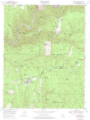
Georgetown Topo Map California
To zoom in, hover over the map of Georgetown
USGS Topo Quad 38120h7 - 1:24,000 scale
| Topo Map Name: | Georgetown |
| USGS Topo Quad ID: | 38120h7 |
| Print Size: | ca. 21 1/4" wide x 27" high |
| Southeast Coordinates: | 38.875° N latitude / 120.75° W longitude |
| Map Center Coordinates: | 38.9375° N latitude / 120.8125° W longitude |
| U.S. State: | CA |
| Filename: | o38120h7.jpg |
| Download Map JPG Image: | Georgetown topo map 1:24,000 scale |
| Map Type: | Topographic |
| Topo Series: | 7.5´ |
| Map Scale: | 1:24,000 |
| Source of Map Images: | United States Geological Survey (USGS) |
| Alternate Map Versions: |
Georgetown CA 1949, updated 1954 Download PDF Buy paper map Georgetown CA 1949, updated 1969 Download PDF Buy paper map Georgetown CA 1949, updated 1975 Download PDF Buy paper map Georgetown CA 1950 Download PDF Buy paper map Georgetown CA 2012 Download PDF Buy paper map Georgetown CA 2015 Download PDF Buy paper map |
| FStopo: | US Forest Service topo Georgetown is available: Download FStopo PDF Download FStopo TIF |
1:24,000 Topo Quads surrounding Georgetown
> Back to 38120e1 at 1:100,000 scale
> Back to 38120a1 at 1:250,000 scale
> Back to U.S. Topo Maps home
Georgetown topo map: Gazetteer
Georgetown: Airports
Georgetown Airport elevation 796m 2611′Georgetown: Canals
Georgetown Divide Ditch elevation 866m 2841′Georgetown: Dams
Georgetown Control 460-002 Dam elevation 953m 3126′Georgetown: Flats
Bear Flat elevation 812m 2664′Georgetown: Mines
Beebe Mine elevation 812m 2664′Cove Hill Mine elevation 818m 2683′
Green Mine elevation 849m 2785′
Josephine Mine elevation 675m 2214′
Paymaster Mine elevation 914m 2998′
Red Diggings elevation 734m 2408′
Georgetown: Populated Places
Balderson Station elevation 1004m 3293′Buckeye elevation 899m 2949′
Buffalo Hill elevation 770m 2526′
Fornis elevation 725m 2378′
Georgetown elevation 809m 2654′
Todd Valley elevation 818m 2683′
Volcanoville elevation 912m 2992′
Georgetown: Post Offices
Georgetown Post Office elevation 815m 2673′Georgetown: Reservoirs
Lake Walton elevation 953m 3126′Georgetown: Ridges
Darling Ridge elevation 897m 2942′Georgetown Divide elevation 1039m 3408′
Georgetown: Streams
Dardanelles Creek elevation 306m 1003′Otter Creek elevation 245m 803′
Pegleg Creek elevation 753m 2470′
Pond Creek elevation 309m 1013′
Georgetown: Summits
Bald Hill elevation 750m 2460′Bottle Hill elevation 807m 2647′
Buckeye Point elevation 836m 2742′
Cement Hill elevation 785m 2575′
Cock Robin Point elevation 731m 2398′
Grey Eagle Hill elevation 999m 3277′
Hotchkiss Hill elevation 973m 3192′
Jakeys Hill elevation 998m 3274′
Little Bald Mountain elevation 925m 3034′
Mameluke Hill elevation 822m 2696′
Shoemaker Hill elevation 930m 3051′
Georgetown: Valleys
Antwine Gulch elevation 689m 2260′Dark Canyon elevation 653m 2142′
Dark Canyon elevation 746m 2447′
Gas Canyon elevation 814m 2670′
Grizzly Canyon elevation 745m 2444′
Hudsons Gulch elevation 683m 2240′
Illinois Canyon elevation 629m 2063′
Jesse Canyon elevation 268m 879′
Josephine Canyon elevation 293m 961′
Kanaka Gulch elevation 293m 961′
Kitts Canyon elevation 765m 2509′
Missouri Canyon elevation 693m 2273′
North Canyon elevation 645m 2116′
Oregon Canyon elevation 635m 2083′
Peachstone Gulch elevation 253m 830′
Quartz Canyon elevation 523m 1715′
Rock Canyon elevation 684m 2244′
Volcano Canyon elevation 297m 974′
West Canyon elevation 622m 2040′
Georgetown digital topo map on disk
Buy this Georgetown topo map showing relief, roads, GPS coordinates and other geographical features, as a high-resolution digital map file on DVD:


