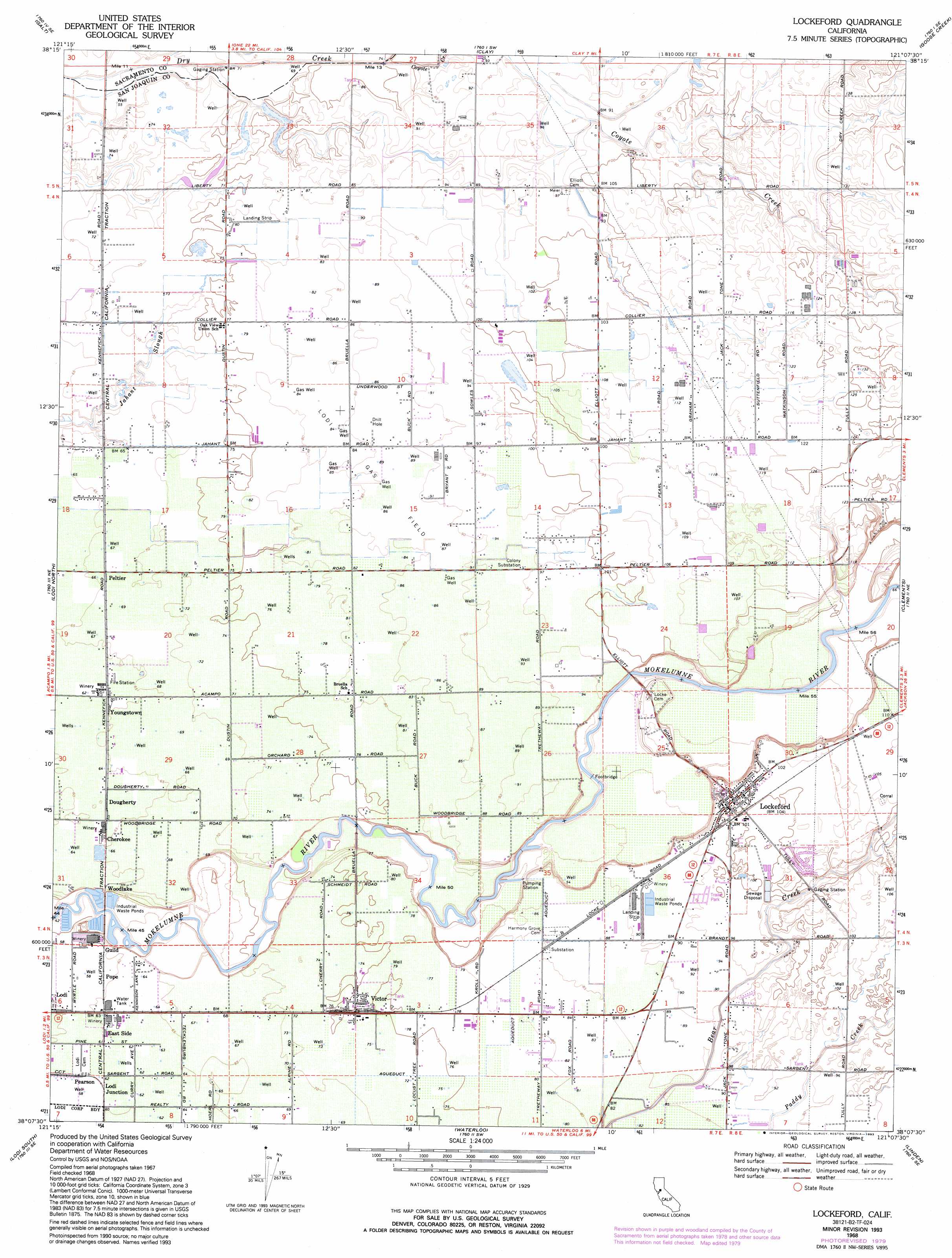
Lockeford Topo Map California
To zoom in, hover over the map of Lockeford
USGS Topo Quad 38121b2 - 1:24,000 scale
| Topo Map Name: | Lockeford |
| USGS Topo Quad ID: | 38121b2 |
| Print Size: | ca. 21 1/4" wide x 27" high |
| Southeast Coordinates: | 38.125° N latitude / 121.125° W longitude |
| Map Center Coordinates: | 38.1875° N latitude / 121.1875° W longitude |
| U.S. State: | CA |
| Filename: | o38121b2.jpg |
| Download Map JPG Image: | Lockeford topo map 1:24,000 scale |
| Map Type: | Topographic |
| Topo Series: | 7.5´ |
| Map Scale: | 1:24,000 |
| Source of Map Images: | United States Geological Survey (USGS) |
| Alternate Map Versions: |
Lockeford CA 1953, updated 1954 Download PDF Buy paper map Lockeford CA 1968, updated 1972 Download PDF Buy paper map Lockeford CA 1968, updated 1980 Download PDF Buy paper map Lockeford CA 1968, updated 1993 Download PDF Buy paper map Lockeford CA 2012 Download PDF Buy paper map Lockeford CA 2015 Download PDF Buy paper map |
1:24,000 Topo Quads surrounding Lockeford
Florin |
Elk Grove |
Sloughhouse |
Carbondale |
Irish Hill |
Bruceville |
Galt |
Clay |
Goose Creek |
Ione |
Thornton |
Lodi North |
Lockeford |
Clements |
Wallace |
Terminous |
Lodi South |
Waterloo |
Linden |
Valley Springs Sw |
Holt |
Stockton West |
Stockton East |
Peters |
Farmington |
> Back to 38121a1 at 1:100,000 scale
> Back to 38120a1 at 1:250,000 scale
> Back to U.S. Topo Maps home
Lockeford topo map: Gazetteer
Lockeford: Airports
Ferdun Ranch Airport elevation 21m 68′Vetters Sky Ranch elevation 25m 82′
Lockeford: Oilfields
Lodi Gas Field elevation 26m 85′Lockeford: Populated Places
Cherokee elevation 20m 65′Dougherty elevation 19m 62′
East Side elevation 19m 62′
Elliott (historical) elevation 28m 91′
Guild elevation 19m 62′
Lockeford elevation 31m 101′
Lodi Junction elevation 19m 62′
Pearson elevation 19m 62′
Peltier elevation 21m 68′
Pope elevation 19m 62′
Roma elevation 20m 65′
Victor elevation 24m 78′
Woodlake elevation 19m 62′
Youngstown elevation 20m 65′
Lockeford: Post Offices
Lockeford Post Office elevation 31m 101′Lockeford: Streams
Coyote Creek elevation 22m 72′Goose Creek elevation 26m 85′
Lockeford digital topo map on disk
Buy this Lockeford topo map showing relief, roads, GPS coordinates and other geographical features, as a high-resolution digital map file on DVD: