Lodi North Topo Map California
To zoom in, hover over the map of Lodi North
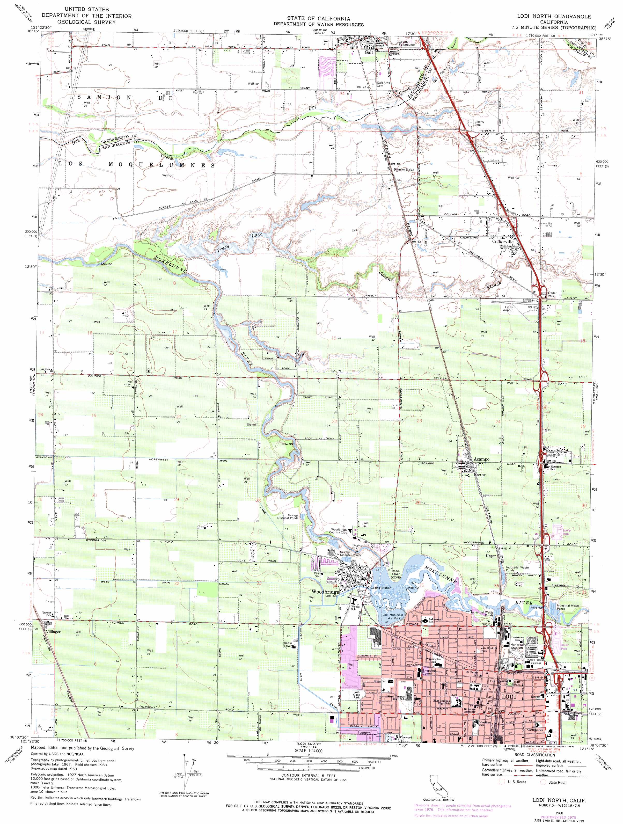
USGS Topo Quad 38121b3 - 1:24,000 scale
| Topo Map Name: | Lodi North |
| USGS Topo Quad ID: | 38121b3 |
| Print Size: | ca. 21 1/4" wide x 27" high |
| Southeast Coordinates: | 38.125° N latitude / 121.25° W longitude |
| Map Center Coordinates: | 38.1875° N latitude / 121.3125° W longitude |
| U.S. State: | CA |
| Filename: | o38121b3.jpg |
| Download Map JPG Image: | Lodi North topo map 1:24,000 scale |
| Map Type: | Topographic |
| Topo Series: | 7.5´ |
| Map Scale: | 1:24,000 |
| Source of Map Images: | United States Geological Survey (USGS) |
| Alternate Map Versions: |
Lodi North CA 1953 Download PDF Buy paper map Lodi North CA 1968, updated 1972 Download PDF Buy paper map Lodi North CA 1968, updated 1977 Download PDF Buy paper map Lodi North CA 2012 Download PDF Buy paper map Lodi North CA 2015 Download PDF Buy paper map |
1:24,000 Topo Quads surrounding Lodi North
Clarksburg |
Florin |
Elk Grove |
Sloughhouse |
Carbondale |
Courtland |
Bruceville |
Galt |
Clay |
Goose Creek |
Isleton |
Thornton |
Lodi North |
Lockeford |
Clements |
Bouldin Island |
Terminous |
Lodi South |
Waterloo |
Linden |
Woodward Island |
Holt |
Stockton West |
Stockton East |
Peters |
> Back to 38121a1 at 1:100,000 scale
> Back to 38120a1 at 1:250,000 scale
> Back to U.S. Topo Maps home
Lodi North topo map: Gazetteer
Lodi North: Airports
Linds Airport elevation 18m 59′Lodi Airport elevation 17m 55′
Lodi North: Canals
West Main Canal elevation 8m 26′Lodi North: Dams
Woodbridge Diversion 71-000 Dam elevation 13m 42′Lodi North: Lakes
Forest Lake elevation 15m 49′Oliver Lake (historical) elevation 11m 36′
Smith Lake elevation 13m 42′
Tracy Lake elevation 6m 19′
Lodi North: Parks
Emerson Park elevation 15m 49′Hale Park elevation 16m 52′
Lawrence Park elevation 16m 52′
Lodi Lake Park elevation 13m 42′
Lodi Municipal Lake Park elevation 14m 45′
Lodi Stadium elevation 16m 52′
Maple Square elevation 15m 49′
Meadow View Park elevation 13m 42′
Twin Oaks Park elevation 13m 42′
Van Buskirk Park elevation 16m 52′
Westgate Park elevation 13m 42′
Woodbridge Regional Park elevation 10m 32′
Zupo Field elevation 16m 52′
Lodi North: Populated Places
Acampo elevation 16m 52′Collierville elevation 19m 62′
Lodi elevation 15m 49′
Urgon elevation 18m 59′
Villinger elevation 8m 26′
Woodbridge elevation 13m 42′
Lodi North: Post Offices
Acampo Post Office elevation 16m 52′Lodi Post Office elevation 15m 49′
Lodi North: Streams
Jahant Slough elevation 8m 26′Lodi North digital topo map on disk
Buy this Lodi North topo map showing relief, roads, GPS coordinates and other geographical features, as a high-resolution digital map file on DVD: