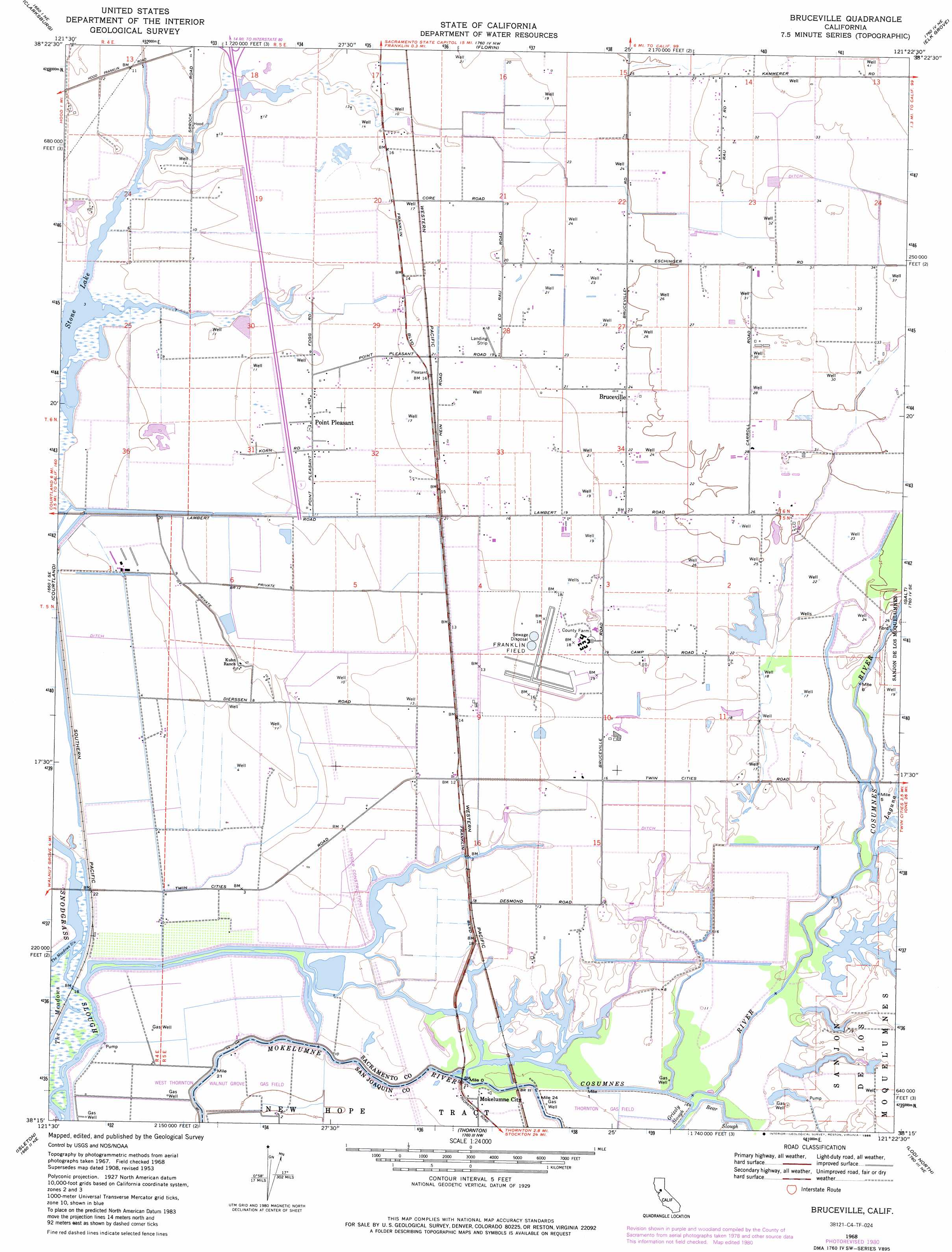
Bruceville Topo Map California
To zoom in, hover over the map of Bruceville
USGS Topo Quad 38121c4 - 1:24,000 scale
| Topo Map Name: | Bruceville |
| USGS Topo Quad ID: | 38121c4 |
| Print Size: | ca. 21 1/4" wide x 27" high |
| Southeast Coordinates: | 38.25° N latitude / 121.375° W longitude |
| Map Center Coordinates: | 38.3125° N latitude / 121.4375° W longitude |
| U.S. State: | CA |
| Filename: | o38121c4.jpg |
| Download Map JPG Image: | Bruceville topo map 1:24,000 scale |
| Map Type: | Topographic |
| Topo Series: | 7.5´ |
| Map Scale: | 1:24,000 |
| Source of Map Images: | United States Geological Survey (USGS) |
| Alternate Map Versions: |
Bruceville CA 1953, updated 1955 Download PDF Buy paper map Bruceville CA 1953, updated 1964 Download PDF Buy paper map Bruceville CA 1968, updated 1972 Download PDF Buy paper map Bruceville CA 1968, updated 1972 Download PDF Buy paper map Bruceville CA 1968, updated 1977 Download PDF Buy paper map Bruceville CA 1968, updated 1977 Download PDF Buy paper map Bruceville CA 1968, updated 1981 Download PDF Buy paper map Bruceville CA 1968, updated 1981 Download PDF Buy paper map Bruceville CA 1968, updated 1986 Download PDF Buy paper map Bruceville CA 1968, updated 1986 Download PDF Buy paper map Bruceville CA 2012 Download PDF Buy paper map Bruceville CA 2015 Download PDF Buy paper map |
1:24,000 Topo Quads surrounding Bruceville
Davis |
Sacramento West |
Sacramento East |
Carmichael |
Buffalo Creek |
Saxon |
Clarksburg |
Florin |
Elk Grove |
Sloughhouse |
Liberty Island |
Courtland |
Bruceville |
Galt |
Clay |
Rio Vista |
Isleton |
Thornton |
Lodi North |
Lockeford |
Jersey Island |
Bouldin Island |
Terminous |
Lodi South |
Waterloo |
> Back to 38121a1 at 1:100,000 scale
> Back to 38120a1 at 1:250,000 scale
> Back to U.S. Topo Maps home
Bruceville topo map: Gazetteer
Bruceville: Airports
Flying B Ranch Airport elevation 6m 19′Franklin Field elevation 5m 16′
Bruceville: Canals
Sacramento Drainage Canal elevation 2m 6′Bruceville: Lakes
Bear Lake (historical) elevation 2m 6′South Stone Lake elevation 2m 6′
Stone Lake elevation 2m 6′
Bruceville: Populated Places
Bruceville elevation 8m 26′Mokelumne City elevation 4m 13′
Point Pleasant elevation 4m 13′
Bruceville: Streams
Cosumnes River elevation 4m 13′Laguna elevation 4m 13′
Bruceville digital topo map on disk
Buy this Bruceville topo map showing relief, roads, GPS coordinates and other geographical features, as a high-resolution digital map file on DVD: