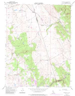
Folsom Se Topo Map California
To zoom in, hover over the map of Folsom Se
USGS Topo Quad 38121e1 - 1:24,000 scale
| Topo Map Name: | Folsom Se |
| USGS Topo Quad ID: | 38121e1 |
| Print Size: | ca. 21 1/4" wide x 27" high |
| Southeast Coordinates: | 38.5° N latitude / 121° W longitude |
| Map Center Coordinates: | 38.5625° N latitude / 121.0625° W longitude |
| U.S. State: | CA |
| Filename: | o38121e1.jpg |
| Download Map JPG Image: | Folsom Se topo map 1:24,000 scale |
| Map Type: | Topographic |
| Topo Series: | 7.5´ |
| Map Scale: | 1:24,000 |
| Source of Map Images: | United States Geological Survey (USGS) |
| Alternate Map Versions: |
Folsom SE CA 1954, updated 1955 Download PDF Buy paper map Folsom SE CA 1954, updated 1963 Download PDF Buy paper map Folsom SE CA 1954, updated 1976 Download PDF Buy paper map Folsom SE CA 1954, updated 1980 Download PDF Buy paper map Folsom SE CA 1954, updated 1985 Download PDF Buy paper map Folsom SE CA 2012 Download PDF Buy paper map Folsom SE CA 2015 Download PDF Buy paper map |
1:24,000 Topo Quads surrounding Folsom Se
> Back to 38121e1 at 1:100,000 scale
> Back to 38120a1 at 1:250,000 scale
> Back to U.S. Topo Maps home
Folsom Se topo map: Gazetteer
Folsom Se: Dams
Chesbro 1450-002 Dam elevation 71m 232′Clementia 1450-004 Dam elevation 50m 164′
Folsom Se: Populated Places
Malby Crossing elevation 138m 452′Rancho Murieta elevation 51m 167′
Walltown elevation 103m 337′
Folsom Se: Ridges
Ben Bolt Ridge elevation 283m 928′Folsom Se: Streams
Burgoyne Creek elevation 59m 193′Indian Creek elevation 74m 242′
Latrobe Creek elevation 152m 498′
Little Deer Creek elevation 48m 157′
Little Indian Creek elevation 68m 223′
Plunkett Creek elevation 160m 524′
Slate Creek elevation 75m 246′
Strap Miner Creek elevation 159m 521′
Folsom Se digital topo map on disk
Buy this Folsom Se topo map showing relief, roads, GPS coordinates and other geographical features, as a high-resolution digital map file on DVD:


