Grays Bend Topo Map California
To zoom in, hover over the map of Grays Bend
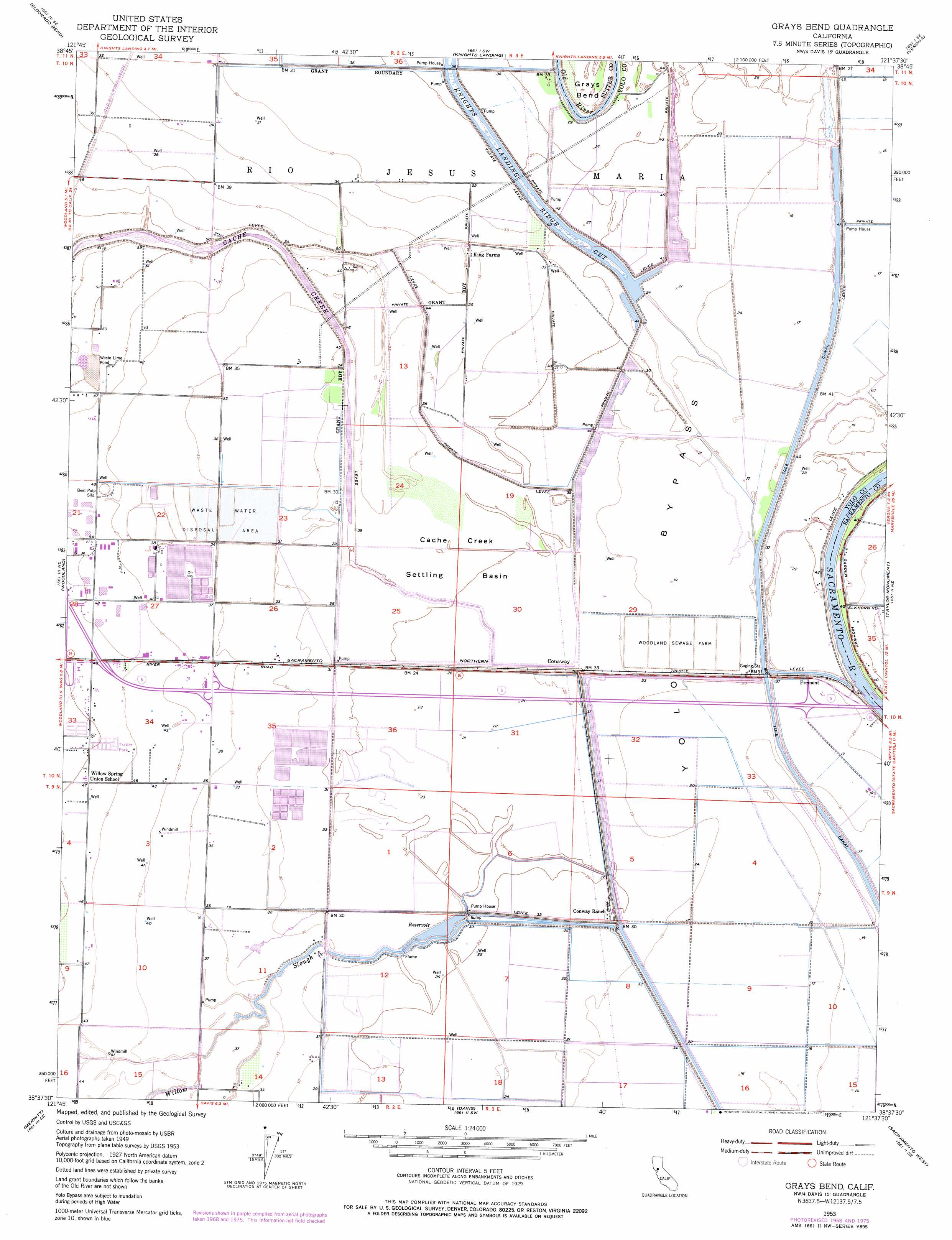
USGS Topo Quad 38121f6 - 1:24,000 scale
| Topo Map Name: | Grays Bend |
| USGS Topo Quad ID: | 38121f6 |
| Print Size: | ca. 21 1/4" wide x 27" high |
| Southeast Coordinates: | 38.625° N latitude / 121.625° W longitude |
| Map Center Coordinates: | 38.6875° N latitude / 121.6875° W longitude |
| U.S. State: | CA |
| Filename: | o38121f6.jpg |
| Download Map JPG Image: | Grays Bend topo map 1:24,000 scale |
| Map Type: | Topographic |
| Topo Series: | 7.5´ |
| Map Scale: | 1:24,000 |
| Source of Map Images: | United States Geological Survey (USGS) |
| Alternate Map Versions: |
Grays Bend CA 1953, updated 1954 Download PDF Buy paper map Grays Bend CA 1953, updated 1966 Download PDF Buy paper map Grays Bend CA 1953, updated 1970 Download PDF Buy paper map Grays Bend CA 1953, updated 1977 Download PDF Buy paper map Grays Bend CA 2012 Download PDF Buy paper map Grays Bend CA 2015 Download PDF Buy paper map |
1:24,000 Topo Quads surrounding Grays Bend
Dunnigan |
Kirkville |
Sutter Causeway |
Nicolaus |
Sheridan |
Zamora |
Eldorado Bend |
Knights Landing |
Verona |
Pleasant Grove |
Madison |
Woodland |
Grays Bend |
Taylor Monument |
Rio Linda |
Winters |
Merritt |
Davis |
Sacramento West |
Sacramento East |
Allendale |
Dixon |
Saxon |
Clarksburg |
Florin |
> Back to 38121e1 at 1:100,000 scale
> Back to 38120a1 at 1:250,000 scale
> Back to U.S. Topo Maps home
Grays Bend topo map: Gazetteer
Grays Bend: Basins
Cache Creek Settling Basin elevation 9m 29′Cache Creek Sink elevation 7m 22′
Grays Bend: Bends
Grays Bend elevation 10m 32′Grays Bend: Dams
Debacco 2465 Dam elevation 6m 19′Grays Bend: Populated Places
Conaway elevation 10m 32′Fremont elevation 7m 22′
Hebron (historical) elevation 12m 39′
Idle Wheel Mobile Estates elevation 16m 52′
King Farms elevation 11m 36′
Laugenour (historical) elevation 14m 45′
Royal Palms Mobile Estates elevation 16m 52′
Grays Bend: Streams
Old River elevation 10m 32′Willow Slough elevation 8m 26′
Grays Bend digital topo map on disk
Buy this Grays Bend topo map showing relief, roads, GPS coordinates and other geographical features, as a high-resolution digital map file on DVD: